Report on Moutohora Island (New Zealand) — March 1990
Bulletin of the Global Volcanism Network, vol. 15, no. 3 (March 1990)
Managing Editor: Lindsay McClelland.
Moutohora Island (New Zealand) CO2-rich gases from thermal area
Please cite this report as:
Global Volcanism Program, 1990. Report on Moutohora Island (New Zealand) (McClelland, L., ed.). Bulletin of the Global Volcanism Network, 15:3. Smithsonian Institution. https://doi.org/10.5479/si.GVP.BGVN199003-241815
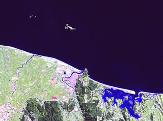
Moutohora Island
New Zealand
37.855°S, 176.974°E; summit elev. 352 m
All times are local (unless otherwise noted)
The following observations, made by scientists from the USSR and New Zealand during a cruise of the RV Vulkanolog, were reported by W.F. Giggenbach and I. Menyailov.
"...Thermal activity manifests itself largely in areas of hydrothermally altered, steaming ground. The major thermal feature is a vigorously boiling pool near sea level in Sulphur Bay (Ramsay and Hayward, 1971). As indicated by the occurrence of bubble zones (Glasby, 1971), submarine thermal activity extends well SW of the island.
"During both the 1988 and 1990 cruises of the RV Vulkanolog, gas and water samples were collected from the main pool. The waters are essentially acid sulfate (4,000 mg/kg; Cl, 20 mg/kg), steam-heated, initially non-saline groundwater. Compositions of 1988 gases are compared in table 1 with those of 1974 samples from Sulphur Bay spring and the seafloor at 34 m depth (Lyon and others, 1977).
Table 1. Chemical composition of gases collected from vents on and near Whale Island (in mmol/mol of dry gas), March 1974 (Lyon and others, 1977) and during the September 1988 cruise of the RV Vulkanolog.
| Vent | Seafloor (34 m depth) | Island (pool) | |||
| Date | 10 Sep 1974 | 10 Sep 1974 | 10 Sep 1974 | 10 Mar 1988 | 10 Mar 1988 |
| C | 15 | 15 | 99 | 99 | 99 |
| CO2 | 734 | 680 | 967 | 935 | 937 |
| H2S | -- | -- | -- | 12.5 | 12.2 |
| He | -- | -- | -- | 0.0028 | 0.0010 |
| Ne | -- | -- | -- | 0.00004 | 0.00006 |
| Ar | 1.2 | 0.8 | 0.07 | 0.04 | 0.03 |
| H2 | 0.1 | 0.3 | 3.2 | 11.2 | 9.7 |
| O2 | 14.1 | 7.5 | <0.01 | <0.03 | <0.03 |
| N2 | 131 | 119 | 11 | 13 | 11 |
| CH4 | 120 | 193 | 18 | 28 | 30 |
"All gases reflect a hydrothermal origin, and their major component is CO2. The seafloor gases are contaminated with air, probably after sampling. Their higher CH4 and lower H2 contents suggest longer residence at lower temperatures compared to the island samples. The composition of the latter has remained essentially unchanged over the last 14 years."
References. Glasby, G.P., 1971, Direct observation of columnar scattering associated with geothermal gas bubbling in the Bay of Plenty, New Zealand: New Zealand Journal of Marine and Freshwater Research, v. 5, p. 483-496.
Lyon, G.L., Giggenbach, W.F., Singleton, R.J., and Glasby, G.P., 1977, Isotopic and Chemical composition of submarine geothermal gases from the Bay of Plenty, New Zealand: New Zealand Department of Scientific and Industrial Research Bulletin, v. 218, p. 65-67.
Ramsay, W.R.H., and Hayward, B.W., 1971, Geology of Whale Island: Tane, v. 17, p. 9-32.
Geological Summary. Moutohora (Whale) Island forms the summit of a largely submerged Pleistocene dacitic-andesitic complex volcano that lies 11 km offshore from Whakatane in the Bay of Plenty. The 2.5-km-long island includes a central dome complex flanked, by East Dome and Pa Hill lava dome, which forms the NW tip of the island. Acid hot springs, steaming ground, and fumaroles are present on the island. The central cone and east dome are both older than the roughly 42,000 before present (BP) Rotoehu Tephra, and Pa Hill dome is overlain by the 9,000 years BP Rotoma Ash, but may be considerably older. It was included in the Catalog of Active Volcanoes of the World (Nairn and Cole, 1975) based on its thermal activity.
Information Contacts: I. Menyailov and A. Ivanenko, IV, Petropavlovsk; W. Giggenbach, DSIR Chemistry, Petone.