Report on Agrigan (United States) — October 1990
Bulletin of the Global Volcanism Network, vol. 15, no. 10 (October 1990)
Managing Editor: Lindsay McClelland.
Agrigan (United States) Strong thermal activity but no unusual seismicity
Please cite this report as:
Global Volcanism Program, 1990. Report on Agrigan (United States) (McClelland, L., ed.). Bulletin of the Global Volcanism Network, 15:10. Smithsonian Institution. https://doi.org/10.5479/si.GVP.BGVN199010-284160
Agrigan
United States
18.77°N, 145.67°E; summit elev. 965 m
All times are local (unless otherwise noted)
A seven-member team of USGS volcanologists visited the CNMI 24 September-6 October at the request of the Office of Civil Defense. The following is from a report by Richard Moore.
"On Agrigan, the team established a new EDM network within the summit caldera, and hope to remeasure it in 1991. At that time, geologic investigations terminated by tropical storm Hattie on 2 October 1990 would be continued.
"A revolving drum seismograph operated continuously 28 September-1 October at a village near the coast, and a portable seismograph operated intermittently 28-29 September at several sites on the caldera floor, recorded no sustained microearthquake activity or volcanic tremor on Agrigan.
"The team discovered a boiling hot spring, associated terrace deposits, and solfataras at the 1917 eruption vent (Agrigan's most recent) on the floor of the 1.5-km-diameter caldera. Steam was being emitted from several areas at the base of the caldera wall. Temperatures of the boiling hot spring and 25 solfataras measured by thermocouple were all 98°C. Water from the hot spring had a pH of 2.0. Chemical analysis of the water is in progress. Several measurements (using Kitagawa and Draeger tubes) of the abundances of various gases emitted by the solfataras are summarized in table 1.
Table 1. Range in compositions of gas samples collected at Agrigan, September-October 1990. Courtesy of Richard Moore.
| Gas | Abundance |
| HCl | 200 - 320 ppm |
| CO | 0 - 3 ppm |
| CO2 | >3% |
| H2S | 1900 - >2000 ppm |
| SO2 | >400 ppm |
"The team found no evidence of new fuming on Agrigan (suggested by reports in August and cause of the island's evacuation; 15:7). Hot spring terraces composed of siliceous sinter covered an area of ~20 x 7 m2 below the boiling hot spring. The terraces are now mostly dry, with current deposition of silica limited to a few square meters adjacent to the hot spring, suggesting that activity was more vigorous sometime in the past. However, fluctuations in the volume of flow from the spring may occur as a result of seasonal variations in rainfall."
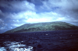
Geological Summary. The highest of the Marianas arc volcanoes, Agrigan contains a 500-m-deep, flat-floored caldera. The elliptical island is 8 km long; its summit is the top of a massive 4000-m-high submarine volcano. Deep radial valleys dissect the flanks of the thickly vegetated stratovolcano. The elongated caldera is 1 x 2 km wide and is breached to the NW, from where a prominent lava flow extends to the coast and forms a lava delta. The caldera floor is surfaced by fresh-looking lava flows and also contains two cones that may have formed during the only historical eruption in 1917. This eruption deposited large blocks and 3 m of ash and lapilli on a village on the SE coast, prompting its evacuation.
Information Contacts: R. Moore, USGS; R. Koyanagi and M. Sako, HVO.