Report on Alcedo (Ecuador) — March 1991
Bulletin of the Global Volcanism Network, vol. 16, no. 3 (March 1991)
Managing Editor: Lindsay McClelland.
Alcedo (Ecuador) Loud booming sounds with accompanying felt shocks; changes at fumarolic area
Please cite this report as:
Global Volcanism Program, 1991. Report on Alcedo (Ecuador) (McClelland, L., ed.). Bulletin of the Global Volcanism Network, 16:3. Smithsonian Institution. https://doi.org/10.5479/si.GVP.BGVN199103-353040
Alcedo
Ecuador
0.43°S, 91.12°W; summit elev. 1130 m
All times are local (unless otherwise noted)
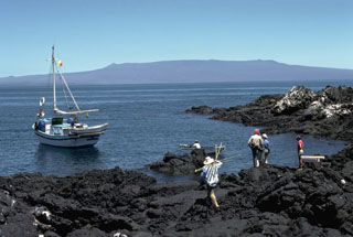
Loud "booms" (sounds like underground detonations, of varying intensities and seemingly different source directions), first reported by scientists in mid-March, were documented during fieldwork 20-27 March. The loudest, at around 1800 on 21 March, was almost immediately followed by a strongly felt shock (estimated to have 2-3 cm of vertical displacement at one location). Less intense "booms," occasionally followed by felt shocks, were heard at a rate of 2-13/day; variations may reflect location and activity of the observers. One notable "boom" and shock was followed by ground shaking that lasted more than a minute. While inside the caldera, observers reported a fairly constant "very low, barely audible, throbbing rumble" which they compared to the engines of a large ship.
No substantial changes were noted at the fumarole area (in the SW portion of the caldera) since the previous visit in 1986. However, vegetation had receded possibly as much as 20 m from around most fumarole areas. Numerous fresh, hairline fissures, two to several dozen meters long, were visible along the lower border of the fumarole field, coinciding with devegetation. Steam emission from a large vent on the SE caldera wall, a geyser until drying up in 1970, was substantially weaker than in 1986 and the sound had changed from a jet roar to "more of an underground rumble".
The first earthquake (mb 4.9) to be located in Galápagos since [5 July 1990] occurred at [0659] on 3 March. Its hypocenter was [25] km [NW] of Alcedo, but accurate locations are difficult in that region and the threshold for locatable earthquakes normally exceeds M 4.
Geological Summary. Alcedo is one of the lowest and smallest of six shield volcanoes on Isabela Island. Much of the flanks and summit caldera are vegetated, but young lava flows are prominent on the N flank near the saddle with Darwin volcano. It is the only Galapagos volcano known to have erupted rhyolite as well as basalt, producing about 1 km3 of late-Pleistocene rhyolitic tephra and lava flows from several vents late in its history. Recent faulting has produced a moat around part of the 7-8 km caldera floor, which is elongated N-S and appears to be migrating to the south. Fewer circumferential fissures occur on Alcedo than on other western Galápagos volcanoes. An eruption attributed to Alcedo in 1954 (Richards, 1957) is more likely to have been from neighboring Sierra Negra (Simkin 1980, pers. comm.). Photo-geologic mapping by K.A. Howard (pers. comm.) revealed only one flow on 30 October 1960 photographs that does not appear on 30 May 1946 photos. That is near Cartago Bay, low on the SE flank, rather than the 610-m, NE-flank elevation listed for the 1954 eruption. An active hydrothermal system is located within the caldera.
Information Contacts: T. De Roy and M. Jones, Isla Santa Cruz; NEIC.