Report on Gede-Pangrango (Indonesia) — June 1991
Bulletin of the Global Volcanism Network, vol. 16, no. 6 (June 1991)
Managing Editor: Lindsay McClelland.
Gede-Pangrango (Indonesia) Seismicity declines without eruption after April/May swarm
Please cite this report as:
Global Volcanism Program, 1991. Report on Gede-Pangrango (Indonesia) (McClelland, L., ed.). Bulletin of the Global Volcanism Network, 16:6. Smithsonian Institution. https://doi.org/10.5479/si.GVP.BGVN199106-263060
Gede-Pangrango
Indonesia
6.786°S, 106.983°E; summit elev. 3026 m
All times are local (unless otherwise noted)
High seismicity associated with the 29 April-1 May swarm activity has continuously declined since late May (figure 1). An average of one volcanic earthquake/day was recorded in June, compared to 43/day in April and 5/day in May. No surface activity was observed.
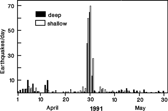 |
Figure 1. Daily number of earthquakes at Gede, April-May 1991. Courtesy of VSI. |
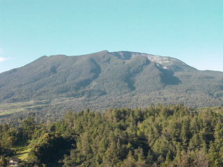
Geological Summary. The two peaks of the Gede-Pangrango volcanic complex overlook the major cities of Cianjur, Sukabumi, and Bogor, situated to the E, S, and NW, respectively. The summit of Gunung Pangrango, constructed over the NE rim of a 3 x 5 km caldera, forms the high point. Many lava flows are visible on the flanks of the younger Gunung Gede to the SE of Pangrango. The steep-walled summit crater has migrated about 1 km NNW over time. Two large debris-avalanche deposits are present on its flanks, one of which underlies the city of Cianjur. Activity recorded since the 16th century has typically consisted of small short explosive eruptions.
Information Contacts: W. Modjo, VSI.