Report on Soufriere Hills (United Kingdom) — June 1995

Bulletin of the Global Volcanism Network, vol. 20, no. 6 (June 1995)
Managing Editor: Richard Wunderman.
Soufriere Hills (United Kingdom) Small phreatic eruptions - the first in recorded history
Please cite this report as:
Global Volcanism Program, 1995. Report on Soufriere Hills (United Kingdom) (Wunderman, R., ed.). Bulletin of the Global Volcanism Network, 20:6. Smithsonian Institution. https://doi.org/10.5479/si.GVP.BGVN199506-360050
Soufriere Hills
United Kingdom
16.72°N, 62.18°W; summit elev. 915 m
All times are local (unless otherwise noted)
The following is based on information as of 24 July from the Seismic Research Unit (SRU) team at the University of the West Indies and Volcanic Alert News Releases from the Montserrat Emergency Operations Center. The SRU maintains a seismic network on Montserrat (figure 1), currently composed of seven instruments.
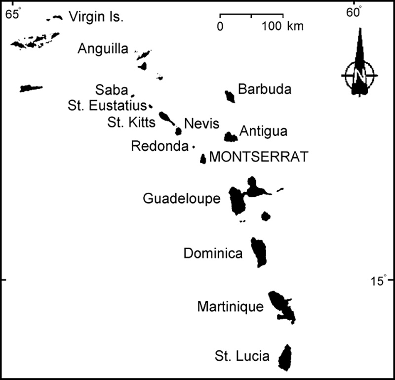 |
Figure 1. Index map showing Montserrat, the island where Soufriere Hills is located. |
On 18 July, villagers around Soufriere Hills volcano reported unusually loud rumbling noises coming from the fumarolic areas, light ashfall, and a strong sulfur odor. Following confirmation of these reports, an Emergency Operations Center, located in the capital city of Plymouth (on the coast ~4 km W of the summit), was activated and fully operational by 1830 that night. The Emergency Operations Center identified two schools as potential refugee centers, but no evacuation was ordered.
As of the morning of 19 July, based on conversations with Montserrat residents, SRU inferred that the initial explosion was small, phreatic, and only spread minor ashfall around the island. In accord with a small explosion size, the Synoptic Analysis Branch of NOAA saw no evidence of a plume on satellite imagery. Seismicity has been elevated since August 1992, and an earthquake swarm began on 14 July. However, no additional increase in seismicity was associated with the 18 July explosions.
An explosion earthquake at 0924 on 19 July was centered close to the top of Chance's Peak, the summit located on the W side of the crater rim. A field team led by Lloyd Lynch (SRU) trekked in from the N to make an initial inspection just after 1300. They reported minor explosions from an area SW of Tar River Soufriere (a fumarolic area ~1.5 km NE of the summit), explosions discharging from a vent within the summit crater between Chance's Peak and the Tar River area. The explosions took place at intervals of ~20 minutes, sending ash and steam ~40 m high. Based on these observations, no evacuations were recommended. Explosions continued that afternoon (figure 2).
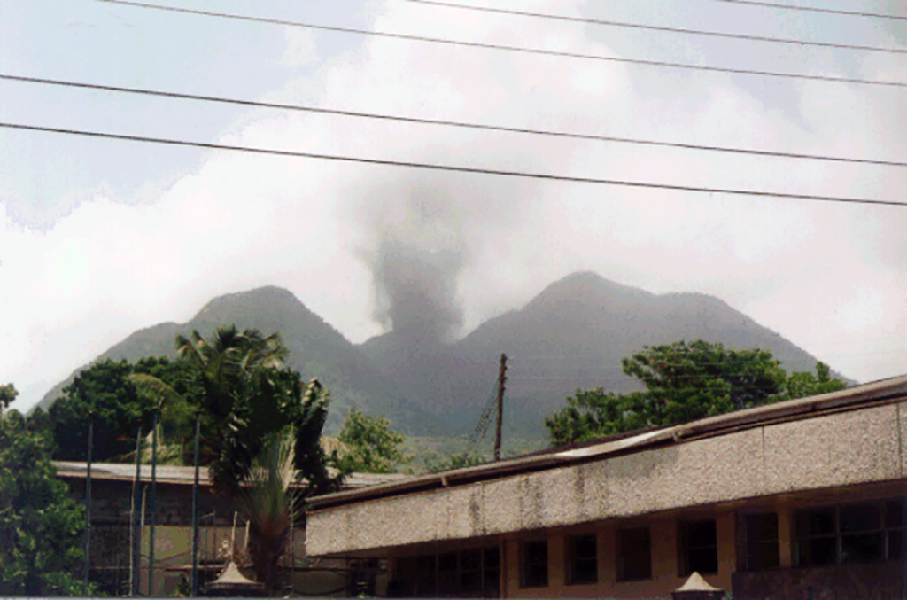 |
Figure 2. Photograph of Soufriere Hills volcano after a phreatic explosion between 1400 and 1500 on 19 July. View is from the center of Plymouth, ~4 km SW of the summit. Courtesy of Nicole and Adam Dennis. |
William Ambeh (SRU) led another observation team on the morning of 20 July to the Paradise Estate area (~2 km N of the summit), and additional monitoring equipment was installed in the Long Ground area (~2.5 km NE of the summit). Reconnaissance photographs taken from a Royal Air Force aircraft confirmed the early field reports. Later photographs taken from a Royal Navy helicopter indicated no increased activity in the Long Ground area.
The shallow earthquake swarm that began on 14 July ended on the 21st; depths were 2-4 km, and the largest event was M 3.5. Volcanic earthquakes were concentrated along the ENE and WSW areas of Lang's Soufriere. Phreatic activity continued on 22 July. Early morning ashfall was reported in Plymouth (~4 km W of the summit) and the SW-sector villages of Gages, Parsons, and Amersham. A small steam-and-ash eruption around 0800 lasted ~ 10 minutes. As of 1030 on 23 July, there was no new volcanic activity.
At the request of Montserrat, France sent two scientists (arriving on 25 July) to provide the SRU with technical assistance and additional equipment. They were joined on 26 July by five geologists from the U.S. Geological Survey's Volcanic Crisis Assistance Team.
Geological Summary. The complex, dominantly andesitic Soufrière Hills volcano occupies the southern half of the island of Montserrat. The summit area consists primarily of a series of lava domes emplaced along an ESE-trending zone. The volcano is flanked by Pleistocene complexes to the north and south. English's Crater, a 1-km-wide crater breached widely to the east by edifice collapse, was formed about 2000 years ago as a result of the youngest of several collapse events producing submarine debris-avalanche deposits. Block-and-ash flow and surge deposits associated with dome growth predominate in flank deposits, including those from an eruption that likely preceded the 1632 CE settlement of the island, allowing cultivation on recently devegetated land to near the summit. Non-eruptive seismic swarms occurred at 30-year intervals in the 20th century, but no historical eruptions were recorded until 1995. Long-term small-to-moderate ash eruptions beginning in that year were later accompanied by lava-dome growth and pyroclastic flows that forced evacuation of the southern half of the island and ultimately destroyed the capital city of Plymouth, causing major social and economic disruption.
Information Contacts: R. Robertson, UWI; Montserrat EOC; A. Dennis, Washington DC, USA.