Report on Adatarayama (Japan) — October 1995
Bulletin of the Global Volcanism Network, vol. 20, no. 10 (October 1995)
Managing Editor: Richard Wunderman.
Adatarayama (Japan) First tremor since 1965
Please cite this report as:
Global Volcanism Program, 1995. Report on Adatarayama (Japan) (Wunderman, R., ed.). Bulletin of the Global Volcanism Network, 20:10. Smithsonian Institution. https://doi.org/10.5479/si.GVP.BGVN199510-283170
Adatarayama
Japan
37.647°N, 140.281°E; summit elev. 1728 m
All times are local (unless otherwise noted)
During 27 October, volcanic tremor of about 3-minutes duration was recorded at a site 4.8 km NE of Adatara's summit (station A). This was the first case of tremor since the local observatory began observations in 1965.
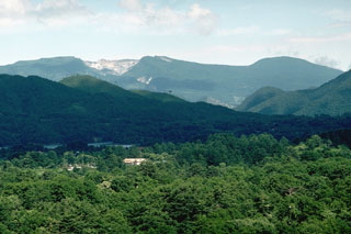
Geological Summary. The broad forested massif of Adatarayama volcano is located E of Bandai volcano, about 15 km SW of Fukushima city. It consists of a group of dominantly andesitic stratovolcanoes and lava domes that rise above Tertiary rocks on the south and abut Azumayama volcano on the north. Construction took place in three main stages that began about 550,000, 350,000, and 200,000 years ago. The high point of the complex is 1728-m-high Minowasan, a dome-shaped stratovolcano north of Tetsuzan, the currently active stratovolcano. Numanotaira, the active summit crater, is surrounded by hot springs and fumaroles and is breached by the Iogawa river ("Sulfur River") on the west. Seventy-two workers of a sulfur mine in the summit crater were killed during an eruption in 1900. Historical eruptions have been restricted to the 1.2-km-wide, 350-m-deep Numonotaira crater.
Information Contacts: Volcanological Division, Seismological and Volcanological Department, Japan Meteorological Agency (JMA), 1-3-4 Ote-machi, Chiyoda-ku, Tokyo 100 Japan.