Report on Socorro (Mexico) — March 1996
Bulletin of the Global Volcanism Network, vol. 21, no. 3 (March 1996)
Managing Editor: Richard Wunderman.
Socorro (Mexico) Slight temperature increases at most summit fumaroles and hot springs
Please cite this report as:
Global Volcanism Program, 1996. Report on Socorro (Mexico) (Wunderman, R., ed.). Bulletin of the Global Volcanism Network, 21:3. Smithsonian Institution. https://doi.org/10.5479/si.GVP.BGVN199603-341021
Socorro
Mexico
18.78°N, 110.95°W; summit elev. 1050 m
All times are local (unless otherwise noted)
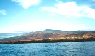
Logistical support from the Méxican Navy enabled researchers to measure seven fumarole and hot spring temperatures on 2 February 1995 in the summit region of Socorro Island's Mount Everman. Previous measurements, taken on 5-12 February 1993, were made at the same sites. These sites, labeled A-G, are shown on sketch maps and tables in Siebe and others (1995) and BGVN 18:01. In this most recent series of measurements, all temperatures were 90°C, except site D, which was 74°C. The 1993 measurements were made in conjunction with a local submarine eruption that also produced T-wave signals. These new measurements showed a several-degree increase over many of those in 1993.
The 1993 eruption was seen at the ocean surface over the island's submarine W flanks; during this visit further signs of eruption were absent from the ocean's surface and from distant hydrophones. Unfortunately, local hydrophones on the S end of the island were not operational. Several hundred meters N of the summit, on North Dome, the visitors saw recently killed vegetation and dead trees on the margins of some hydrothermally active pits. They also noted soft warm ground, dead bracken, and newly established pits, suggesting reactivation. In other cases green trees grew in the pit walls. While the majority of the fumaroles appeared similar to those in 1993, the observers noted three 'mud volcanoes'; two were active and the third issued deep rumblings. A stream in the vicinity of the summit and North Dome had a temperature of 60°C and numerous 80°C springs were seen both along its bed and nearby.
Reference. Siebe, C., Komorowski, J-C., Navarro, C., McHone, J., Delgado, H., and Cortes, A., 1995, Submarine eruption near Socorro Island, Mexico: Geochemistry and scanning electron microscope studies of floating scoria and reticulite: Journal of Volcanology and Geothermal Research, v. 68, p. 239-71.
Geological Summary. Socorro, the SE-most of the Revillagigedo Islands south of Baja California, is the summit of a massive, predominately submarine basaltic shield volcano capped by a largely buried, 4.5 x 3.8-km-wide summit caldera. A large tephra cone and lava dome complex, Cerro Evermann, forms the summit, and along with other cones and vents, fills much of the Pleistocene caldera. Rhyolitic lava domes have been constructed along flank rifts oriented to the N, W, and SE, and silicic lava flows from summit and flank vents have reached the coast and created an extremely irregular shoreline. Late-stage basaltic eruptions produced cones and flows near the coast. Only minor explosive activity, some of which is of uncertain validity, has occurred from flank vents in historical time dating back to the 19th century. In 1951 a brief phreatic eruption ejected blocks, and the gas column reached 1200 m altitude. A submarine eruption occurred during 1993-94 from a vent 3 km W of the island during which large scoriaceous blocks up to 5 m in size floated to the surface without associated explosive activity.
Information Contacts: Andrew M. Burton, OCEAN, Organizatión para la Conservación Estudio y Análisis de la Naturaleza, A.C., 22 de Diciembre No. 1, Col. Manuel Avila Camancho, Naucalpan, Edo. de México.