Report on Krakatau (Indonesia) — July 1997
Bulletin of the Global Volcanism Network, vol. 22, no. 7 (July 1997)
Managing Editor: Richard Wunderman.
Krakatau (Indonesia) Activity increases in May
Please cite this report as:
Global Volcanism Program, 1997. Report on Krakatau (Indonesia) (Wunderman, R., ed.). Bulletin of the Global Volcanism Network, 22:7. Smithsonian Institution. https://doi.org/10.5479/si.GVP.BGVN199707-262000
Krakatau
Indonesia
6.1009°S, 105.4233°E; summit elev. 285 m
All times are local (unless otherwise noted)
The following describes the volcanism during March-May based on reports by the NOAA Satellite Analysis Branch (SAB), a team of the Société Volcanologique Européenne (SVE), and Mike Lyvers. Lyvers noted that the Indonesian government's 5-km exclusion zone around the island has not deterred local boat operators from anchoring offshore or even landing tourists on Anak Krakatau.
SAB reported that on 6 March at 0442 an unidentified aviator saw a significant eruption with ash reaching an altitude of ~7 km. This cloud, however, was not seen in GMS satellite imagery.
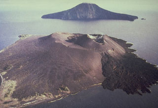
Members of the SVE visited the island twice in April. They learned that during March at Carita, a beach resort on the W coast of Java 40 km from the volcano, there were ashfalls and explosions from the volcano were heard. During April, emissions became less prominent and more irregular. During their first visit on 9-10 April they did not observe any plumes. After landing they ascended to the first crest line where the group encountered several bread-crust bombs and their substantial impact craters. As they were ascending the cone of the volcano the visitors felt the heated ground through their hiking boots. There were fumaroles on both the flank and the summit. The crater, 150-200 m in diameter, was breached to the W; the crater floor was occupied by large blocks, and it was possible to distinguish two vents aligned on a fissure trending SE-NW.
The group returned on 17-18 April, after another eruptive episode. This time they observed enormous new blocks at the summit. The S vent continuously emitted white steam; the N vent sporadically discharged brown-black ash that rose up to 500 m above the vent. The SVE team watched from a spot in front of the cone, ~400 m from the summit, when at 1820 the S vent exploded generating an ash plume and throwing incandescent projectiles ~200 m above the crater. One projectile landed very close to the observation point. The next morning, ash on the tents suggested that the volcano had another explosion. The group witnessed another eruption as they were leaving the island by boat at 1000.
SVE members learned that after spending 21-22 April on the island, Guy de St. Cyr (a French tourist-guide) saw plumes accompanied by projectiles. He described the ash as an unusual pink color. During the night, incandescent explosions were took place about every 30 minutes; several incandescent blocks fell over the dome's N side. The next morning, during a boat tour around the island, some blue smoke rose from mid-way up the W-SW flanks of the dome, conceivably a sign of minor lava flows.
During the afternoon and evening of 17 May, Mike Lyvers visited the island by boat. The previous few days, when observed from Carita Beach, the volcano had been quiet. In contrast, on 17 May it erupted almost continuously, issuing minor amounts of ash and sometimes a few bombs. Occasionally, larger explosions sent incandescent ash high into the sky, generating a spectacular display of volcanic lightning and covering the cone with glowing bombs. The volcano seemed to show no obvious pattern to its activity, with random fluctuations in the intensity of eruption.
Geological Summary. The renowned Krakatau (frequently mis-named as Krakatoa) volcano lies in the Sunda Strait between Java and Sumatra. Collapse of an older edifice, perhaps in 416 or 535 CE, formed a 7-km-wide caldera. Remnants of that volcano are preserved in Verlaten and Lang Islands; subsequently the Rakata, Danan, and Perbuwatan cones were formed, coalescing to create the pre-1883 Krakatau Island. Caldera collapse during the catastrophic 1883 eruption destroyed Danan and Perbuwatan, and left only a remnant of Rakata. This eruption caused more than 36,000 fatalities, most as a result of tsunamis that swept the adjacent coastlines of Sumatra and Java. Pyroclastic surges traveled 40 km across the Sunda Strait and reached the Sumatra coast. After a quiescence of less than a half century, the post-collapse cone of Anak Krakatau (Child of Krakatau) was constructed within the 1883 caldera at a point between the former Danan and Perbuwatan cones. Anak Krakatau has been the site of frequent eruptions since 1927.
Information Contacts: NOAA/NESDIS Satellite Analysis Branch (SAB), Room 401, 5200 Auth Road, Camp Spring, MD 20746, USA; Société Volcanologique Européenne, C.P. 1, 1211 Genève 17, Switzerland (URL: http://www.sveurop.org/); Mike Lyvers, School of Humanities and Social Sciences, Bond University Gold Coast, Qld. 4229 Australia.

