Report on Mayon (Philippines) — January 2000
Bulletin of the Global Volcanism Network, vol. 25, no. 1 (January 2000)
Managing Editor: Richard Wunderman.
Mayon (Philippines) Summit-crater dome growth and escalating eruptions herald evacuations
Please cite this report as:
Global Volcanism Program, 2000. Report on Mayon (Philippines) (Wunderman, R., ed.). Bulletin of the Global Volcanism Network, 25:1. Smithsonian Institution. https://doi.org/10.5479/si.GVP.BGVN200001-273030
Mayon
Philippines
13.257°N, 123.685°E; summit elev. 2462 m
All times are local (unless otherwise noted)
Mayon stratovolcano, in SE Luzon, entered a period of increasing unrest in May 1999. This has led to significant ash eruptions, lava flows, and pyroclastic flows-and associated rises in the hazard status. On 22 June 1999 an eruption sent an ash plume 10 km above the summit and the volcano continued to exhibit activity that could signify additional eruptions (BGVN 24:06). After this event the hazard status was raised from Alert Level 1 (slight unrest) to Alert Level 2 (moderate unrest, no eruption imminent). Another ash explosion on 5 January 2000 produced a 5-km-high ash column.
A lava dome was spotted growing in the summit crater on 12 February. Accordingly, on the 15th the hazard status was raised to Alert Level 3 (intensifying unrest, magma close to the crater, eruption within weeks). Dome theodolite measurements showed continuing growth and, as of 23 February, the dome was ~74 m wide by ~24 m high. On 19 February, portions of the dome began to glow, presumably as magma forced cracks to open. At the time of this report, the dome already overlapped the SE side of the crater, which was unconfined and open. On 20 February some lava fragments detached from the dome and incandescent rockfalls descended the SE flank, traveling within a large channel called the Bonga Gully.
As of 23 February, PHIVOLCS had recommended evacuation to at least 7 km from the summit in the SE and to at least 6 km elsewhere. The former is a permanent danger zone. Activity continued to increase during the night of 23-24 February, with minor explosions and lava fountaining, prompting a change in the hazard status to Alert Level 4 (hazardous eruption imminent, possible within days) at 0300 on 24 February. No additional evacuation was recommended, but people residing within 8 km of the summit were advised to prepare for evacuation. Later that morning, at 0829, a pyroclastic flow descended the SE flank towards the Bonga Gully. This caused the hazard status to rise to Alert Level 5 (hazardous eruption in progress). Eruptive and seismic activity continued into early March. Additional details will be provided in next month's Bulletin.
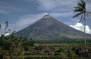
Geological Summary. Symmetrical Mayon, which rises above the Albay Gulf NW of Legazpi City, is the most active volcano of the Philippines. The steep upper slopes are capped by a small summit crater. Recorded eruptions since 1616 CE range from Strombolian to basaltic Plinian, with cyclical activity beginning with basaltic eruptions, followed by longer term andesitic lava flows. Eruptions occur predominately from the central conduit and have also produced lava flows that travel far down the flanks. Pyroclastic flows and mudflows have commonly swept down many of the approximately 40 ravines that radiate from the summit and have often damaged populated lowland areas. A violent eruption in 1814 killed more than 1,200 people and devastated several towns.
Information Contacts: Raymundo S. Punongbayan and Ernesto Corpuz, Philippine Institute of Volcanology and Seismology (PHIVOLCS), C.P. Garcia St. Diliman, Quezon City Philippines (URL: http://www.phivolcs.dost. gov.ph/).

