Report on Ruapehu (New Zealand) — September 2000
Bulletin of the Global Volcanism Network, vol. 25, no. 9 (September 2000)
Managing Editor: Richard Wunderman.
Ruapehu (New Zealand) Intermittent periods of increased seismicity; new monitoring system plans
Please cite this report as:
Global Volcanism Program, 2000. Report on Ruapehu (New Zealand) (Wunderman, R., ed.). Bulletin of the Global Volcanism Network, 25:9. Smithsonian Institution. https://doi.org/10.5479/si.GVP.BGVN200009-241100
Ruapehu
New Zealand
39.28°S, 175.57°E; summit elev. 2797 m
All times are local (unless otherwise noted)
Following increased volcanic tremor levels during the first 2-3 weeks of September 1999 (BGVN 24:08), Ruapehu had about 6 months of low seismic activity. However, on 10 April 2000, a period of moderate volcanic tremor occurred followed by a period of weaker tremors. An increase in seismicity took place during the week ending 28 April. After 28 April, seismic activity remained low until 16 July. At 1232 an intense period of volcanic tremor began and lasted until 0635 on 17 July. Other weak volcanic tremor episodes were recorded during the weeks ending 25 August, 1 September, 22 September, and 29 September. No surface activity was observed during any of these episodes.
Two volcanic earthquakes and steam plumes were recorded during the week ending 8 September, but there was no evidence of eruptive activity. The temperature of the crater lake was measured during this week at 39°C. This is the lowest recorded temperature since late September 1996, when the new lake began to form.
In mid-March a network of 20 seismic stations was installed at Whakapapa skifield on the NE flank of Ruapehu. This network recorded seismic data through mid-May. In addition, plans for a new warning system were announced during the week of 12 May. As part of this warning system, sensors will be placed around the crater rim and along the Whangaehu River to the W of Ruapehu. The Whangaehu River valley was the site of several lahars during eruptions in 1995 and 1996 (BGVN 20:10 and 21:05). Because of concern over a rim collapse as the crater lake fills, these monitors will detect drops in water level at the crater lake. In addition, the new warning system will upgrade the current monitoring system. In the past, it has taken up to two weeks for data to be analyzed after a seismic episode. The new system will use seismic monitors and satellites to create real-time warnings. Ruapehu remains at alert level 1.
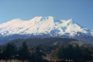
Geological Summary. Ruapehu, one of New Zealand's most active volcanoes, is a complex stratovolcano constructed during at least four cone-building episodes dating back to about 200,000 years ago. The dominantly andesitic 110 km3 volcanic massif is elongated in a NNE-SSW direction and surrounded by another 100 km3 ring plain of volcaniclastic debris, including the NW-flank Murimoto debris-avalanche deposit. A series of subplinian eruptions took place between about 22,600 and 10,000 years ago, but pyroclastic flows have been infrequent. The broad summait area and flank contain at least six vents active during the Holocene. Frequent mild-to-moderate explosive eruptions have been recorded from the Te Wai a-Moe (Crater Lake) vent, and tephra characteristics suggest that the crater lake may have formed as recently as 3,000 years ago. Lahars resulting from phreatic eruptions at the summit crater lake are a hazard to a ski area on the upper flanks and lower river valleys.
Information Contacts: Institute of Geological & Nuclear Sciences (IGNS), Private Bag 2000, Wairakei, New Zealand (URL: http://www.gns.cri.nz/).

