Report on Cameroon (Cameroon) — November 2001
Bulletin of the Global Volcanism Network, vol. 26, no. 11 (November 2001)
Managing Editor: Richard Wunderman.
Cameroon (Cameroon) Late June non-volcanic floods and landslides take ten's of lives; 1,000 homeless
Please cite this report as:
Global Volcanism Program, 2001. Report on Cameroon (Cameroon) (Wunderman, R., ed.). Bulletin of the Global Volcanism Network, 26:11. Smithsonian Institution. https://doi.org/10.5479/si.GVP.BGVN200111-224010
Cameroon
Cameroon
4.203°N, 9.17°E; summit elev. 4095 m
All times are local (unless otherwise noted)
Heavy downpours struck Limbe (formerly Victoria), a coastal town located on the southern foot of Mt. Cameroon, during 26-27 June 2001. They led to a series of floods and landslides that killed ~23 people and rendered over 1,000 people homeless. People were buried alive as the floods and landslides reduced houses to mud. The disaster took hundreds of thousands of dollars in property and left surviving residents deeply shaken.
Limbe (population, over 80,000) lies ~25 km directly S of Mt. Cameroon's summit. The town sits on the Atlantic coastal plain, an area bordered on its E and N sides by high, steep slopes of unconsolidated pyroclastic cones. Most of these cones are still geologically very young, most likely Late Quaternary in age, judging from their freshness and lack of vegetation. Other cones appear older as they have developed an appreciable soil overburden capable of supporting deep-rooted woody vegetation.
The main landslide occurred in the section of Limbe called Mabeta. There it covered four houses and killed 21 people. Rescue teams deployed from neighboring towns used a front-end loader to search for survivors and to excavate battered corpses who were seen by passing residents. The floods also took a boy who had sought refuge in a coconut tree. Many other sections of the town, including Down Beach Limbe, also suffered significant losses and damage. Some news sources cited 19 people confirmed dead and an additional 15 missing.
A government crisis commission was set up to handle the disaster. They were charged with finding ways to move people away from the disaster zone and resettle them elsewhere, and to propose new ways of avoiding future disasters in Limbe.
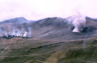
Geological Summary. Mount Cameroon, one of Africa's largest volcanoes, rises above the coast of west Cameroon. The massive steep-sided volcano of dominantly basaltic-to-trachybasaltic composition forms a volcanic horst constructed above a basement of Precambrian metamorphic rocks covered with Cretaceous to Quaternary sediments. More than 100 small cinder cones, often fissure-controlled parallel to the long axis of the 1400 km3 edifice, occur on the flanks and surrounding lowlands. A large satellitic peak, Etinde (also known as Little Cameroon), is located on the S flank near the coast. Historical activity was first observed in the 5th century BCE by the Carthaginian navigator Hannon. During historical time, moderate explosive and effusive eruptions have occurred from both summit and flank vents. A 1922 SW-flank eruption produced a lava flow that reached the Atlantic coast, and a lava flow from a 1999 south-flank eruption stopped only 200 m from the sea. Explosive activity from two vents on the upper SE flank was reported in May 2000.
Information Contacts: B. Ateba, R.U. Ubangoh, N. Ntepe, and F.T. Aka., IRGM/ARGV, P.O. Box 370, Buea, Cameroon; International Federation of Red Cross and Red Crescent Societies (IFRC), PO Box 372, CH-1211 Geneva 19, Switzerland (URL: http://www.ifrc.org/).