Report on Tangkoko-Duasudara (Indonesia) — September 2003
Bulletin of the Global Volcanism Network, vol. 28, no. 9 (September 2003)
Managing Editor: Edward Venzke.
Tangkoko-Duasudara (Indonesia) Volcanic earthquakes during October 2002-January 2003
Please cite this report as:
Global Volcanism Program, 2003. Report on Tangkoko-Duasudara (Indonesia) (Venzke, E., ed.). Bulletin of the Global Volcanism Network, 28:9. Smithsonian Institution. https://doi.org/10.5479/si.GVP.BGVN200309-266130
Tangkoko-Duasudara
Indonesia
1.518°N, 125.185°E; summit elev. 1334 m
All times are local (unless otherwise noted)
The Volcanological Survey of Indonesia (VSI) reported deep volcanic and A-type earthquakes at Tongkoko (also known as Tangkoko) over the period 7 October-24 November 2002 and more deep-volcanic events during 23 December 2002-19 January 2003 (table 1). The earthquakes, which began in May 2002, were recorded following relocation of an observatory post to Wainenet village in the Bitung area. The temperature at Batu Angus hot spring on 10 October 2002 was 70-73°C. While no visible activity has been observed, the hazard status was raised to Alert Level 2 (on a scale of 1-4) on 24 October 2002 as a result of the increased seismicity. The last recorded activity at Tongkoko consisted of flank lava flows and lava dome extrusion in 1880.
Table 1. Earthquakes recorded at Tongkoko, 7 October 2002-19 January 2003. In addition, one shallow volcanic event was recorded during 13-19 January 2003, and single B-type earthquakes each occurred during 21-27 October and 4-10 November 2002. Courtesy of VSI.
| Date | Deep Volcanic (B-type) | Shallow volcanic (A-type) | Tectonic |
| 07 Oct-13 Oct 2002 | 4 | -- | -- |
| 14 Oct-20 Oct 2002 | -- | 12 | 23 |
| 21 Oct-27 Oct 2002 | -- | 9 | 34 |
| 28 Oct-03 Nov 2002 | -- | 17 | 19 |
| 04 Nov-10 Nov 2002 | -- | 9 | 38 |
| 11 Nov-18 Nov 2002 | -- | 2 | 37 |
| 19 Nov-24 Nov 2002 | -- | 2 | 25 |
| 23 Dec-29 Dec 2002 | 5 | -- | 16 |
| 06 Jan-12 Jan 2003 | 11 | -- | 21 |
| 13 Jan-19 Jan 2003 | 5 | -- | 28 |
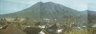
Geological Summary. The eastern peninsula at the far NE end of Sulawesi near the city of Bitung is occupied by a volcanic complex consisting of two major edifices within a nature reserve. To the north is Tangkoko (also known as Tongkoko), with a large caldera (~3 x 1.5 km) elongated towards the SE from the highest rim point; the rim at the opposite end is more than 400 m lower. Eruptions occurred from the summit crater in the 17th century and in 1801, when the caldera also reportedly contained a cone surrounded by a lake. About 1.5 km down the outer E flank is the Batuangus (or Batu Angus) lava dome, formed in 1801, along with an adjacent vent (Baru Batuangus) that has been the source of all subsequent eruptions. The higher twin-peaked Duasudara (also Dua Suadara) stratovolcano is about 4.5 km SW of the Tangkoko summit. A NE-facing open crater appears to have a hummocky debris flow that reaches the base of the Tangkoko edifice.
Information Contacts: Dali Ahmad, Hetty Triastuty, Nia Haerani, and Suswati, Volcanological Survey of Indonesia (VSI), Jalan Diponegoro No. 57, Bandung 40122, Indonesia (URL: http://www.vsi.esdm.go.id/).