Report on Soputan (Indonesia) — November 2004
Bulletin of the Global Volcanism Network, vol. 29, no. 11 (November 2004)
Managing Editor: Richard Wunderman.
Soputan (Indonesia) 12 December eruption covered villages with ash up to 2 cm thick
Please cite this report as:
Global Volcanism Program, 2004. Report on Soputan (Indonesia) (Wunderman, R., ed.). Bulletin of the Global Volcanism Network, 29:11. Smithsonian Institution. https://doi.org/10.5479/si.GVP.BGVN200411-266030
Soputan
Indonesia
1.112°N, 124.737°E; summit elev. 1785 m
All times are local (unless otherwise noted)
Soputan erupted again on 12 December 2004. The Directorate of Volcanology and Geological Hazard Mitigation (DVGHM) noted that an eruption on 18 October 2004 sent a cloud ~ 600 meters above the crater. The previous eruptive episode occurred during July and August 2003 (BGVN 28:08, 28:10, and 28:11). A summary of ash plumes from mid-2003 through 12 December 2004 appears in table 6. Large discrepancies appeared in reported ash column heights; with the satellite estimates about 10 times larger than ground-based estimates.
Table 6. Reported ash plume altitudes recorded from Soputan, 18 July 2003-12 December 2004. Courtesy of DVGHM and Darwin VAAC.
| Date | Description | Source |
| 18 Jul 2003 | ~2 km above summit | DVGHM |
| 02 Sep 2003 | ~2 km altitude | Darwin VAAC |
| 04 Sep 2003 | ~3 km altitude (extending ~75 km N of the summit) | Satellite imagery, Darwin VAAC |
| 18 Oct 2004 | ~600 m above summit | DVGHM |
| 12 Dec 2004 | ~1 km above summit | DVGHM |
| 12 Dec 2004 | ~10.7 km altitude | Darwin VAAC |
The earliest details mentioned by DVGHM regarding the 2004 activity discussed 11 December 2004, a time when the tremor tended to rise, attaining peak-to-peak amplitudes of 0.5-3.0 mm. Observers also saw incandescence at the crater's rim.
At 0046 on 12 December tremor again registered with maximum peak-to-peak amplitudes of ~ 45 mm. At 0050 on 12 December Soputan erupted, sending an ash cloud up to 1 km. This was followed by discharge of a "hot cloud" (pyroclastic flow ?) to a distance of ~ 200 m E (from 'Aeseput,' a prominent NE-flank vent that formed in 1906). A lava flow spread W and S of Soputan. Observers could hear rumbling noise and thunder from their monitoring station ~ 11 km from the crater.
White-to-gray ash went E. At 0130 on 12 December a problem arose with the seismic sensors, perhaps because the solar panel was covered with ash. By 0600 the sensor was down. At 0500 that day a hot cloud occurred with a run out distance of ~ 150 m and a height of 200 m. Activity persisted until 1030. Soputan's summit then became visually obscured by clouds, but observers could still make out a white thin-to-medium plume to 70-80 m above the crater, and incandescence.
On the 13 December at 1752 observers felt an earthquake with a magnitude of MM I-II. The seismograph was then still inoperable.
News reports. A 13 December news report in The Daily Reform Voice stated that hundreds of hectares of paddy-fields and other agricultural land to the W of the Soputan was seriously impacted by tephra.
Thomas Dobat, a German expatriat living in Indonesia and concerned about the situation, sent Bulletin editors a translation of a 13 December 2004 article on Soputan taken from the Indonesian Journal Komentar. Similar to the above report, it also noted that hundreds of villages in 13 districts in Central Minahasa and in South Minahasa suffered from tephra fall emitted on 11-12 December. These eruptions of Soputan were accompanied by heavy thunder and lightning, which were heard in the town of Amurang.
Ash fell in nearly all of Central Minahasa and in parts of South Minahasa. The result was that in all areas of Central Minahasa, especially in the town of Tondano, houses, rice-fields, and roads were ash-covered up to 2 cm thick.
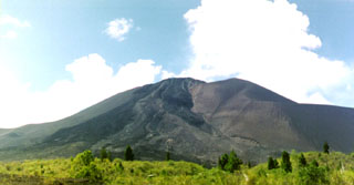
Geological Summary. The Soputan stratovolcano on the southern rim of the Quaternary Tondano caldera on the northern arm of Sulawesi Island is one of Sulawesi's most active volcanoes. The youthful, largely unvegetated volcano is the only active cone in the Sempu-Soputan volcanic complex, which includes the Soputan caldera, Rindengan, and Manimporok (3.5 km ESE). Kawah Masem maar was formed in the W part of the caldera and contains a crater lake; sulfur has been extracted from fumarolic areas in the maar since 1938. Recent eruptions have originated at both the summit crater and Aeseput, a prominent NE-flank vent that formed in 1906 and was the source of intermittent major lava flows until 1924.
Information Contacts: Directorate of Volcanology and Geological Hazard Mitigation, Jalan Diponegoro 57, Bandung 40122, Indonesia (URL: http://www.vsi.esdm.go.id/); Darwin Volcanic Ash Advisory Centre, Australian Bureau of Meteorology (URL: http://www.bom.gov.au/info/vaac); The Daily Reform Voice; Komentar; Thomas Dobat, Lorong Jerman, Kauditan II, 95372, Sulawesi Utara, Indonesia.

