Report on Soputan (Indonesia) — December 2004
Bulletin of the Global Volcanism Network, vol. 29, no. 12 (December 2004)
Managing Editor: Richard Wunderman.
Soputan (Indonesia) Explosive eruption causes ash plume and avalanche on 18 October 2004
Please cite this report as:
Global Volcanism Program, 2004. Report on Soputan (Indonesia) (Wunderman, R., ed.). Bulletin of the Global Volcanism Network, 29:12. Smithsonian Institution. https://doi.org/10.5479/si.GVP.BGVN200412-266030
Soputan
Indonesia
1.112°N, 124.737°E; summit elev. 1785 m
All times are local (unless otherwise noted)
Activity at Soputan that began on 18 July 2003 (BGVN 28:08) continued with occasional ash explosions in August (BGVN 28:10 and 28:11) and through 4 September 2003 (BGVN 29:11). The report of the 12 December 2004 eruption (BGVN 29:11) also mentioned activity on 18 October. The following information from the Indonesian Directorate of Volcanology and Geological Hazard Mitigation describes that October 2004 activity in greater detail.
Volcanic tremor increased at 0930 on 18 October 2004 with amplitudes in the range of 10-40 mm. From 1026 to 1452 tremor amplitudes reached a maximum of 41 mm (over scale). At 1041 Soputan exploded, releasing a white to gray ash column as high as 600 m above the crater rim and drifting E. The explosion, along with rumbling sounds, was heard at the Post Observatory ~ 12 km from the summit. Based on increasing seismicity, the official hazard level was raised to Orange or II (on a scale of I-IV) at 1500 that day. At 1815 incandescence was visible, rising 25-30 m above the crater rim. Ash reached the Observatory at 2130, and a "lava avalanche" at 2135 traveled to the S. Tremor was recorded until 0712 on the following day, 19 October, with amplitudes of 0.5-2 mm.
A GOES-9 satellite loop of the 18 October 2004 eruption was compiled by the Darwin Volcanic Ash Advisory Centre (VAAC). Based on the dispersion patterns and infrared temperatures (minimum temperature of zero degrees), the cloud probably reached between 5,000 and 6,000 m altitude, where there was an atmospheric inversion that prevented further rise.
The Darwin VAAC also noted that a satellite image from the Terra MODIS instrument taken at 0210 UTC on 1 September 2003 showed an eruption plume during clear weather. The imaged eruption, described as a low-level cloud streaming to the SW that probably didn't rise much above the summit, occurred during a period of previously reported ash plumes and lava flow activity (BGVN 28:10).
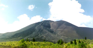
Geological Summary. The Soputan stratovolcano on the southern rim of the Quaternary Tondano caldera on the northern arm of Sulawesi Island is one of Sulawesi's most active volcanoes. The youthful, largely unvegetated volcano is the only active cone in the Sempu-Soputan volcanic complex, which includes the Soputan caldera, Rindengan, and Manimporok (3.5 km ESE). Kawah Masem maar was formed in the W part of the caldera and contains a crater lake; sulfur has been extracted from fumarolic areas in the maar since 1938. Recent eruptions have originated at both the summit crater and Aeseput, a prominent NE-flank vent that formed in 1906 and was the source of intermittent major lava flows until 1924.
Information Contacts: Directorate of Volcanology and Geological Hazard Mitigation, Jalan Diponegoro 57, Bandung 40122, Indonesia (URL: http://www.vsi.esdm.go.id/); Andrew Tupper, Darwin Volcanic Ash Advisory Centre (VAAC), Australian Bureau of Meteorology (URL: http://www.bom.gov.au/info/vaac/soputan.shtml).

