Report on Whakaari/White Island (New Zealand) — December 2006

Bulletin of the Global Volcanism Network, vol. 31, no. 12 (December 2006)
Managing Editor: Richard Wunderman.
Whakaari/White Island (New Zealand) Relative quite prevails during 2005-6
Please cite this report as:
Global Volcanism Program, 2006. Report on Whakaari/White Island (New Zealand) (Wunderman, R., ed.). Bulletin of the Global Volcanism Network, 31:12. Smithsonian Institution. https://doi.org/10.5479/si.GVP.BGVN200612-241040
Whakaari/White Island
New Zealand
37.52°S, 177.18°E; summit elev. 294 m
All times are local (unless otherwise noted)
Between June 2005 and December 2006, seismic activity remained low at White Island. According to the Institute of Geological and Nuclear Sciences (GNS), observers have occasionally seen elevated levels of sulfur gases (sulfur dioxide, hydrogen sulfide) and carbon dioxide, as well as periods of micro-earthquakes and steam plumes. Minor changes in fumarole activity have also occurred. The crater lake has remained well below the overflow level. As of 15 December 2006, White Island remained at Alert Level 1 (some signs of volcano unrest).
Franz Jeker visited White Island on 9 January 2005 and took a series of photos showing some crater features (figures 47-49). Images from a web camera located on the crater rim show that no significant change in activity has occurred as of 9 February 2007 (figure 50).
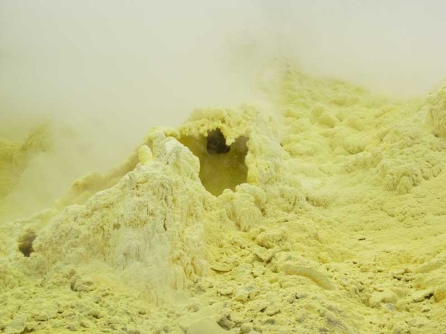 |
Figure 47. Native sulfur deposits in a fumarolic environment at White Island, 9 January 2005. Courtesy of Franz Jeker. |
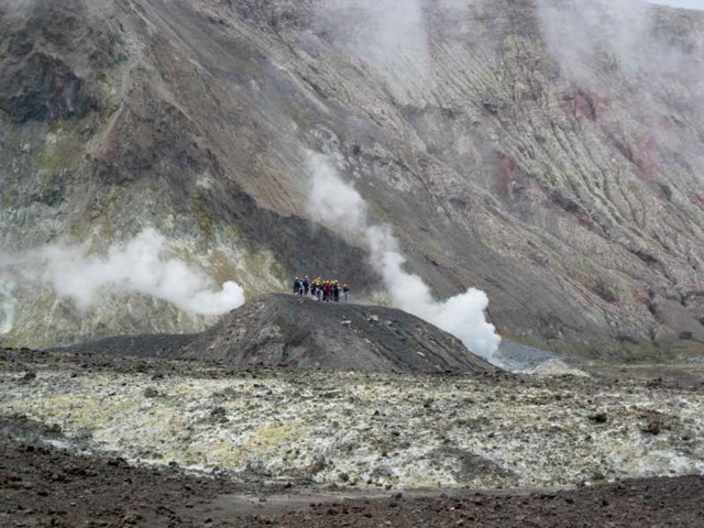 |
Figure 48. Visitors standing on a high point in the crater at White Island, 9 January 2005. Courtesy of Franz Jeker. |
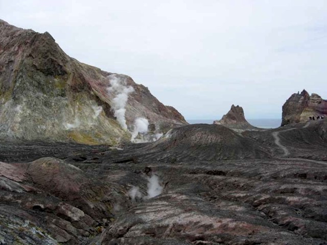 |
Figure 49. Photo of the crater at White Island looking SE towards the ocean, 9 January 2005. Courtesy of Franz Jeker. |
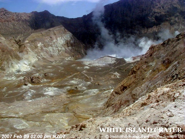 |
Figure 50. Webcam image taken from the crater rim at White Island, 9 February 2007. Courtesy of GeoNet. |
Geological Summary. The uninhabited Whakaari/White Island is the 2 x 2.4 km emergent summit of a 16 x 18 km submarine volcano in the Bay of Plenty about 50 km offshore of North Island. The island consists of two overlapping andesitic-to-dacitic stratovolcanoes. The SE side of the crater is open at sea level, with the recent activity centered about 1 km from the shore close to the rear crater wall. Volckner Rocks, sea stacks that are remnants of a lava dome, lie 5 km NW. Descriptions of volcanism since 1826 have included intermittent moderate phreatic, phreatomagmatic, and Strombolian eruptions; activity there also forms a prominent part of Maori legends. The formation of many new vents during the 19th and 20th centuries caused rapid changes in crater floor topography. Collapse of the crater wall in 1914 produced a debris avalanche that buried buildings and workers at a sulfur-mining project. Explosive activity in December 2019 took place while tourists were present, resulting in many fatalities. The official government name Whakaari/White Island is a combination of the full Maori name of Te Puia o Whakaari ("The Dramatic Volcano") and White Island (referencing the constant steam plume) given by Captain James Cook in 1769.
Information Contacts: Institute of Geological and Nuclear Sciences (GNS), Private Bag 2000, Wairakwi, New Zealand (URL: http://www.gns.cri.nz/); GeoNet, a project sponsored by the New Zealand Government through these agencies: Earthquake Commission (E.C.), Geological and Nuclear Sciences (GNS), and Foundation for Research, Science and Technology (FAST) (URL: http://www.geonet.org.nz/); Franz Jeker, Rigistrasse 10, 8173 Neerach, Switzerland.