Report on Tongariro (New Zealand) — December 2006
Bulletin of the Global Volcanism Network, vol. 31, no. 12 (December 2006)
Managing Editor: Richard Wunderman.
Tongariro (New Zealand) Elevated seismicity at Ngauruhoe during May-October 2006
Please cite this report as:
Global Volcanism Program, 2006. Report on Tongariro (New Zealand) (Wunderman, R., ed.). Bulletin of the Global Volcanism Network, 31:12. Smithsonian Institution. https://doi.org/10.5479/si.GVP.BGVN200612-241080
Tongariro
New Zealand
39.157°S, 175.632°E; summit elev. 1978 m
All times are local (unless otherwise noted)
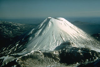
Ngāuruhoe is the youngest and highest volcanic cone (figure 1) of the Tongariro volcanic complex on the North Island of New Zealand. According to New Zealand GeoNet Project volcanologists, the number of small (less than magnitude 2), low-frequency earthquakes near Ngāuruhoe recorded by seismometers increased from less than five per day at the beginning of May 2006 to more than 20/day by the end of May. Typically, only a few earthquakes of any type are recorded in the vicinity of Ngāuruhoe each year. In 1983, 1991, and 1994 there were clusters of similar earthquakes recorded near Ngāuruhoe, but there have been very few recorded since then. Due to the increased seismicity, the Scientific Alert Level was raised to Alert Level 1 (some signs of unrest) on 6 June. Earthquakes of this type are commonly interpreted as being related to the movement of magma and/or volcanic gases.
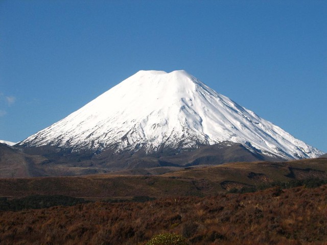 |
Figure 1. Snow covered Mt. Ngāuruhoe as seen on 28 July 2006. Photo credit to University of Auckland Snowsports Club. |
Earthquakes peaked in early June at about 50/day and then declined to about 10-20/day by the 14th, with the largest about magnitude 1. Seismic activity has remained elevated through the middle of December 2006. Initial observations suggested that hypocenters were 1-4 km deep, slightly N or E of the summit. By mid-June volcanologists had installed three additional seismographs around the base of Ngāuruhoe, including one that could be monitored in real-time. Between 14 June and 3 July the number of volcanic earthquakes recorded near Ngāuruhoe has varied between approximately 20 and 40 per day. Using data from the additional seismographs, volcanologists were able to refine the location of the earthquakes to within about 1 km of the surface beneath the N flank; the largest events were approximately magnitude 1. Elevated seismicity continued at up to 30 events/day through October 2006.
As of the last GeoNet report on 1 November, no other signs of unrest had been recorded. Multiple measurements showed that temperatures and volcanic gas concentrations have not changed since the increased seismicity began in May, and were similar to measurements made in 2003. Carbon-dioxide release through the soil (from degassing magma) is also similar to measurements in 2003. The maximum fumarole temperature near the summit is about 85°C. Reports of steaming in the summit area were investigated, but because no new features were seen that could have caused emissions, the sightings were attributed to clouds rather than volcanic activity.
Geological Summary. Tongariro is a large volcanic massif, located immediately NE of Ruapehu volcano, that is composed of more than a dozen composite cones constructed over a period of 275,000 years. Vents along a NE-trending zone extending from Saddle Cone (below Ruapehu) to Te Maari crater (including vents at the present-day location of Ngauruhoe) were active during several hundred years around 10,000 years ago, producing the largest known eruptions at the Tongariro complex during the Holocene. North Crater stratovolcano is truncated by a broad, shallow crater filled by a solidified lava lake that is cut on the NW side by a small explosion crater. The youngest cone, Ngauruhoe, is also the highest peak.
Information Contacts: New Zealand GeoNet Project, a project sponsored by the New Zealand Government through these agencies: Earthquake Commission (E.C.), Geological and Nuclear Sciences (GNS), and Foundation for Research, Science and Technology (FAST) (URL: https://www.geonet.org.nz/); University of Auckland Snowsports Club, University of Auckland, New Zealand (URL: http://www.uasc.co.nz/).