Report on Talang (Indonesia) — February 2008
Bulletin of the Global Volcanism Network, vol. 33, no. 2 (February 2008)
Managing Editor: Richard Wunderman.
Talang (Indonesia) Ash emissions in March, June, and November 2007
Please cite this report as:
Global Volcanism Program, 2008. Report on Talang (Indonesia) (Wunderman, R., ed.). Bulletin of the Global Volcanism Network, 33:2. Smithsonian Institution. https://doi.org/10.5479/si.GVP.BGVN200802-261160
Talang
Indonesia
0.979°S, 100.681°E; summit elev. 2575 m
All times are local (unless otherwise noted)
The Center of Volcanology and Geological Hazard Mitigation (CVGHM) lowered the Alert Level of Talang to 2 (on a scale of 1-4) on 27 January 2007 due to a reduced seismicity between 23 November 2006 and 24 January 2007, although gas plumes originated from South and Main craters. There had been eruptive episodes in April 2005 and elevated activity during late 2006 (BGVN 32:01).
On 17 March 2007, CVGHM raised the Alert Level based on increased "smoke" and tremors to 3 (on a scale of 1-4). The Darwin Volcanic Ash Advisory Centre (VAAC) reported that, based on information from CVGHM, ash plumes rose to altitudes of 3.4-3.9 km on 19-20 March. Local authorities and residents were advised to prepare for a possible evacuation. On 23 April 2007 the Alert Level was reduced to 2. During 18-25 June, thick brown ash plumes rose from Main crater to an altitude of 3.1 km. Diffuse "white ash" plumes rose from South crater to an altitude of 3 km.
On 29 November CVGHM raised the Alert Level to 3 (on a scale of 1-4) based on visual observations and seismicity. During 27-29 November, ash and steam plumes from multiple craters rose to altitudes of 3.1-4.1 km. A strong smell of sulfur dioxide gas was reported. Visitors were advised not to go within 3 km of the summit.
During 7-10 December, observations were limited by inclement weather. On 11 December, "smoke" rose from the Main crater to a maximum altitude of 3.3 km. Plumes were also observed from the South crater and Gabuo Atas solfatara field. On 14 December visual observations and a decrease in the number of earthquakes prompted a lowering of the Alert Level back to 2.
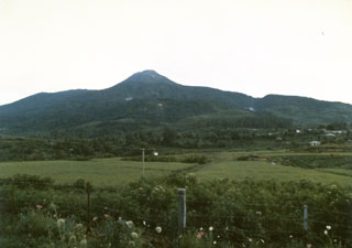
Geological Summary. Talang, which forms a twin volcano with the extinct Pasar Arbaa volcano, lies ESE of the major city of Padang and rises NW of Dibawah Lake. Talang has two crater lakes on its flanks; the largest of these is 1 x 2 km wide Danau Talang. The summit exhibits fumarolic activity, but which lacks a crater. Historical eruptions have mostly involved small-to-moderate explosive activity first documented in the 19th century that originated from a series of small craters in a valley on the upper NE flank.
Information Contacts: Darwin Volcanic Ash Advisory Centre, Bureau of Meteorology, Commonwealth of Australia (URL: http://www.bom.gov.au/info/vaac); Center of Volcanology and Geological Hazard Mitigation (CVGHM), Jalan Diponegoro 57, Bandung 40122, Indonesia (URL: http://www.vsi.esdm.go.id/).