Report on Montagu Island (United Kingdom) — July 2008
Bulletin of the Global Volcanism Network, vol. 33, no. 7 (July 2008)
Managing Editor: Richard Wunderman.
Montagu Island (United Kingdom) Eruption of Mount Belinda ceased by late 2007
Please cite this report as:
Global Volcanism Program, 2008. Report on Montagu Island (United Kingdom) (Wunderman, R., ed.). Bulletin of the Global Volcanism Network, 33:7. Smithsonian Institution. https://doi.org/10.5479/si.GVP.BGVN200807-390081
Montagu Island
United Kingdom
58.445°S, 26.374°W; summit elev. 1370 m
All times are local (unless otherwise noted)
MODVOLC thermal alerts and a recent ASTER image indicate that the eruption of Mount Belinda, on Montagu Island, which began in 2001, has ceased. There have been no MODVOLC alerts over the volcano since September 2007 (BGVN 33:03) and a cloud-free ASTER thermal image from 19 July 2008 confirms the absence of a thermal anomaly at the summit of Mount Belinda.
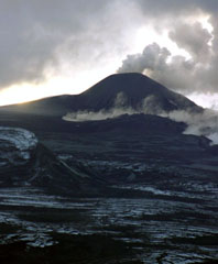
The eruption, the first recorded historical activity at the volcano, began in October 2001 and probably ceased in September 2007, amounting to almost six years of persistent activity. The activity was characterized by low-level ash emission from the summit of Mount Belinda, an intra-caldera cone. At least three effusive events produced lava flows that cut into the island's ice cover. The largest effusive event, in September 2005, created a flow which traveled 3.5 km to reach the sea, creating a 500 m wide delta on the N shore. This delta remained on a July 2008 ASTER image (figure 20).
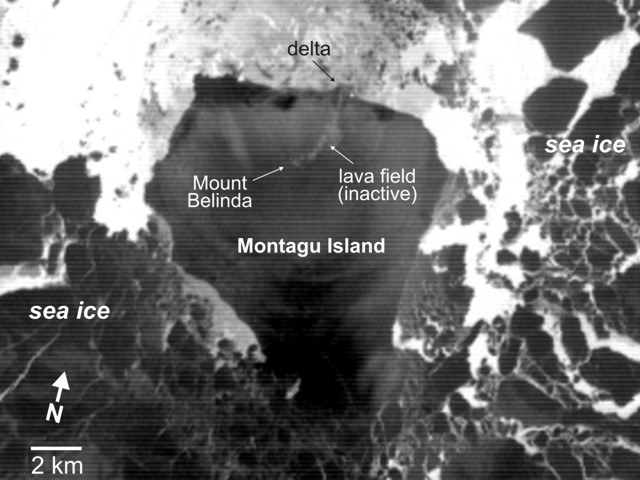 |
Figure 20. ASTER thermal image taken on 19 July 2008 showing Montagu Island and surroundings. The absence of eruptive activity is shown by the lack of high thermal radiance areas. The September 2005 lava delta on the N coast had not eroded away. Courtesy of Matt Patrick. |
Geological Summary. The largest of the South Sandwich Islands, Montagu consists of a massive shield volcano cut by a 6-km-wide ice-filled summit caldera. The summit of the 11 x 15 km island rises about 3,000 m from the sea floor between Bristol and Saunders Islands. Around 90% of the island is ice-covered; glaciers extending to the sea typically form vertical ice cliffs. The name Mount Belinda has been applied both to the high point at the southern end of the summit caldera and to the young central cone. Mount Oceanite, an isolated peak at the SE tip of the island, was the source of lava flows exposed at Mathias Point and Allen Point. There was no record of Holocene activity until MODIS satellite data, beginning in late 2001, revealed thermal anomalies consistent with lava lake activity. Apparent plumes and single anomalous pixels were observed intermittently on AVHRR images from March 1995 to February 1998, possibly indicating earlier volcanic activity.
Information Contacts: Matt Patrick, Hawaiian Volcano Observatory (HVO), U.S. Geological Survey, PO Box 51, Hawai'i National Park, HI 96718, USA (URL: https://volcanoes.usgs.gov/observatories/hvo/); John Smellie, British Antarctic Survey, Natural Environment Research Council, High Cross, Madingly Road, Cambridge CB3 0ET, United Kingdom (URL: https://www.bas.ac.uk/).