Report on Karangetang (Indonesia) — January 2010
Bulletin of the Global Volcanism Network, vol. 35, no. 1 (January 2010)
Managing Editor: Richard Wunderman.
Karangetang (Indonesia) Lava flows and pyroclastic flows seen during 2009
Please cite this report as:
Global Volcanism Program, 2010. Report on Karangetang (Indonesia) (Wunderman, R., ed.). Bulletin of the Global Volcanism Network, 35:1. Smithsonian Institution. https://doi.org/10.5479/si.GVP.BGVN201001-267020
Karangetang
Indonesia
2.781°N, 125.407°E; summit elev. 1797 m
All times are local (unless otherwise noted)
At Karangetang during May 2009, emissions included explosions and lava flows (BGVN 34:05). Activity continued during June and into at least early 2010.
During the first week of June 2009, lava flows from Karangetang traveled 50 m E and 600 m SE. According to the Center of Volcanology and Geological Hazard Mitigation (CVGHM), incandescent rocks from the main craters and ends of the lava flow traveled as far as 2 km towards multiple river valleys, including the Keting River to the S. On 1 June, white-to-gray-to-brown plumes rose 700 m above the main crater. Incandescent lava was ejected 500-700 m. On 4 June, both the tremor amplitude and the number of earthquakes decreased. During 4-6 June, white plumes rose 50-300 m from the main crater. On 7 and 8 June, fog often prevented observations and incandescent rocks were rarely seen. The Alert Level was lowered to 3 (on a scale of 1-4) on 9 June.
No further activity was reported until 3 November 2009. Based on a pilot observation and satellite imagery, the Darwin Volcanic Ash Advisory Centre (VAAC) reported that on 3 November an ash plume rose to an altitude of 3 km and drifted 90-185 km W.
According to news reports, a pyroclastic flow and a lahar descended the flanks on 4 November. Residents saw active lava flows the next day. On 11 November, incandescent material was ejected 5 m into the air.
CVGHM noted that seismicity declined during 1 January-8 February 2010. When the weather was clear, white plumes were seen rising 100-200 m above the crater rim. Incandescent material was ejected 10-50 m above the Utama Crater. CVGHM lowered the Alert Level to 2 on 12 February.
MODVOLC. MODVOLC thermal alerts that were previously reported in March through 3 June 2009 (BGVN 34:05) continued through 8 November. Alerts were recorded on 10 July, 5 September, 5 October, 16 October, 30 October, 3 November (4 pixels on Aqua, 4 pixels on Terra), 4 November (2 pixels on Terra, 1 pixel on Aqua), and 8 November. No alerts were recorded between 8 November 2009 and 19 February 2010.
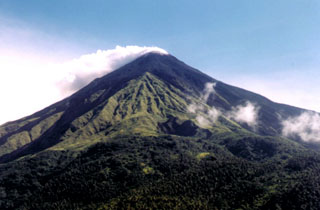
Geological Summary. Karangetang (Api Siau) volcano lies at the northern end of the island of Siau, about 125 km NNE of the NE-most point of Sulawesi. The stratovolcano contains five summit craters along a N-S line. It is one of Indonesia's most active volcanoes, with more than 40 eruptions recorded since 1675 and many additional small eruptions that were not documented (Neumann van Padang, 1951). Twentieth-century eruptions have included frequent explosive activity sometimes accompanied by pyroclastic flows and lahars. Lava dome growth has occurred in the summit craters; collapse of lava flow fronts have produced pyroclastic flows.
Information Contacts: Center of Volcanology and Geological Hazard Mitigation (CVGHM), Jalan Diponegoro 57, Bandung 40122, Indonesia (URL: http://vsi.esdm.go.id/); Hawai'i Institute of Geophysics and Planetology (HIGP) Thermal Alerts System, School of Ocean and Earth Science and Technology (SOEST), Univ. of Hawai'i, 2525 Correa Road, Honolulu, HI 96822, USA (URL: http://modis.higp.hawaii.edu/); Darwin Volcanic Ash Advisory Centre (VAAC), Bureau of Meteorology, Northern Territory Regional Office, PO Box 40050, Casuarina, NT 0811, Australia (URL: http://www.bom.gov.au/info/vaac/); Berita News (URL: http://berita.liputan6.com/).

