Report on Dukono (Indonesia) — August 2011

Bulletin of the Global Volcanism Network, vol. 36, no. 8 (August 2011)
Managing Editor: Richard Wunderman.
Dukono (Indonesia) Continued frequent minor ash plume at least as late as 13 September 2011
Please cite this report as:
Global Volcanism Program, 2011. Report on Dukono (Indonesia) (Wunderman, R., ed.). Bulletin of the Global Volcanism Network, 36:8. Smithsonian Institution. https://doi.org/10.5479/si.GVP.BGVN201108-268010
Dukono
Indonesia
1.6992°N, 127.8783°E; summit elev. 1273 m
All times are local (unless otherwise noted)
Frequent minor ash plumes have occurred at Dukono (see figure 4) since before July 2008 (BGVN 33:08, 33:11, 35:04, and 36:03). This report covers the time period subsequent to our previous report, which ended on 4 April 2011 (BGVN 36:03), through 13 September 2011. The Darwin Volcanic Ash Advisory Centre (VAAC) has provided continuous monitoring of the activity through satellite surveillance (table 12) during this time period.
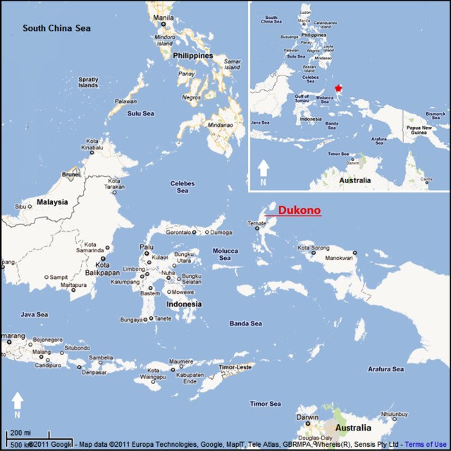 |
Figure 4. Map showing Dukono volcano, on the island of Halmahera, Indonesia. Courtesy of Google Maps (prepared by GVP editor Jeff Jessens). |
Table 12. Ash plumes from Dukono detected in satellite images between 21 April 2011 and 13 September 2011. Each date or date range represents at least one plume. No plumes were reported between the end of the table in our previous report (4 April 2011) and 21 April 2011. Data from the Darwin Volcanic Ash Advisory Centre.
| Date (UTC) | Plume Altitude | Plume Direction | Plume Distance |
| 21 Apr-22 Apr 2011 | 2.1 km | NE and E | Up to 85 km |
| 28 Apr-02 May 2011 | 4.3 km | NW, W, and SW | 55-150 km |
| 10 May-12 May 2011 | 4.3 km | NE and E | 75-110 km |
| 16 May 2011 | 3 km | E | Over 90 km |
| 19 May 2011 | 3 km | NE | 110 km |
| 01 Jun 2011 | 3 km | NE | 110 km |
| 01 Jul 2011 | 3 km | E | 110 km |
| 06 Jul-07 Jul 2011 | 3 km | NW | 55 km |
| 11 Aug 2011 | 3 km | Various | 14-93 km |
| 14 Aug 2011 | 3 km | NW | 93 km |
| 18 Aug-21 Aug 2011 | 3 km | N and NE | 110-150 km |
| 13 Sep 2011 | 3 km | NW | 75 km |
According to a news article (Metro TV News), seismic activity increased in August 2011. On 11 August, ash explosions were audible within a radius of about 7 km from the base of the volcano. Ash was ejected as high as 1 km above the crater, producing plumes that drifted E and S, and also approached Tobelo City (14 km ENE). The news article noted that seismographs at the Dukono observation post had recorded more than 100 eruption earthquakes during this time.
A news report posted on the web (YouTube, 2011) discussed an eruption at Dukono during first half of September 2011. The commentator spoke in Indonesian. The video shows a large column of ash rising what appears to be on the order of one or a few kilometers above the crater. This news report was discussed elsewhere as well on the web.
During this reporting period (21 April 2011 to 13 September 2011), there were no thermal alerts derived from the Hawai'i Institute of Geophysics and Planetology Thermal Alerts System (MODVOLC). The most recent MODVOLC thermal alert was on 20 November 2010.
Reference. YouTube (2011), Gunung Dukono letusan, Leputan 6.com, uploaded by szbrnr on 7 September 2011 (URL: http://www.youtube.com/watch?v=mb3We1MwXdg).
Geological Summary. Reports from this remote volcano in northernmost Halmahera are rare, but Dukono has been one of Indonesia's most active volcanoes. More-or-less continuous explosive eruptions, sometimes accompanied by lava flows, have occurred since 1933. During a major eruption in 1550 CE, a lava flow filled in the strait between Halmahera and the N-flank Gunung Mamuya cone. This complex volcano presents a broad, low profile with multiple summit peaks and overlapping craters. Malupang Wariang, 1 km SW of the summit crater complex, contains a 700 x 570 m crater that has also been active during historical time.
Information Contacts: Darwin Volcanic Ash Advisory Centre (VAAC), Bureau of Meteorology, Northern Territory Regional Office, PO Box 40050, Casuarina, NT 0811, Australia (URL: http://www.bom.gov.au/info/vaac/); Center of Volcanology and Geological Hazard Mitigation (CVGHM), Jalan Diponegoro 57, Bandung 40122, Indonesia (URL: http://vsi.esdm.go.id/); Hawai'i Institute of Geophysics and Planetology (HIGP) Thermal Alerts System, School of Ocean and Earth Science and Technology (SOEST), University of Hawai'i, 2525 Correa Road, Honolulu, HI 96822, USA (URL: http://modis.higp.hawaii.edu/); Metro TV News (URL: http://www.metrotvnews.com).