Report on Gaua (Vanuatu) — June 2012
Bulletin of the Global Volcanism Network, vol. 37, no. 6 (June 2012)
Managing Editor: Richard Wunderman.
Gaua (Vanuatu) Ongoing eruptions from Mt. Garat during 2011
Please cite this report as:
Global Volcanism Program, 2012. Report on Gaua (Vanuatu) (Wunderman, R., ed.). Bulletin of the Global Volcanism Network, 37:6. Smithsonian Institution. https://doi.org/10.5479/si.GVP.BGVN201206-257020
Gaua
Vanuatu
14.281°S, 167.514°E; summit elev. 729 m
All times are local (unless otherwise noted)
Gaua awoke in 2009 (BGVN 34:10) and has continued sporadic eruptions and seismic unrest into 2012. Our last Bulletin report discussed events at Gaua (and island of the same name) into late 2010, with some later seismic and thermal data (BGVN 35:05). A new report from the Vanuatu Geohazards Observatory (VGO) issued in October 2011 contains a new hazards map (figure 21).
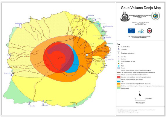 |
Figure 21. An updated hazard map for Gaua ("Gaua Volkeno Denja Map" in local parlance). Note the crescent-shaped Lake Letas (blue, and overlain with other colors) wrapping around the N and E sides of the active center's ~800-m-tall summit (Mt. Garat). An earlier map appeared in BGVN 34:12. From the VGO Bulletin issued on 26 October 2011. [Note: This image is very low resolution; a higher resolution version of this map and explanation of symbols will be posted if it becomes available.] |
In addition, a new geosciences publication, Globe Magazine, contained photos (figures 22 and 23) and a brief discussion of Gaua's behavior as late as early 2010 (Scott and others, 2010). The report included the following statements on events at the volcano and efforts to bolster instrumental observations.
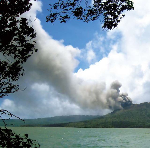 |
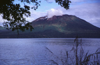
Figure 22. Undated photo of Gaua in the course of a modest ash-bearing eruption at Mt. Garat. The water in the foreground is Lake Letas, which surrounds the N to SE flanks. From Scott and others (2010). |
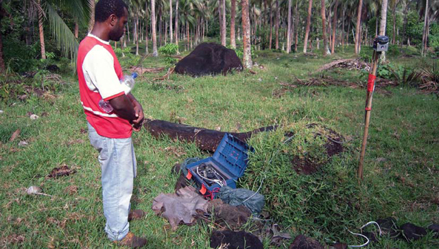 |
Figure 23. Vanuatu Geohazards Unit staff member Jimmy Loic checking one of the GNS Science seismic stations installed on Gaua. From Scott and others (2010). |
"Mount Garet [Garat] on Gaua, a 20-km-diameter island 400 km N of the capital Port Vila, started erupting in September 2009, and by late November there were signs that eruptions might become larger and more explosive. Because of its remoteness and the vulnerability of its population of about 3,000 to volcanic ash, the Vanuatu government decided immediate action was needed. The main concerns are volcanic ash contaminating water supplies and anxiety caused by the erratic behaviour of the volcano.
"The volcano has been erupting mostly steam and fine ash. However, in early 2010 several more explosive eruptions threw scoria bombs up to 2 km from the crater. The ash has been falling mostly on villages and fields W and NW of the volcano, and more than 200 people living in those areas have been relocated.
"Based on their observations and the recent history of eruptions on Gaua, volcanologists from GNS Science and Vanuatu concluded that the eruptive activity is most likely to continue for some months at a level similar to that seen so far. The New Zealand government's international aid and development agency, NZAID, has funded the visits by GNS Science. NZAID has subsequently asked GNS Science to provide the Vanuatu government with three seismographs and to train local staff in their use, and in data analysis and interpretation."
2011 activity. VGO reported on 10 October 2011 that data collected by the Gaua monitoring system showed the existence of earthquakes caused by volcanic activity in August 2011. OMI satellite images clearly showed degassing during 17 and 27-28 September 2011, indicating ongoing activity. According to VGO, on 10 October local authorities reported ashfall on the NE and W sides of Gaua Island.
VGO issued a report on 26 October 2011 that described an activity assessment made during 17-18 October 2011. The report confirmed Gaua's ash emissions since September 2011, with ash distribution dictated by trade winds. Seismic data suggested eruptive activity since June 2011, but the intensity of the activity was lower than during 2009-2010.
VGO indicated that two scenarios were envisaged for Gaua. Activity could intensify with little or no warning and then cease. On the other hand, activity could continue more regularly, causing ashfall in the neighboring communities, especially those on the W side of the island that are exposed to trade winds. With this analysis, the Alert Level of Gaua remained at level 1 (on a scale from 0-4), meaning that activity had slightly increased, with the risk remaining near the volcano crater, within the red zone (see figure 21).
Reference. Scott, B., Jolly, A., Sherburn, S., and Jolly, G., 2010, Expert advice on Vanuatu volcano, Globe Magazine, Issue 1 (July 2010); pp. 12-13. Published by GNS Science (New Zealand; Editor, John Callan; Chief Executive, Alex Malahoff); ISSN 1179-7177 (Print); ISSN 1179-7185 (Online)
Geological Summary. The roughly 20-km-diameter Gaua Island, also known as Santa Maria, consists of a basaltic-to-andesitic stratovolcano with an 6 x 9 km summit caldera. Small vents near the caldera rim fed Pleistocene lava flows that reached the coast on several sides of the island; littoral cones were formed where these lava flows reached the ocean. Quiet collapse that formed the roughly 700-m-deep caldera was followed by extensive ash eruptions. The active Mount Garet (or Garat) cone in the SW part of the caldera has three pit craters across the summit area. Construction of Garet and other small cinder cones has left a crescent-shaped lake. The onset of eruptive activity from a vent high on the SE flank in 1962 ended a long period of dormancy.
Information Contacts: Vanuatu Geohazards Observatory (VGO), Department of Geology, Mines and Water Resources (DGMWR), Vanuatu (URL: http://www.vmgd.gov.vu/vmgd/).