Report on Nishinoshima (Japan) — September 2018

Bulletin of the Global Volcanism Network, vol. 43, no. 9 (September 2018)
Managing Editor: Edward Venzke.
Edited by Janine B. Krippner.
Nishinoshima (Japan) Quiescence interrupted by brief lava flow emission and small explosions in July 2018
Please cite this report as:
Global Volcanism Program, 2018. Report on Nishinoshima (Japan) (Krippner, J.B., and Venzke, E., eds.). Bulletin of the Global Volcanism Network, 43:9. Smithsonian Institution. https://doi.org/10.5479/si.GVP.BGVN201809-284096
Nishinoshima
Japan
27.247°N, 140.874°E; summit elev. 100 m
All times are local (unless otherwise noted)
Nishinoshima is an active volcano in the Ogasawara Arc, about 1,000 km S of Tokyo, Japan. After 40 years of dormancy, activity increased in November 2013 and has since formed an island. The eruption has continued with subaerial activity that largely consists of lava flows and small gas-and-ash plumes. This report covers November 2017 through July 2018, and summarizes activity noted in reports issued by the Japan Meteorological Agency, and images and footage taken by the Japan Coast Guard (JCG).
No eruptive activity at Nishinoshima had been noted since mid-August 2017, when lava was last entering the ocean. Activity recommenced on 12 July and a 200-m-long lava flow was confirmed on 13 July. The lava flow was accompanied by explosive activity that ejected blocks and bombs out to 500 m from the vent, plumes and water discoloration (figures 60, 61, and 62). An aerial survey by the JCG on 30 July showed that activity had ceased and the lava flow had reached 700 m in length, terminating 100 m from the ocean.
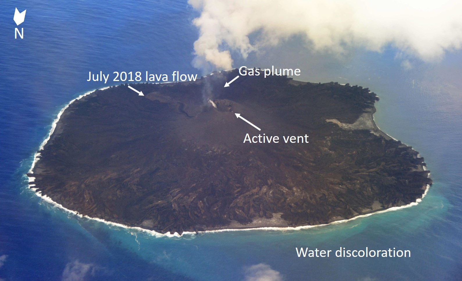 |
Figure 60. Aerial photo of Nishinoshima taken on 18 July 2018. The photo shows the active lava flow emanating from the vent along with a gas plume, and water discoloration. A closer view of the lava flow is given in figure 61. The island is approximately 1.9 x 1.9 km in size. Courtesy of the Japan Coast Guard. |
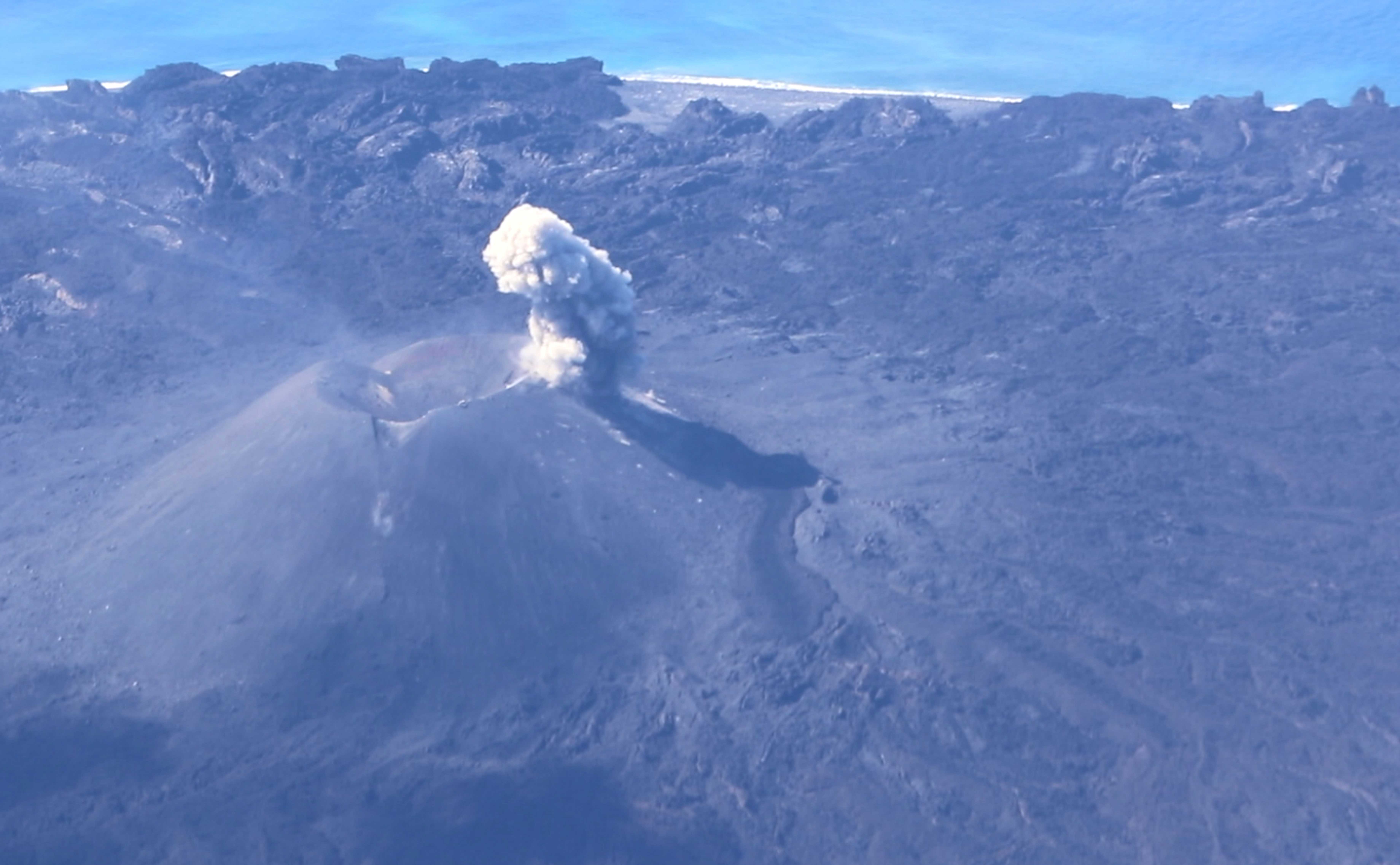 |
Figure 61. A view of the active Nishinoshima vent and 200-m-long lava flow on 13 July 2018. The vent is also producing a dilute ash plume from the eastern side of the cone. Courtesy of the Japan Coast Guard. |
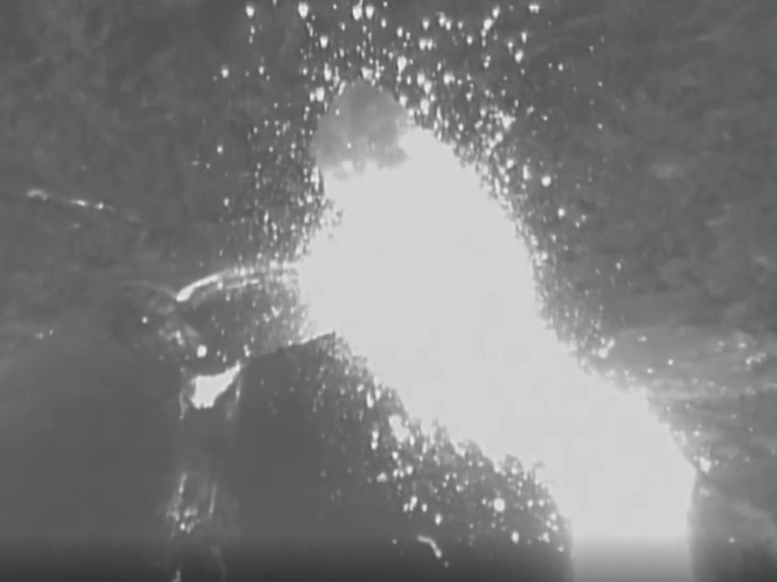 |
Figure 62. Screenshot from a thermal infrared video of the active Nishinoshima vent taken on 13 July 2018. The video shows explosions ejecting incandescent material onto the flanks of the cone and the active lava flow. Courtesy of the Japan Coast Guard. |
After the July activity, Nishinoshima again entered a phase of quiescence with activity limited to fumaroles around the vent. Himawari-8 satellite observations noted no increased thermal output following the July 2018 eruption. Thermal anomalies detected by satellite-based MODIS instruments were identified by the MODVOLC system from during 12-21 July 2018.
Geological Summary. The small island of Nishinoshima was enlarged when several new islands coalesced during an eruption in 1973-74. Multiple eruptions that began in 2013 completely covered the previous exposed surface and continued to enlarge the island. The island is the summit of a massive submarine volcano that has prominent peaks to the S, W, and NE. The summit of the southern cone rises to within 214 m of the ocean surface 9 km SSE.
Information Contacts: Japan Coast Guard (JCG) Volcano Database, Hydrographic and Oceanographic Department, 3-1-1, Kasumigaseki, Chiyoda-ku, Tokyo 100-8932, Japan (URL: http://www.kaiho.mlit.go.jp/info/kouhou/h29/index.html, http://www1.kaiho.mlit.go.jp/GIJUTSUKOKUSAI/kaiikiDB/kaiyo18-e1.htm); Japan Meteorological Agency (JMA), Otemachi, 1-3-4, Chiyoda-ku Tokyo 100-8122, Japan (URL: http://www.jma.go.jp/jma/indexe.html); Hawai'i Institute of Geophysics and Planetology (HIGP) - MODVOLC Thermal Alerts System, School of Ocean and Earth Science and Technology (SOEST), Univ. of Hawai'i, 2525 Correa Road, Honolulu, HI 96822, USA (URL: http://modis.higp.hawaii.edu/).