Report on Dukono (Indonesia) — April 2019

Bulletin of the Global Volcanism Network, vol. 44, no. 4 (April 2019)
Managing Editor: Edward Venzke.
Research and preparation by Paul Berger.
Dukono (Indonesia) Numerous ash explosions from October 2018 through March 2019
Please cite this report as:
Global Volcanism Program, 2019. Report on Dukono (Indonesia) (Venzke, E., ed.). Bulletin of the Global Volcanism Network, 44:4. Smithsonian Institution. https://doi.org/10.5479/si.GVP.BGVN201904-268010
Dukono
Indonesia
1.6992°N, 127.8783°E; summit elev. 1273 m
All times are local (unless otherwise noted)
The eruption at Dukono that began in 1933 has showered the area with ash from frequent explosions (BGVN 43:04, 43:12). The Pusat Vulkanologi dan Mitigasi Bencana Geologi (PVMBG), also known as the Center for Volcanology and Geological Hazard Mitigation (CVGHM), is responsible for monitoring this volcano.
This long-term pattern of intermittent ash explosions continued during October 2018-March 2019, with ash plumes rising to between 1.5 and 2.7 km altitude, or about 300-1,500 m above the summit (table 19). Although meteorological clouds often obscured views, satellite imagery captured typical ash plumes on 28 September 2018 (figure 10) and 5 February 2019 (figure 11). Instruments aboard NASA satellites (TROPOMI and OMPS) detected high levels of sulfur dioxide near or directly above the volcano on multiple days during January-March 2019. The Alert Level remained at 2 (on a scale of 1-4), and visitors were warned to remain outside of the 2-km exclusion zone.
Table 19. Monthly summary of reported ash plumes from Dukono for October 2018-March 2019. The direction of drift for the ash plume through each month was highly variable. Data courtesy of the Darwin VAAC and PVMBG.
| Month | Plume Altitude (km) | Notable Plume Drift |
| Oct 2018 | 1.5-2.1 | -- |
| Nov 2018 | 1.5-2.1 | -- |
| Dec 2018 | 1.5-2.4 | -- |
| Jan 2019 | 1.8-2.1 | -- |
| Feb 2019 | 1.8-2.7 | -- |
| Mar 2019 | 1.5-2.4 | -- |
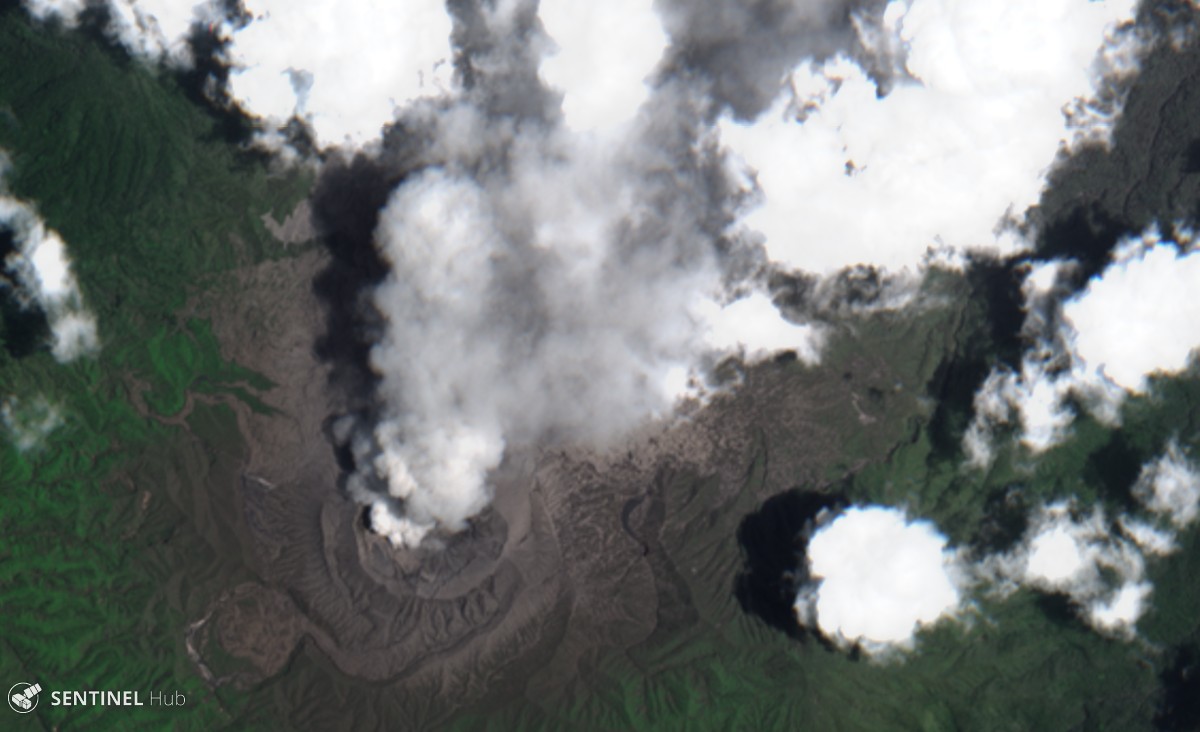 |
Figure 10. Satellite image from Sentinel-2 (LC1 natural color) of an ash plume at Dukono on 28 September 2018 with the plume blowing towards the NE. Courtesy of Sentinel Hub Playground. |
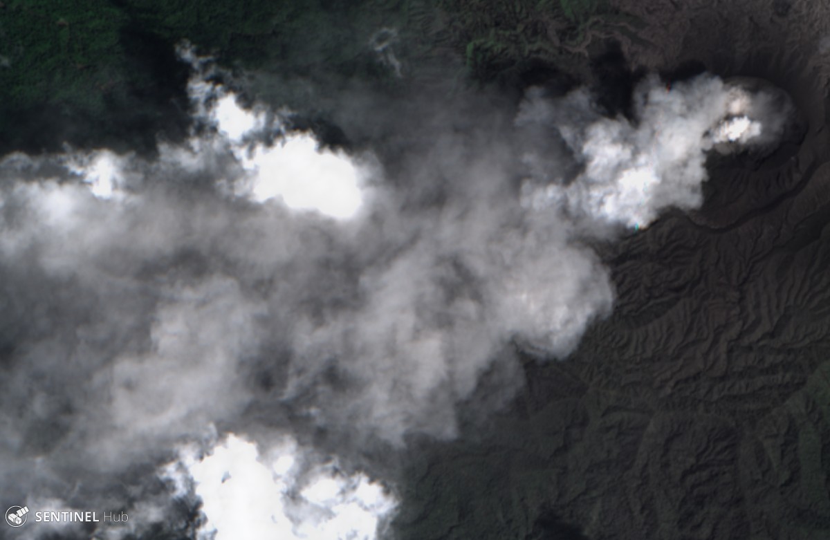 |
Figure 11. Satellite image from Sentinel-2 (LC1 natural color) of an ash plume at Dukono on 5 February 2019, with the plume blowing SW. Courtesy of Sentinel Hub Playground. |
Geological Summary. Reports from this remote volcano in northernmost Halmahera are rare, but Dukono has been one of Indonesia's most active volcanoes. More-or-less continuous explosive eruptions, sometimes accompanied by lava flows, have occurred since 1933. During a major eruption in 1550 CE, a lava flow filled in the strait between Halmahera and the N-flank Gunung Mamuya cone. This complex volcano presents a broad, low profile with multiple summit peaks and overlapping craters. Malupang Wariang, 1 km SW of the summit crater complex, contains a 700 x 570 m crater that has also been active during historical time.
Information Contacts: Pusat Vulkanologi dan Mitigasi Bencana Geologi (PVMBG, also known as Indonesian Center for Volcanology and Geological Hazard Mitigation, CVGHM), Jalan Diponegoro 57, Bandung 40122, Indonesia (URL: http://www.vsi.esdm.go.id/); Darwin Volcanic Ash Advisory Centre (VAAC), Bureau of Meteorology, Northern Territory Regional Office, PO Box 40050, Casuarina, NT 0811, Australia (URL: http://www.bom.gov.au/info/vaac/); Global Sulfur Dioxide Monitoring Page, Atmospheric Chemistry and Dynamics Laboratory, NASA Goddard Space Flight Center (NASA/GSFC), 8800 Greenbelt Road, Goddard, Maryland, USA (URL: https://so2.gsfc.nasa.gov/); Sentinel Hub Playground (URL: https://www.sentinel-hub.com/explore/sentinel-playground).