Tangkuban Parahu
Indonesia
6.77°S, 107.6°E; summit elev. 2084 m
All times are local (unless otherwise noted)
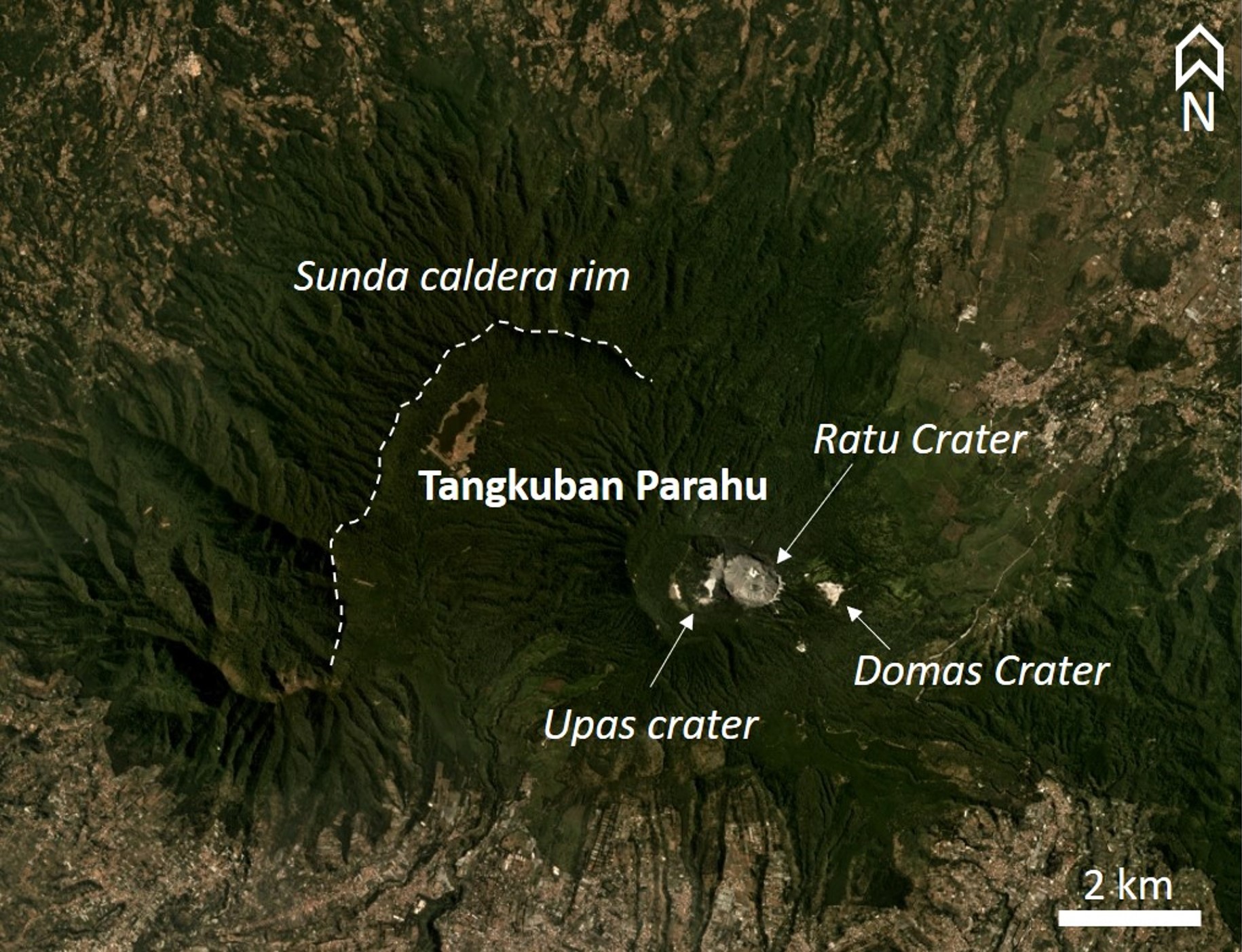
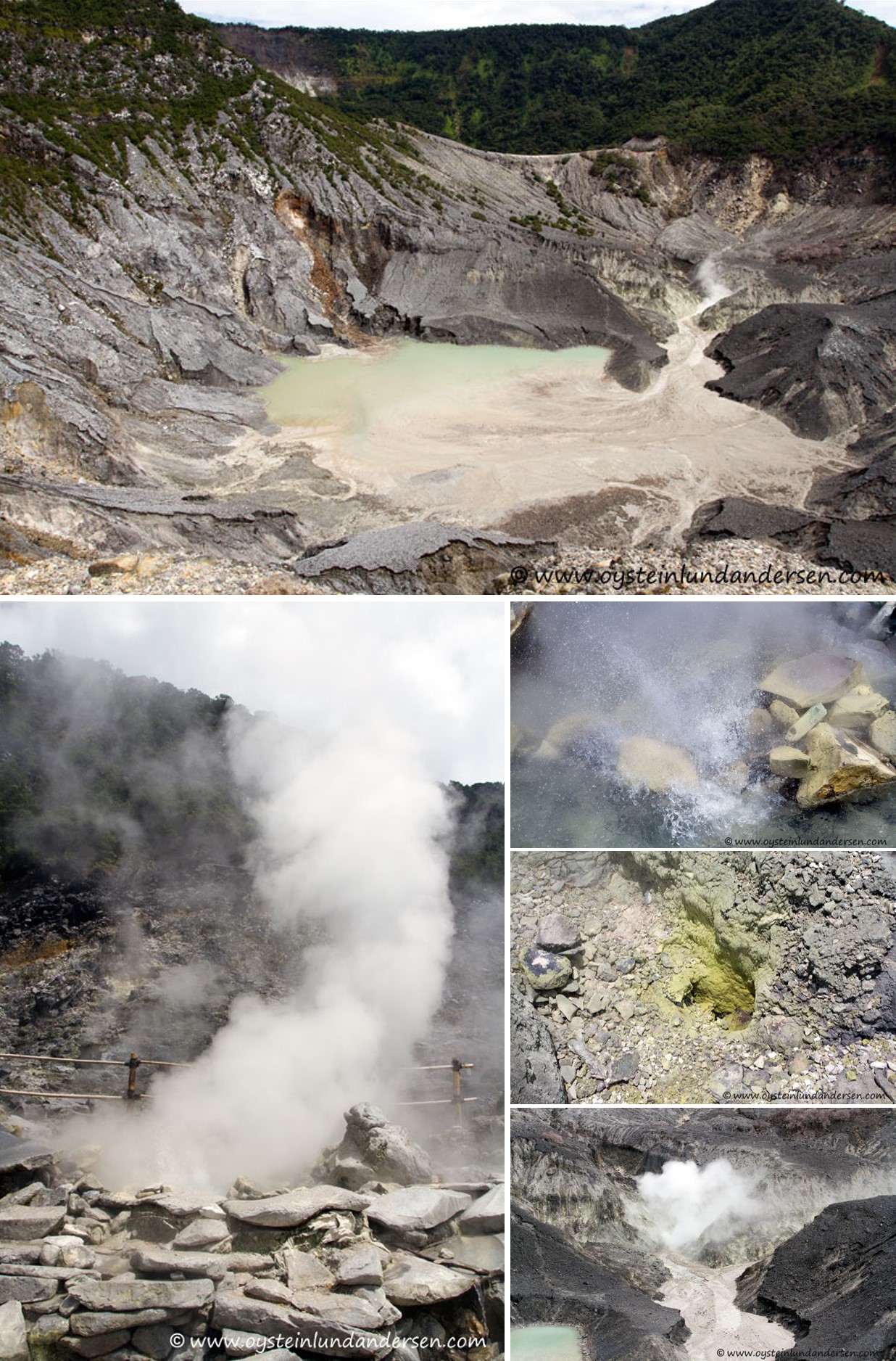
Tangkuban is located in the West Bandung and Subang Regencies in the West Java Province and has two main summit craters, Ratu and Upas (figure 3). Recent activity has largely consisted of phreatic explosions and gas-and-steam plumes at the Ratu crater. Prior to July 2019, the most recent activity occurred in 2012-2013, ending with a phreatic eruption on 5 October 2013 (BGVN 40:04). Background activity includes geothermal activity in the Ratu crater consisting of gas and steam emission (figure 4). This area is a tourist destination with infrastructure, and often people, overlooking the active crater. This report summarizes activity during 2014 through September 2019 and is based on official agency reports. Monitoring is the responsibility of Pusat Vulkanologi dan Mitigasi Bencana Geologi (PVMBG, also known as Indonesian Center for Volcanology and Geological Hazard Mitigation, CVGHM).
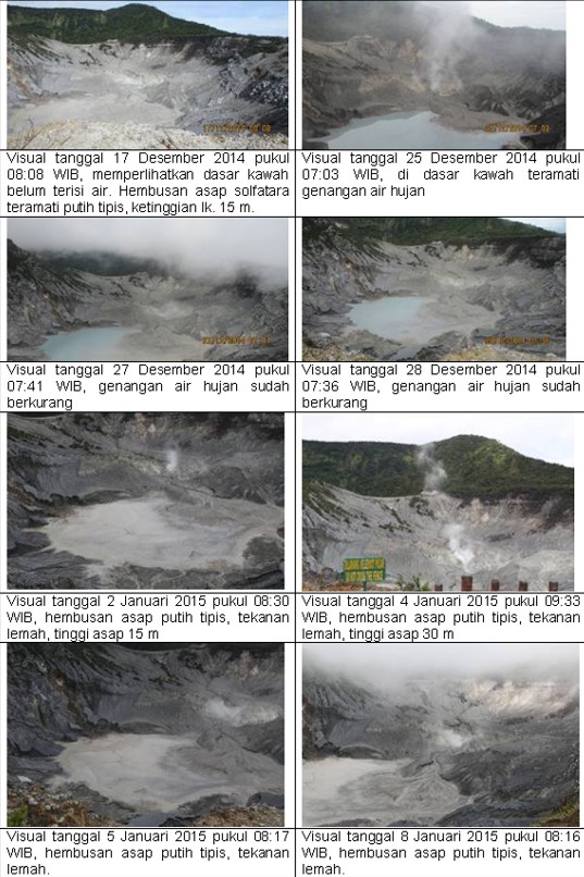
The first reported activity in 2014 consisted of gas-and-steam plumes during October-December, prompting PVMBG to increase the alert level from I to II on 31 December 2014. These white plumes reached a maximum of 50 m above the Ratu crater (figure 5) and were accompanied by elevated seismicity and deformation. This prompted the implementation of an exclusion zone with a radius of 1.5 km around the crater. The activity decreased and the alert level was lowered back to I on 8 January 2015. There was no further reported activity from January 2015 through mid-2019.
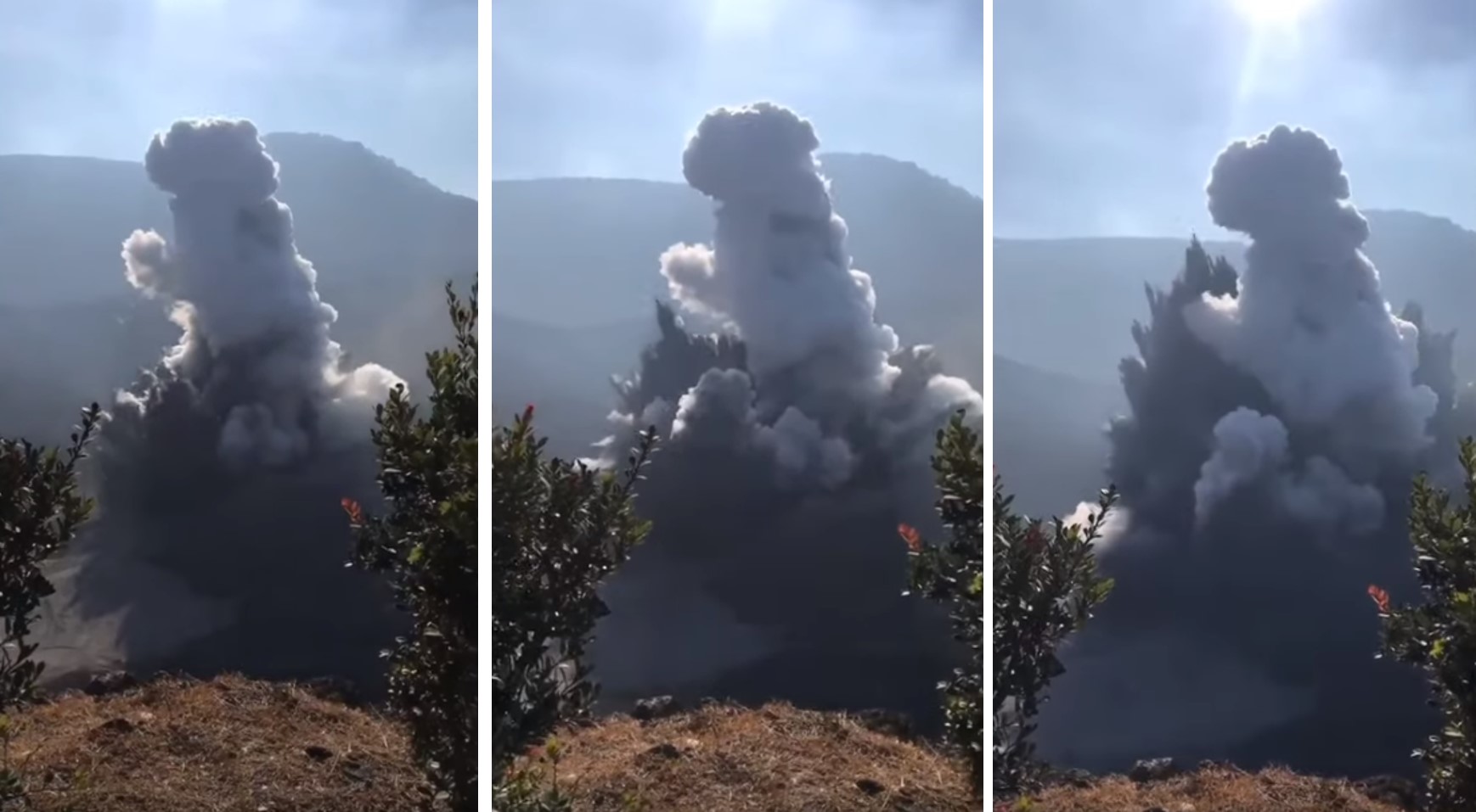
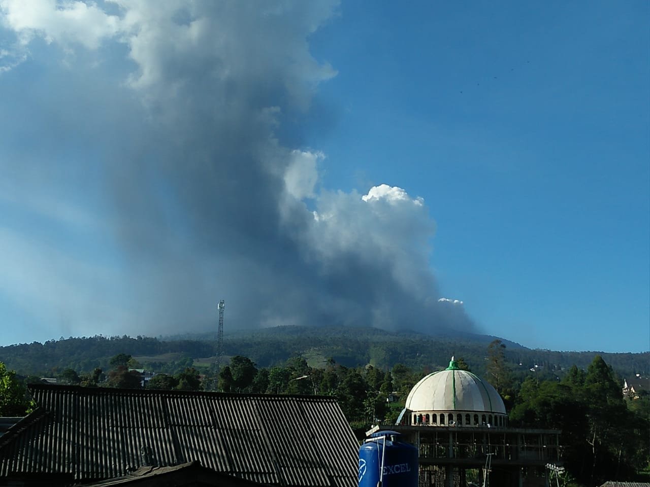
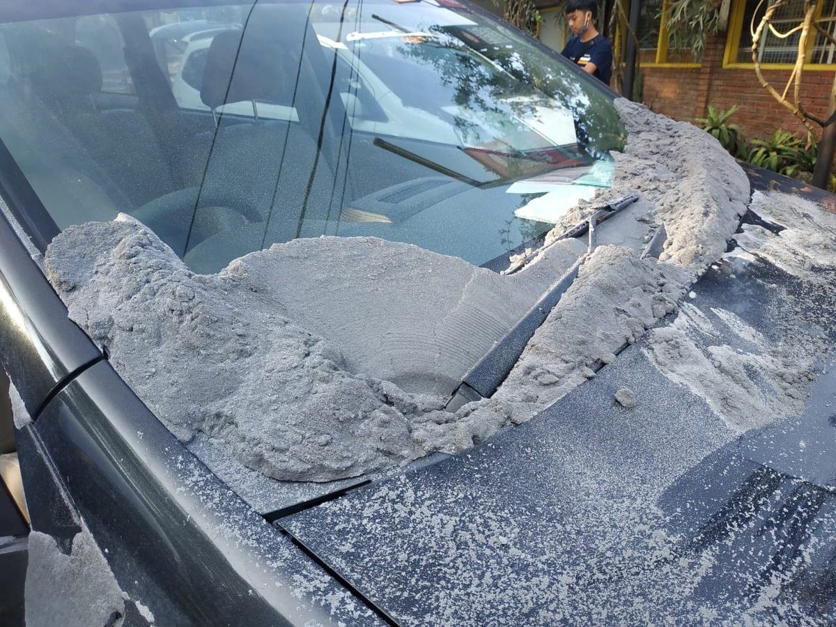
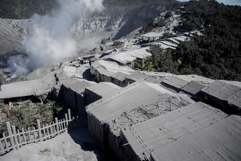
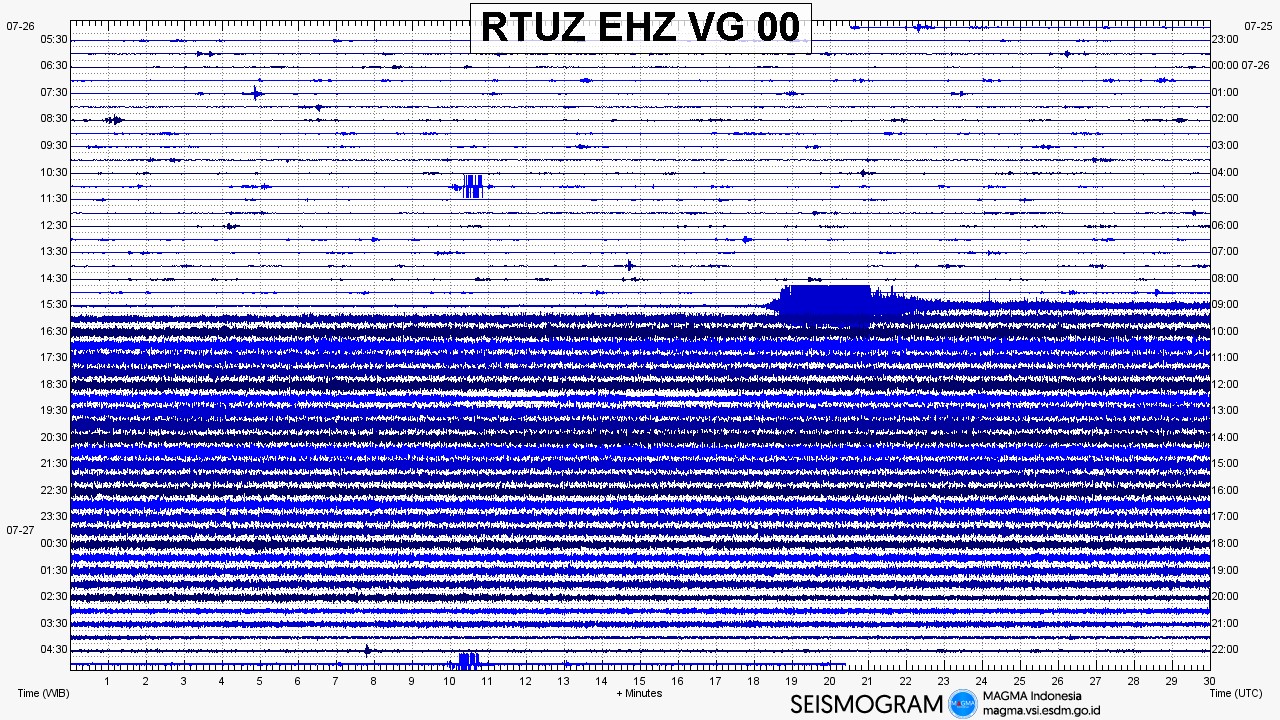
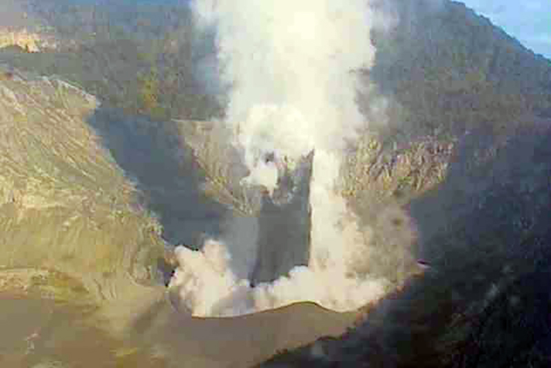
From 27 June 2019 an increase in activity was recorded in seismicity, deformation, gas chemistry, and visual observations. By 24 July the responsible government agencies had communicated that the volcano could erupt at any time. At 1548 on 26 July a phreatic (steam-driven) explosion ejected an ash plume that reached 200 m; a steam-rich plume rose to 600 m above the Ratu crater (figures 6, and 7). People were on the crater rim at the time and videos show a white plume rising from the crater followed by rapid jets of ash and sediment erupting through the first plume. Deposition of eruption material was 5-7 cm thick and concentrated within a 500 m radius from the point between the Rata and Upas craters, and wider deposition occurred within 2 km of the crater (figures 8 and 9). According to seismic data, the eruption lasted around 5 minutes and 30 seconds (figure 10). Videos show several pulses of ash that fell back into the crater, followed by an ash plume moving laterally towards the viewers.
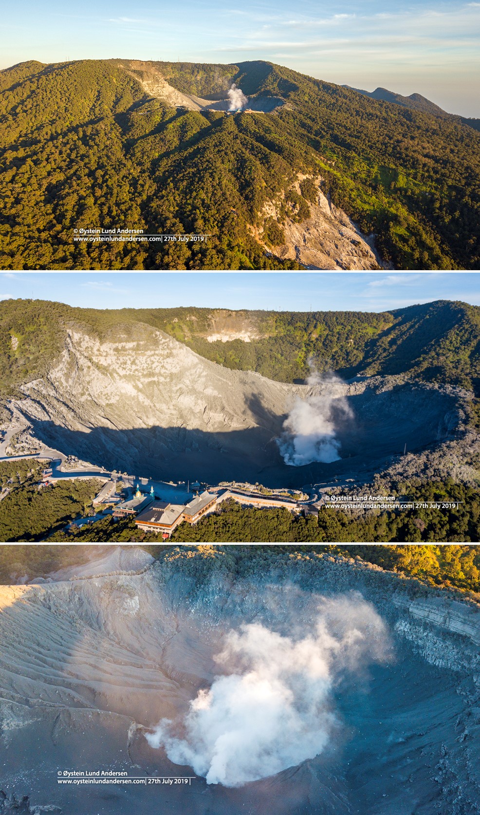
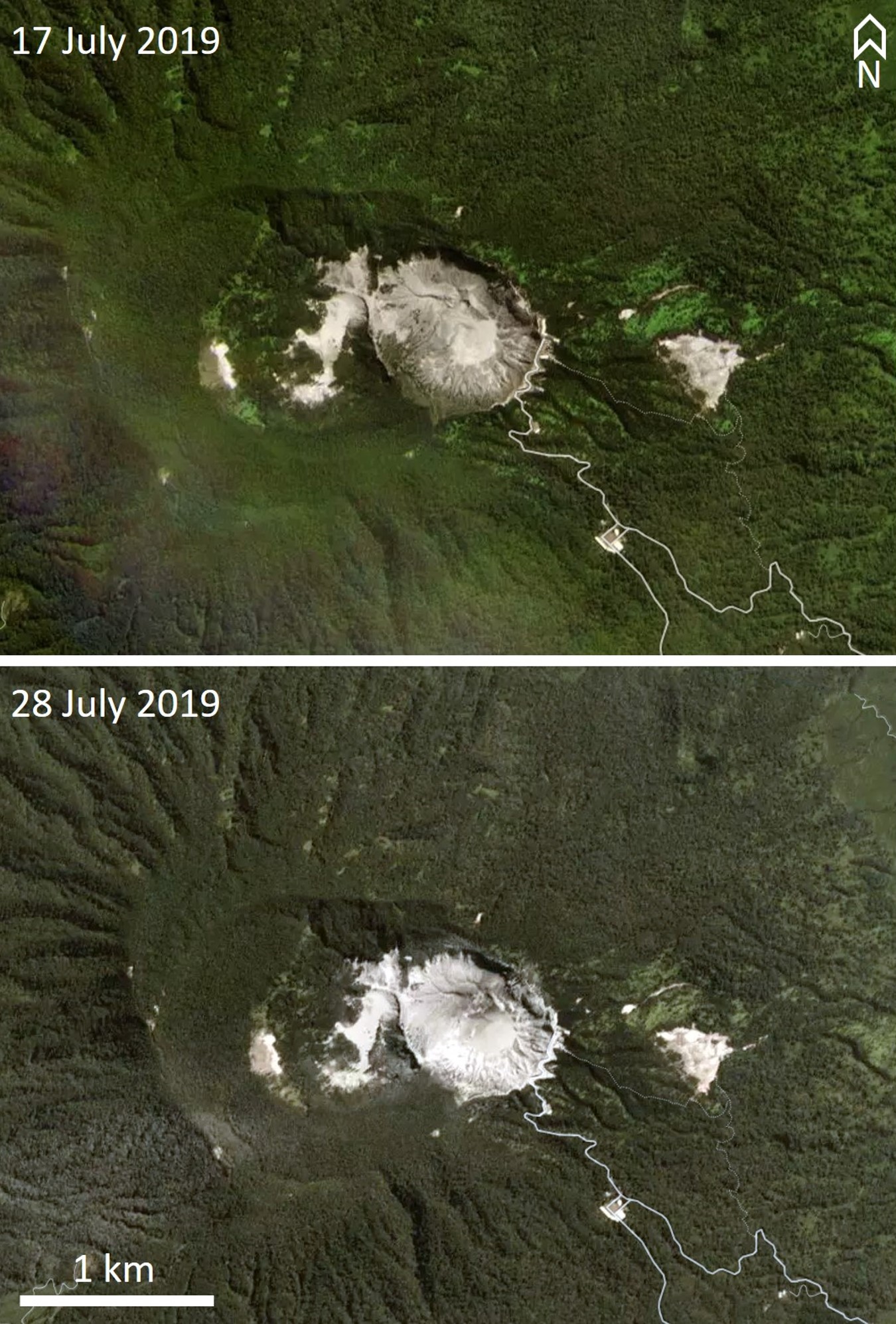
On 27 July, the day after the eruption, Øystein Lund Andersen observed the volcano using a drone camera, operated from outside the restricted zone. Over a period of two hours the crater produced a small steam plume; ashfall and small blocks from the initial eruption are visible in and around the crater (figure 11). The ashfall is also visible in satellite imagery, which shows that deposition was restricted to the immediate vicinity to the SW of the crater (figure 12).
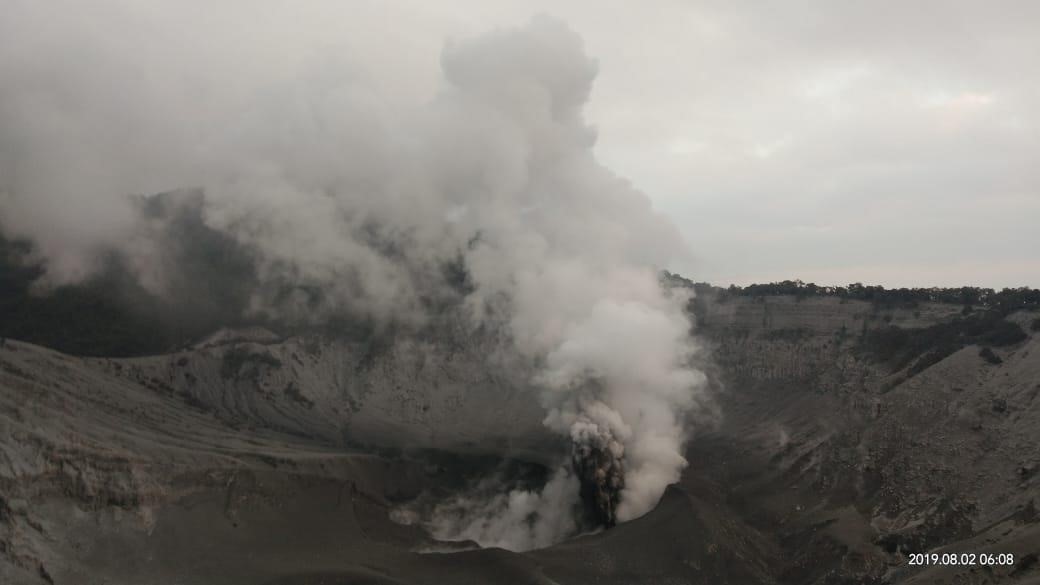
Another eruption occurred at 2046 on 1 August 2019 and lasted around 11 minutes, producing a plume up to 180 m above the vent. Additional explosions occurred at 0043 on 2 August, lasting around 3 minutes according to seismic data, but were not observed. Explosions continued to be recorded at 0145, 0357, and 0406 at the time of the PVMBG report when the last explosion was ongoing, and a photo shows an explosion at 0608 (figure 13). The explosions produced plumes that reached between 20 and 200 m above the vent. Due to elevated activity the Alert Level was increased to II on 2 August. Ash emission continued through the 4th. During 5-11 August events ejecting ash continued to produce plumes up to 80 m, and gas-and-steam plumes up to 200 m above the vent. Ashfall was localized around Ratu crater. The following week, 12-18 August, activity continued with ash and gas-and-steam plumes reaching 100-200 m above the vent. During 19-25 August, similar activity sent ash to 50-180 m, and gas-and-steam plumes to 200 m. A larger phreatic explosion occurred at 0930 on 31 August with an ash plume reaching 300 m, and a gas-and-steam plume reaching 600 m above the vent, depositing ash and sediment around the crater.
In early September activity consisted of gas-and-steam plumes up to 100-180 m above the vent with some ash plumes observed (figure 14). Two larger explosions occurred at 1657 and 1709 on 7 September with ash reaching 180 m, and gas-and-steam up to 200 m above the vent. Ash and sediment deposited around the crater. Due to strong winds to the SSW, the smell of sulfur was reported around Cimahi City in West Bandung, although there was no detected increase in sulfur emissions. A phreatic explosion on 17 September produced an ash plume to 40 m and a steam plume to 200 m above the crater. Weak gas-and-steam emissions reaching 200 m above the vent continued through to the end of September.
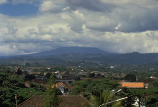
Geological Summary. Gunung Tangkuban Parahu is a broad stratovolcano overlooking Indonesia's former capital city of Bandung. The volcano was constructed within the 6 x 8 km Pleistocene Sunda caldera, which formed about 190,000 years ago. The volcano's low profile is the subject of legends referring to the mountain of the "upturned boat." The Sunda caldera rim forms a prominent ridge on the western side; elsewhere the rim is largely buried by deposits of the current volcano. The dominantly small phreatic eruptions recorded since the 19th century have originated from several nested craters within an elliptical 1 x 1.5 km summit depression.
Information Contacts: Pusat Vulkanologi dan Mitigasi Bencana Geologi (PVMBG, also known as Indonesian Center for Volcanology and Geological Hazard Mitigation, CVGHM), Jalan Diponegoro 57, Bandung 40122, Indonesia (URL: http://www.vsi.esdm.go.id/); Badan Nasional Penanggulangan Bencana (BNPB), National Disaster Management Agency, Graha BNPB - Jl. Scout Kav.38, East Jakarta 13120, Indonesia (URL: http://www.bnpb.go.id/); Øystein Lund Andersen (Twitter: @OysteinLAnderse, https://twitter.com/OysteinLAnderse, URL: https://www.oysteinlundandersen.com/tangkuban-prahu/tangkuban-prahu-volcano-west-java-one-day-after-the-26th-july-phreatic-eruption/); Reuters (URL: https://www.reuters.com/news/picture/editors-choice-pictures-idUSRTX71F3E); Planet Labs, Inc. (URL: https://www.planet.com/); .