Unnamed
Tonga
18.325°S, 174.365°W; summit elev. -40 m
All times are local (unless otherwise noted)
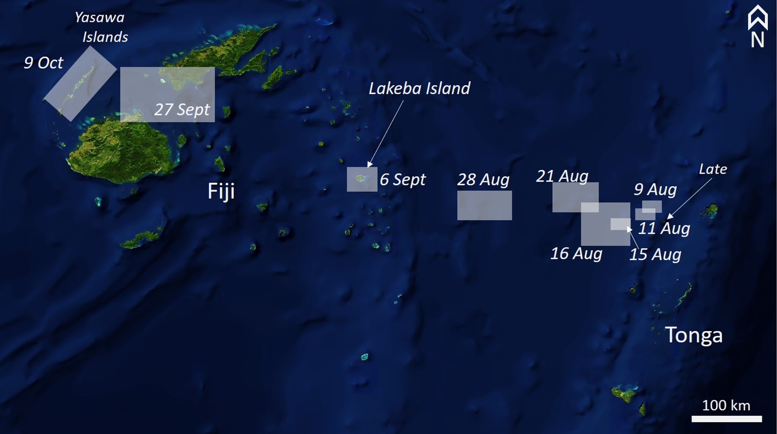
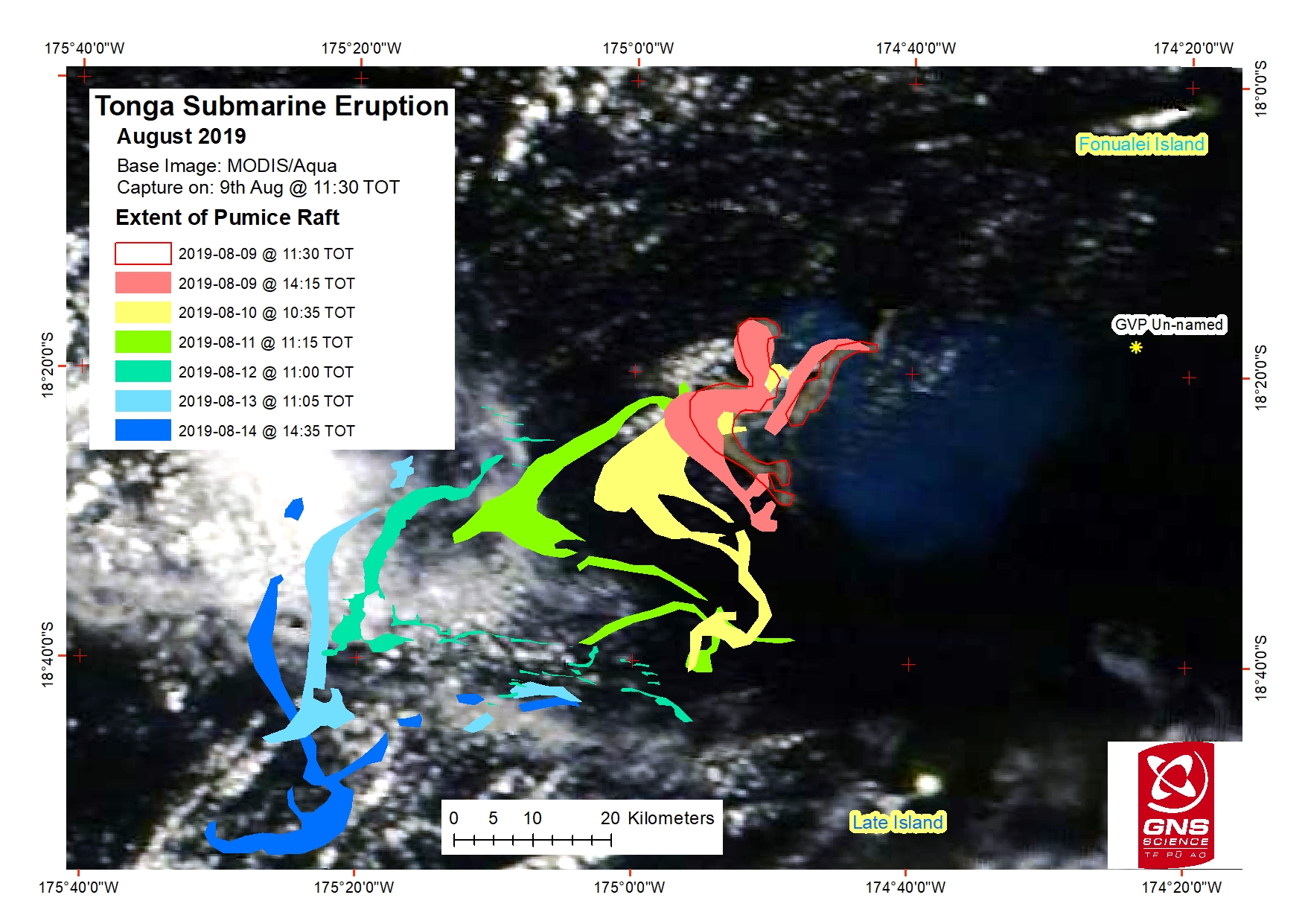
Large areas of floating pumice, termed rafts, were encountered by sailors in the northern Tonga region approximately 80 km NW of Vava'u starting around 9 August 2019; the pumice reached the western islands of Fiji by 9 October (figure 7). Pumice rafts are floating masses of individual clasts ranging from millimeters to meters in diameter. The pumice clasts form when silicic magma is degassing, forming bubbles as it rises to the surface, which then rapidly cools to form solid rock. The isolated vesicles formed by the bubbles provide buoyancy to the rock and in turn, the entire pumice raft. These rafts are spread and carried by currents across the ocean; rafts originating in the Tonga area can eventually reach Australia. This report summarizes the pumice raft eruption from early August 2019 using witness accounts and satellite images (acquisition dates are given in UTC). Pending further research, the presumed source is the unnamed Tongan seamount (volcano number 243091) about 45 km NW of Vava'u, the origin of an earlier pumice raft produced during an eruption in 2001.
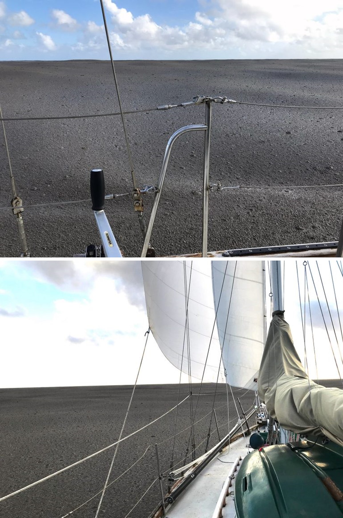
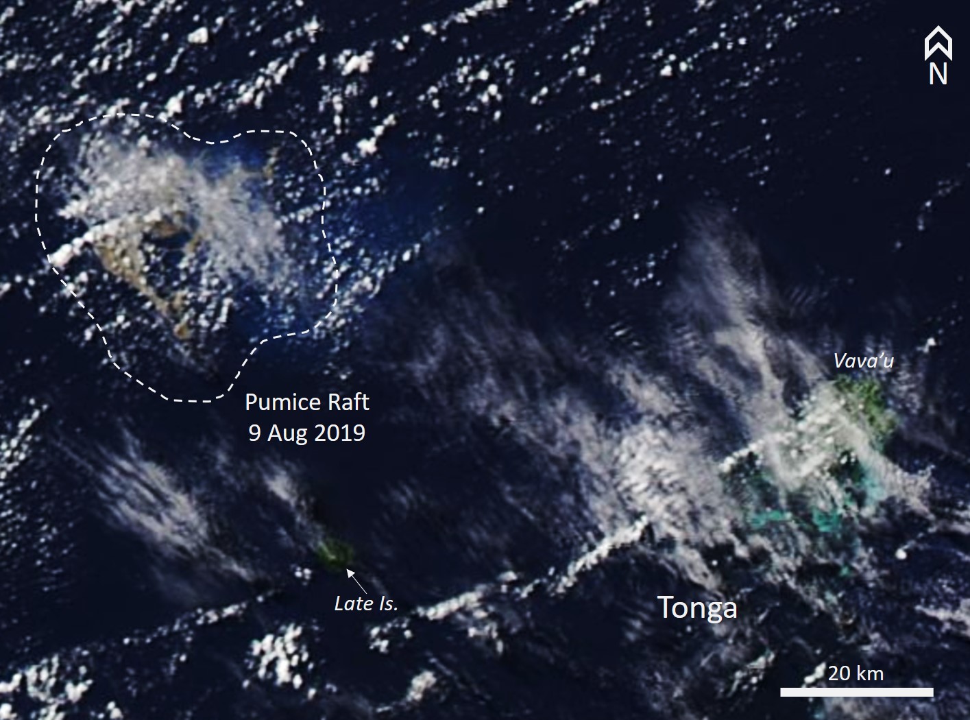
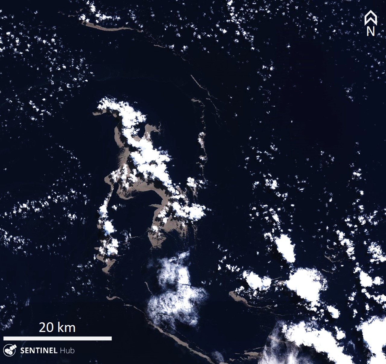
The first sighting of pumice was around 1430 on 9 August NW of Vava'u in Tonga (18° 22.068' S, 174° 50.800' W), when Shannon Lenz and Tom Whitehead on board SV Finely Finished initially encountered isolated rocks and smaller streaks of pumice clasts. The area covered by rock increasing to a raft with an estimated thickness of at least 15 cm that extended to the horizon in different directions, and which took 6-8 hours to cross (figure 8). There was no sulfur smell and the sound was described as a "cement mixer, especially below deck." There was also no plume or incandescence observed. Their video, posted to YouTube on 17 August, showed a thin surface layer of cohesive interconnected irregular streaks of pumice with the ocean surface still visible between them. Later footage showed a continuous, undulating mass of pumice entirely covering the ocean surface. Larger clasts are visible scattered throughout the raft. The pumice raft was visible in satellite imagery on this day NW of Late Island (figure 9). By 11 August the raft had evolved into a largely linear feature with smaller rafts to the SW (figure 10). Approximately four hours later, about 15 km to the WSW, Rachel Mackie encountered the pumice. Initially the pumice was "ribbons several hundred meters long and up to 20m wide. It was quite fine and like a slick across the surface of the water." By 2130 they were surrounded by the pumice, and around 25 km away the smell of sulfur was noted.
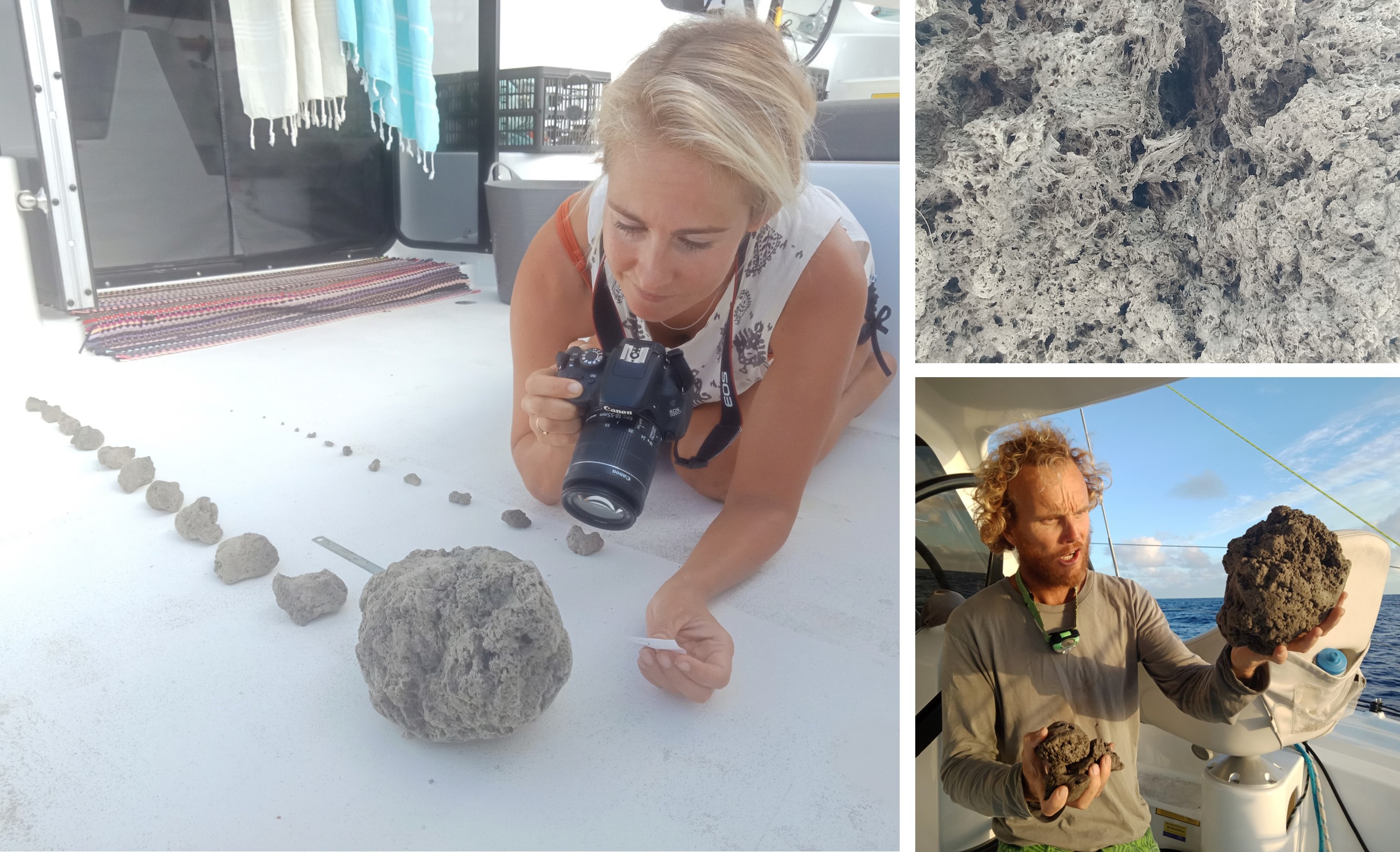
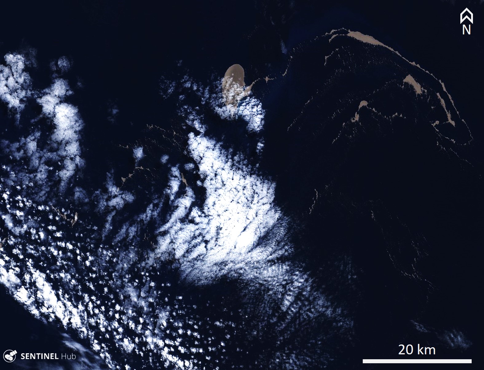
Michael and Larissa Hoult aboard the catamaran ROAM encountered the raft on 15 August (figure 11). They initially saw isolated clasts ranging from marble to tennis ball size (15-70 mm) at 18° 46′S, 174° 55'W. At around 0700 UTC (1900 local time) they noted the smell of sulfur at 18° 55′S, 175° 21′W, and by 0800 UTC they were immersed in the raft with visible clasts ranging from marble to basketball (25 cm) sizes. At this point the raft was entirely obscuring the ocean surface. On 16 and 21 August the pumice continued to disperse and drift NW (figures 12 and 13). On 20 August Scott Bryan calculated an average drift rate of around 13 km/day, with the pumice on this date about 164 km W of the unnamed seamount.
An online article published by Brad Scott at GeoNet on 9 September reported the preliminary size of the raft to be 60 km2, significantly smaller than the 2012 Havre seamount pumice raft that was 400 km2. Satellite identification of pumice-covered areas by GNS scientists showed the material moving SSW through 14 August (figure 14).
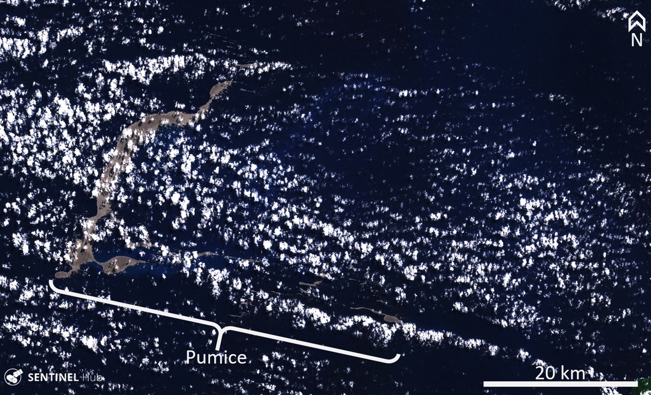
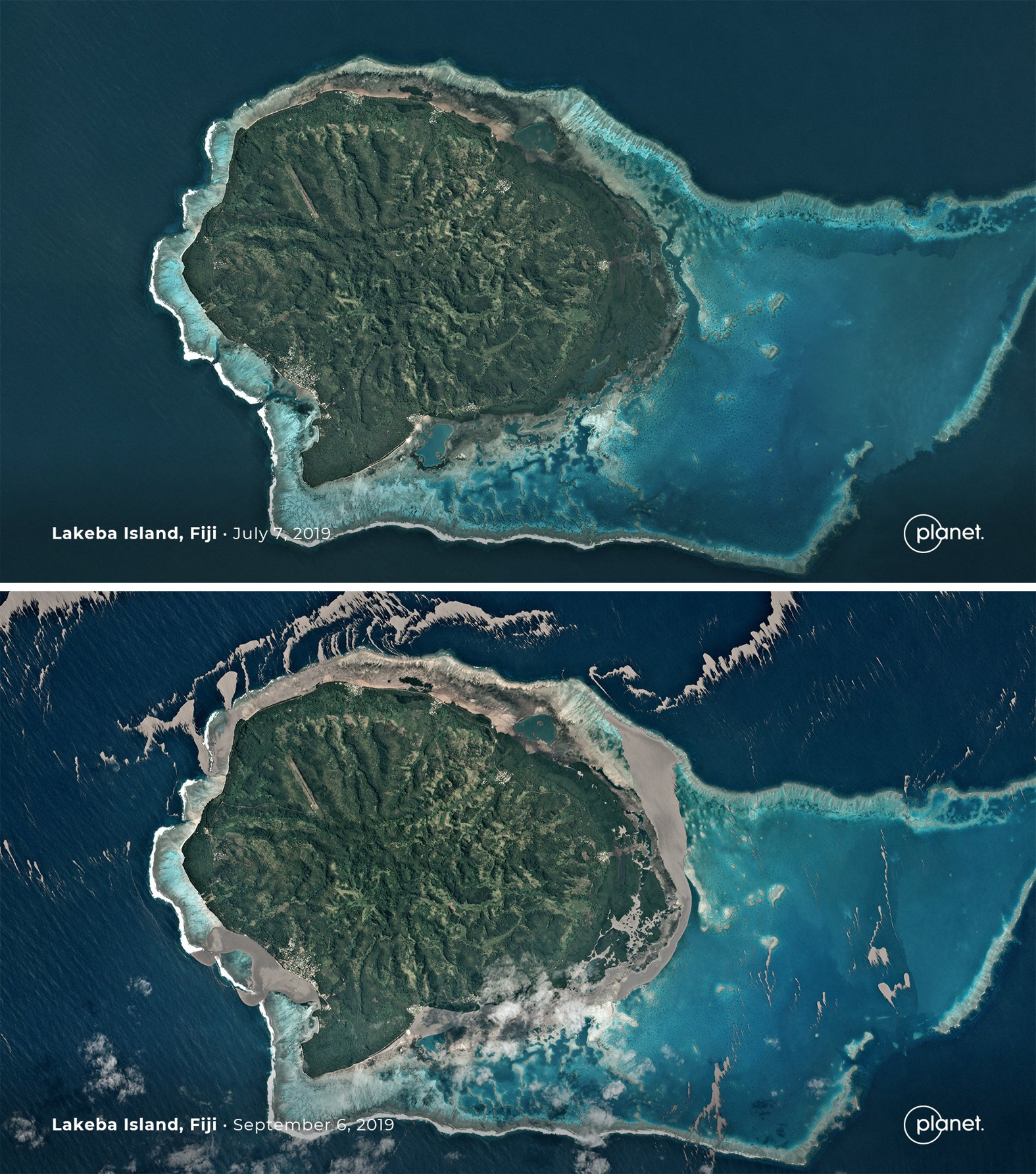
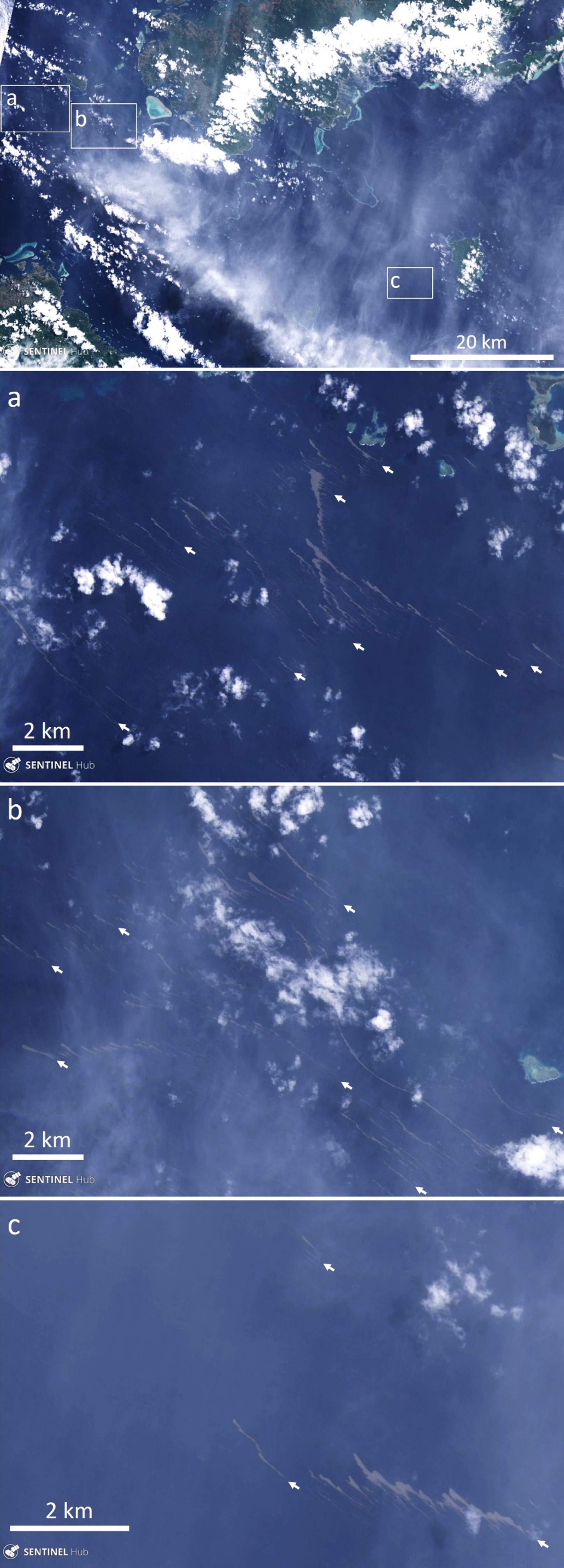
On 5 September the Maritime Safety Authority of Fiji (MSAF) issued a notice to mariners stating that the pumice was sighted in the vicinity of Lakeba, Oneata, and Aiwa Islands and was moving to the W. On 6 September a Planet Labs satellite image shows pumice encompassing the Fijian island of Lakeba over 450 km W of the Tongan islands (figure 15). The pumice entered the lagoon within the barrier reef and drifted around the island to continue towards the W. The pumice was imaged by the Landsat 8 satellite on 26 September as it moved through the Fijian islands, approximately 760 km away from its source (figure 16). The pumice is segmented into numerous smaller rafts of varying sizes that stretch over at least 140 km. On 12 September the Fiji Sun reported that the pumice had reached some of the Lau islands and was thick enough near the shore for people to stand on it.
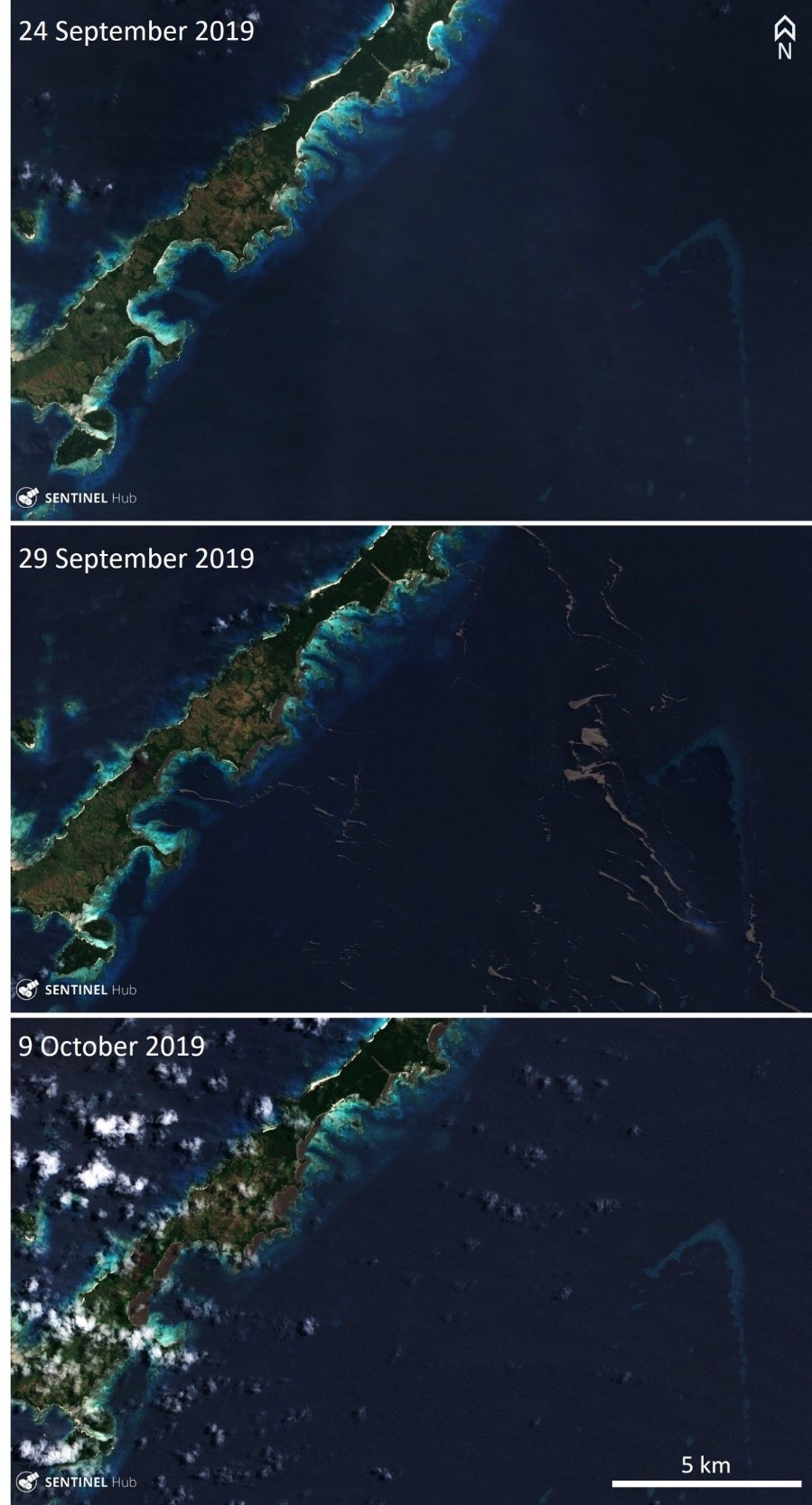
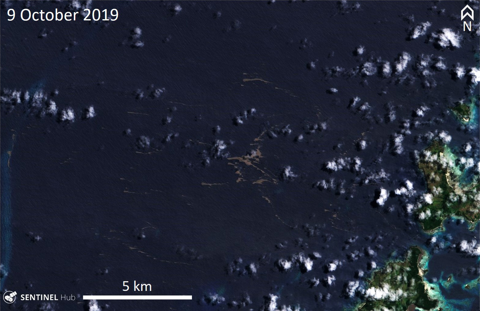
Pumice had reached the Yasawa islands in western Fiji by 29 September and was beginning to fill the eastern bays (figure 17). By 9 October bays had been filled out to 500-600 m from the shore, and pumice had also passed through the islands to continue towards the W (figure 18). At this point the pumice beyond the islands had broken up into linear segments that continued towards the NW.
Geological Summary. A submarine volcano along the Tofua volcanic arc ~45 km NW of Vava'u Island was first observed in September 2001, ~35 km S of Fonualei and 60 km NE of Late volcano. The site of the eruption is at an approximate bathymetric depth of 300 m. T-phase waves were recorded on 27-28 September 2001, and on the 27th local fishermen observed an ash-rich eruption column that rose above the ocean surface. No eruptive activity was reported after the 28th, but water discoloration was documented the following month. In early November rafts and strandings of dacitic pumice were reported along the coasts of Kadavu and Viti Levu in Fiji. The depth of the summit of the submarine cone following the eruption was determined to be 40 m during a 2007 survey; the crater of the 2001 eruption was open to the E.
Information Contacts: GNS Science, Wairakei Research Centre, Private Bag 2000, Taupo 3352, New Zealand (URL: http://www.gns.cri.nz/); Salman Ashraf, GNS Science, Wairakei Research Centre, Private Bag 2000, Taupo 3352, New Zealand (URL: http://www.gns.cri.nz/, https://www.geonet.org.nz/news/8RnSKdhaWOEABBIh0bHDj); Brad Scott, New Zealand GeoNet Project, a collaboration between the Earthquake Commission and GNS Science, Wairakei Research Centre, Private Bag 2000, Taupo 3352, New Zealand (URL: http://www.geonet.org.nz/, https://www.geonet.org.nz/news/8RnSKdhaWOEABBIh0bHDj); Scott Bryan, School of Earth, Environmental & Biological Sciences, Science and Engineering Faculty, Queensland University of Technology, R Block Level 2, 204, Gardens Point (URL: https://staff.qut.edu.au/staff/scott.bryan); Shannon Lenz and Tom Whitehead, SV Finely Finished (URL: https://www.noonsite.com/news/south-pacific-tonga-to-fiji-navigation-alert-dangerous-slick-of-volcanic-rubble/, YouTube: https://www.youtube.com/watch?v=PEsHLSFFQhQ); Michael and Larissa Hoult, Sail Surf ROAM (URL: https://www.facebook.com/sailsurfroam/); Rachel Mackie, OLIVE (URL: http://www.oliveocean.com/, https://www.facebook.com/rachel.mackie.718); Sentinel Hub Playground (URL: https://www.sentinel-hub.com/explore/sentinel-playground); Planet Labs, Inc. (URL: https://www.planet.com/); Fiji Sun (URL: https://fijisun.com.fj/2019/09/12/pumice-menace-hits-parts-of-lau-group/).