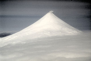
Shishaldin
United States
54.756°N, 163.97°W; summit elev. 2857 m
All times are local (unless otherwise noted)
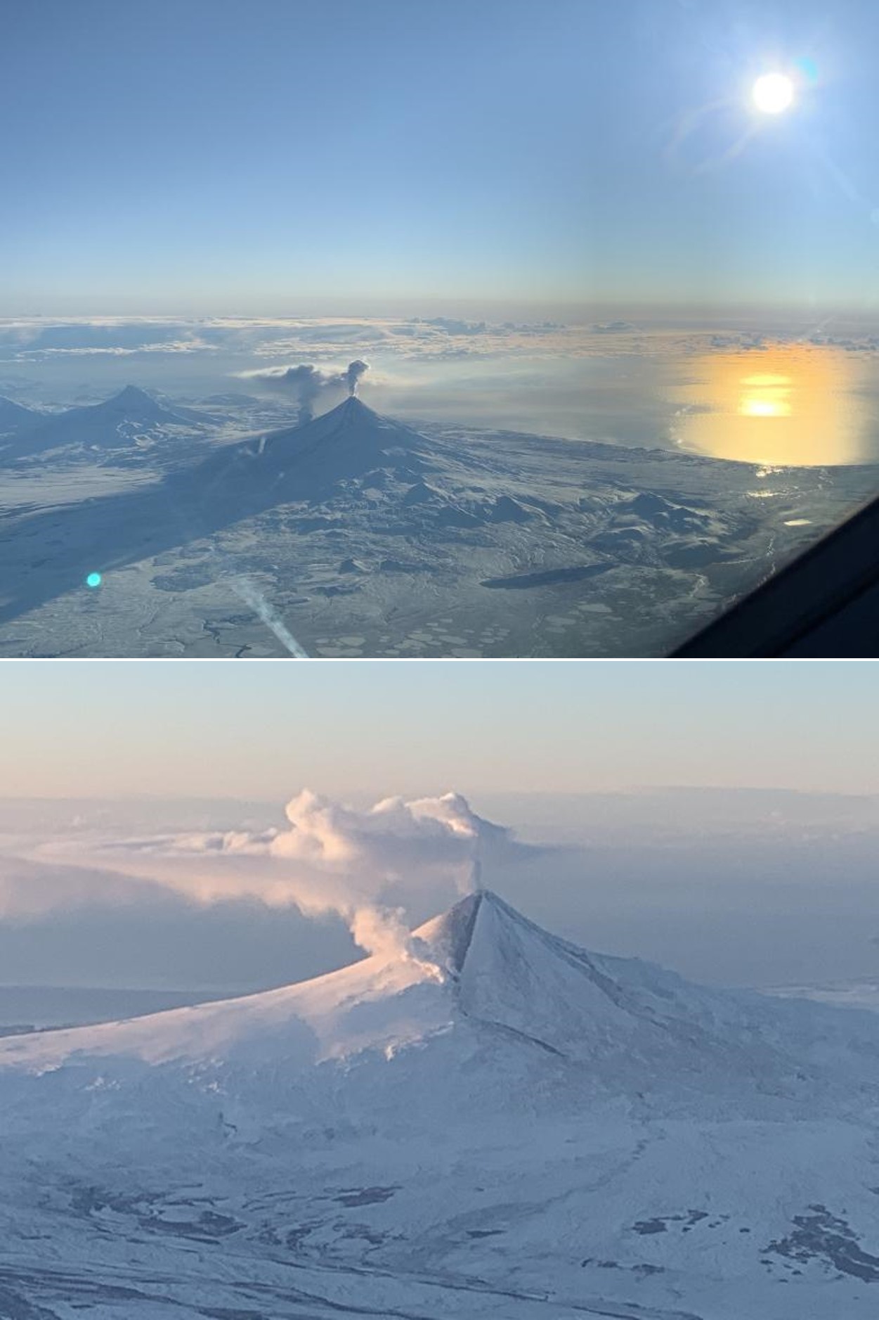
Shishaldin is located near the center of Unimak Island in Alaska and has been frequently active in recent times. Activity includes steam plumes, ash plumes, lava flows, lava fountaining, pyroclastic flows, and lahars. The current eruption phase began on 23 July 2019 and through September included lava fountaining, explosions, and a lava lake in the summit crater. Continuing activity during October 2019 through January 2020 is described in this report based largely on Alaska Volcano Observatory (AVO) reports, photographs, and satellite data.
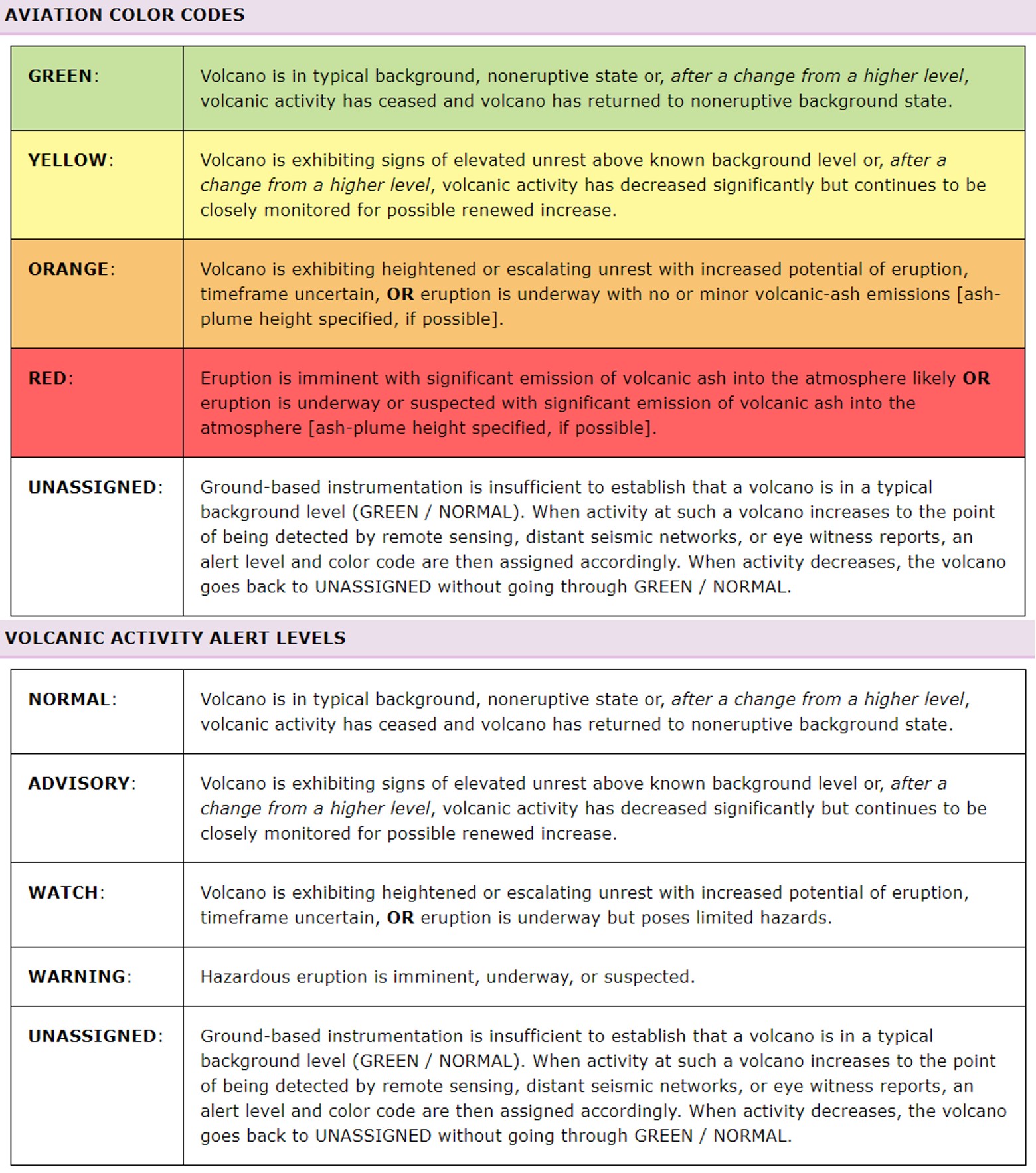
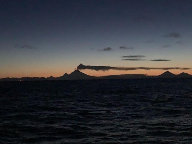
Minor steam emissions were observed on 30 September 2019, but no activity was observed through the following week. Activity at that time was slightly above background levels with the Volcano Alert Level at Advisory and the Aviation Color Code at Yellow (figure 17). In the first few days of October weak tremor continued but no eruptive activity was observed. Weakly elevated temperatures were noted in clear satellite images during 4-9 October and weak tremor continued. Elevated temperatures were recorded again on the 14th with low-level tremor.
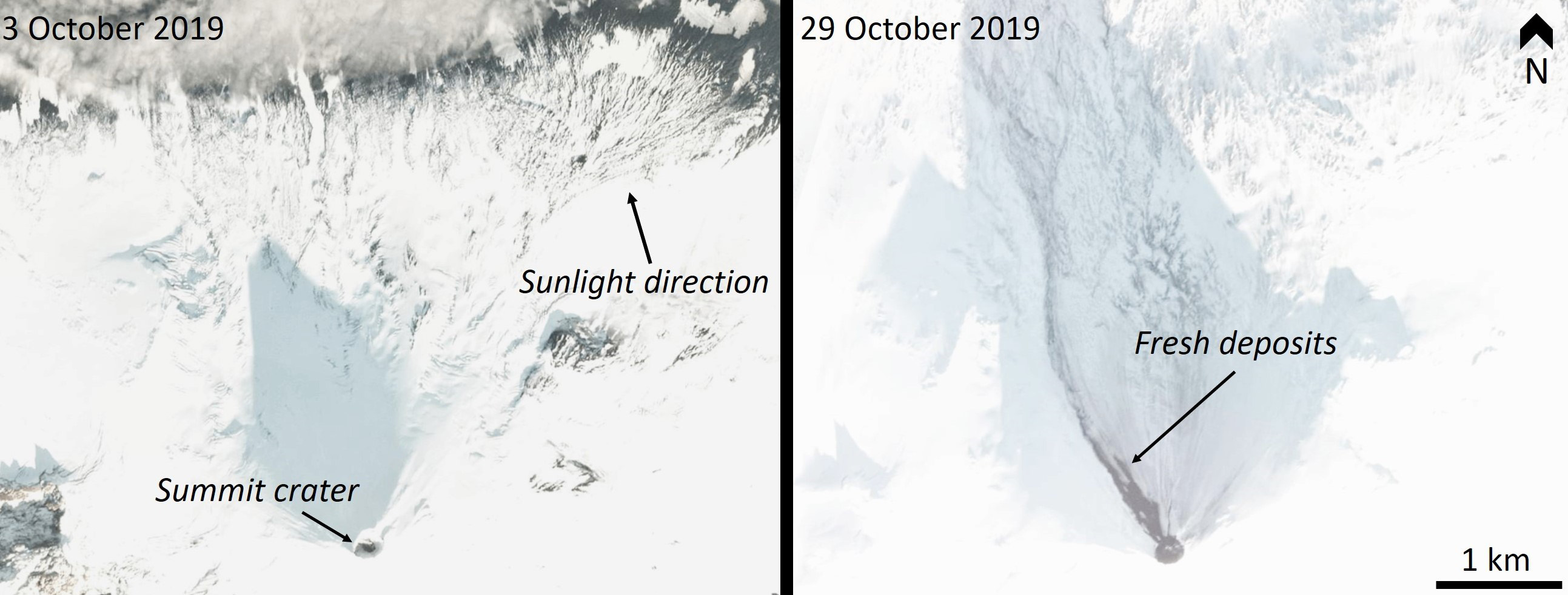
New lava extrusion was observed on 13 October, prompting AVO to raise the Aviation Color Code to Orange and the Volcano Alert Level to Watch. Elevated surface temperatures were detected by satellite during the 13th and 17-20th, and a steam plume was observed on the 19th. A change from small explosions to continuous tremor that morning suggested a change in eruptive behavior. Low-level Strombolian activity was observed during 21-22 October, accompanied by a persistent steam plume. Lava had filled the crater by the 23rd and began to overflow at two places. One lava flow to the north reached a distance of 200 m on the 24th and melted snow to form a 2.9-km-long lahar down the N flank. The second smaller lava flow resulted in a 1-km-long lahar down the NE flank. Additional snowmelt was produced by spatter accumulating around the crater rim. By 25 October the northern flow reached 800 m, there was minor explosive activity with periodic lava fountaining, and lahar deposits reached 3 km to the NW with shorter lahars to the N and E (figure 18). Trace amounts of ashfall extended at least 8.5 km SE. There was a pause in activity on the 29th, but beginning at 1839 on the 31st seismic and infrasound monitoring detected multiple small explosions.
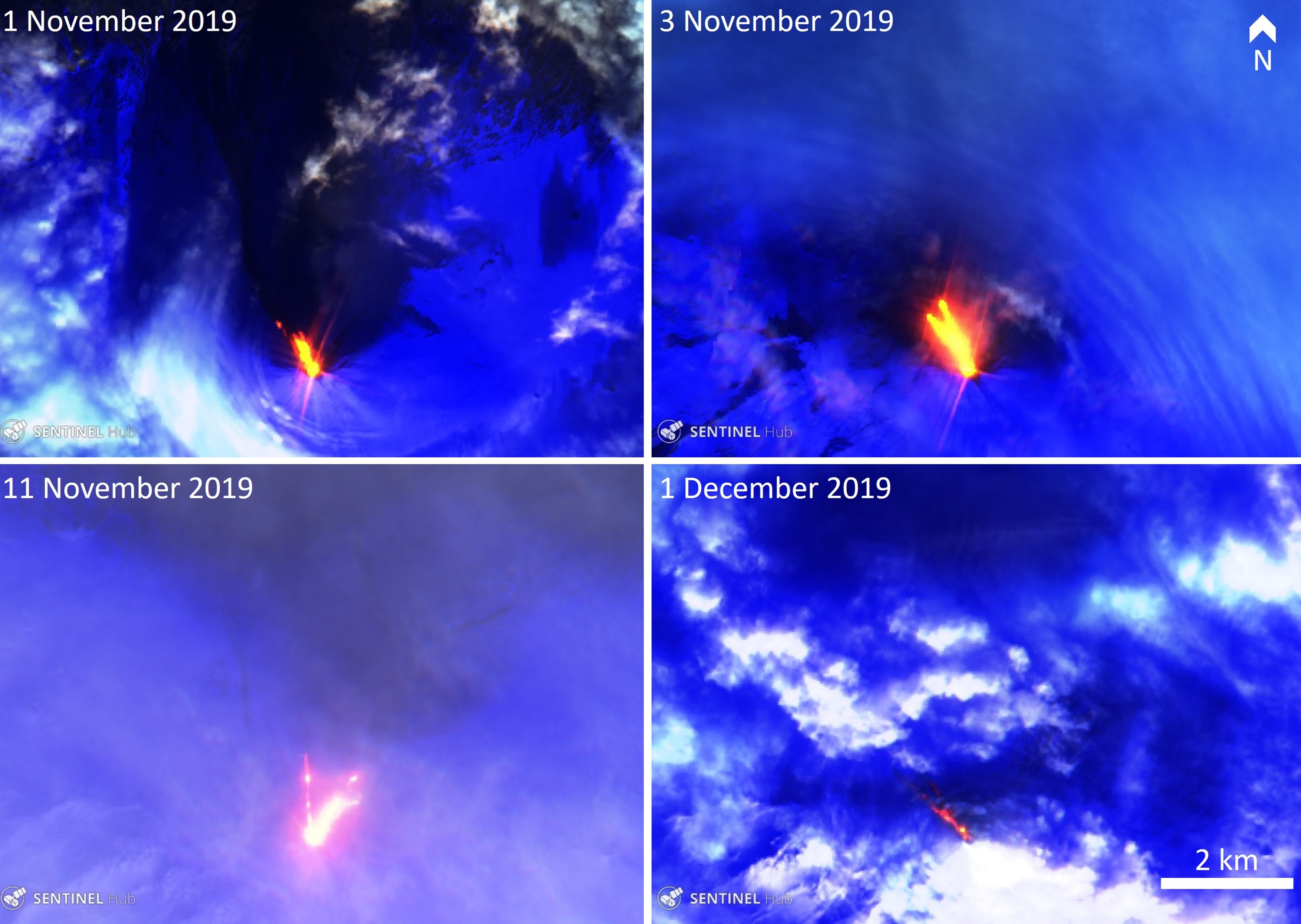
Elevated activity continued through November with multiple lava flows on the northern flanks (figure 19). By 1 November the two lava flows had stalled after extending 1.8 km down the NW flank. Lahars had reached at least 4 km NW and trace amounts of ash were deposited on the north flank. Elevated seismicity on 2 November indicated that lava was likely flowing beyond the summit crater, supported by a local pilot observation. The next day an active lava flow moved 400 m down the NW flank while a smaller flow was active SE of the summit. Minor explosive activity and/or lava fountaining at the summit was indicated by incandescence during the night. Small explosions were recorded in seismic and infrasound data. On 5 November the longer lava flow had developed two lobes, reaching 1 km in length. The lahars had also increased in length, reaching 2 km on the N and S flanks. Incandescence continued and hot spatter was accumulating around the summit vent. Activity continued, other than a 10-hour pause on 4-5 November, and another pause on the 7th. The lava flow length had reached 1.3 km on the 8th and lahar deposits reached 5 km.
After variable levels of activity for a few days, there was a significant increase on 10-11 November with lava fountaining through the evening and night. This was accompanied by minor to moderate ash emissions up to around 3.7 km altitude and drifting northwards, and a significant increase in seismicity. Activity decreased again during the 11-12th while minor steam and ash emissions continued. On 14 November minor ash plumes were visible on the flanks, likely caused by the collapse of accumulated spatter. By 15 November a large network of debris flows consisting of snowmelt and fresh deposits extended 5.5 km NE and the collapse of spatter mounds continued. Ashfall from ash plumes reaching as high as 3.7 km altitude produced thin deposits to the NE, S, and SE. Activity paused during the 17-18th and resumed again on the 19th; intermittent clear views showed either a lava flow or lahar descending the SE flank. Activity sharply declined at 0340 on the 20th.
Seismicity began increasing again on 24 November and small explosions were detected on the 23rd. A small collapse of spatter that had accumulated at the summit occurred at 2330 on the 24th, producing a pyroclastic flow that reached 3 km in length down the NW flank. A new lava flow had also reached several hundred meters down the same flank. Variable but elevated activity continued over 27 November into early December, with a 1.5-km-long lava flow observed in satellite imagery acquired on the 1st. On 5 December minor steam or ash emissions were observed at the summit and on the north flank, and Strombolian explosions were detected. Activity from that day produced fresh ash deposits on the northern side of the volcano and a new lava flow extended 1.4 km down the NW flank. Three small explosions were detected on the 11th.
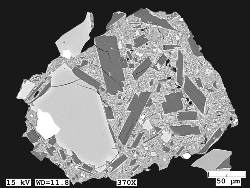
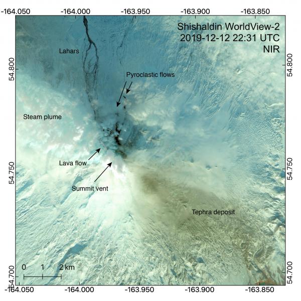
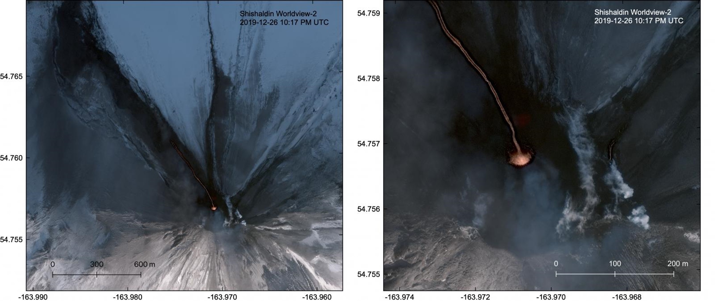
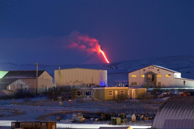
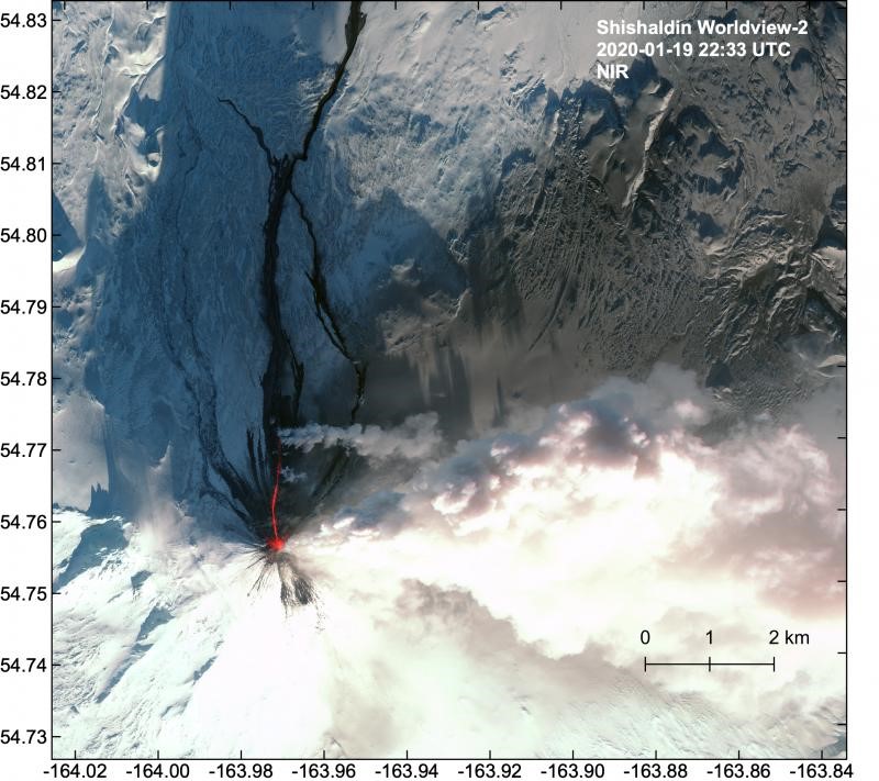
At 0710 on 12 December a 3-minute-long explosion produced an ash plume up to 6-7.6 km altitude that dispersed predominantly towards the W to NW and three lightning strokes were detected. Ash samples were collected on the SE flank by AVO field crews on 20 December and analysis showed variable crystal contents in a glassy matrix (figure 20). A new ash deposit was emplaced out to 10 km SE, and a 3.5-km-long pyroclastic flow had been emplaced to the north, containing blocks as large as 3 m in diameter. The pyroclastic flow was likely a result from collapse of the summit spatter cone and lava flows. A new narrow lava flow had reached 3 km to the NW and lahars continued out to the northern coast of Unimak island (figure 21). The incandescent lava flow was visible from Cold Bay on the evening of the 12th and a thick steam plume continued through the next day.
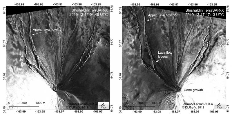
A new lava flow was reported by a pilot on the night of 16 December. Thermal satellite data showed that this flow reached 2 km to the NW. High-resolution radar satellite images over the 15-17th showed that the lava flow had advanced out to 2.5 km and had developed levees along the margins (figure 22). The lava channel was 5-15 m wide and was originating from a crater at the base of the summit scoria cone, which had been rebuilt since the collapse the previous week. Minor ash emissions drifted to the south on the 19tt and 20th (figure 23).
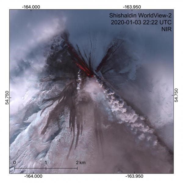
On 21 December a new lava flow commenced, traveling down the northern slope and accompanied by minor ash emissions. Continued lava extrusion was indicated by thermal data on the 25th and two lava flows reaching 1.5 km and 100 m were observed in satellite data on the 26th, as well as ash deposits on the upper flanks (figure 24). Weak explosions were detected by the regional infrasound network the following day. A satellite image acquired on the 30th showed a thick steam plume obscuring the summit and snow cover on the flanks indicating a pause in ash emissions.
In early January satellite data indicated slow lava extrusion or cooling lava flows (or both) near the summit. On the morning of the 3rd an ash plume rose to 6-7 km altitude and drifted 120 km E to SE, producing minor amounts of volcanic lightning. Elevated surface temperatures the previous week indicated continued lava extrusion. A satellite image acquired on 3 January showed lava flows extending to 1.6 km NW, pyroclastic flows moving 2.6 km down the western and southern flanks, and ashfall on the flanks (figure 25).
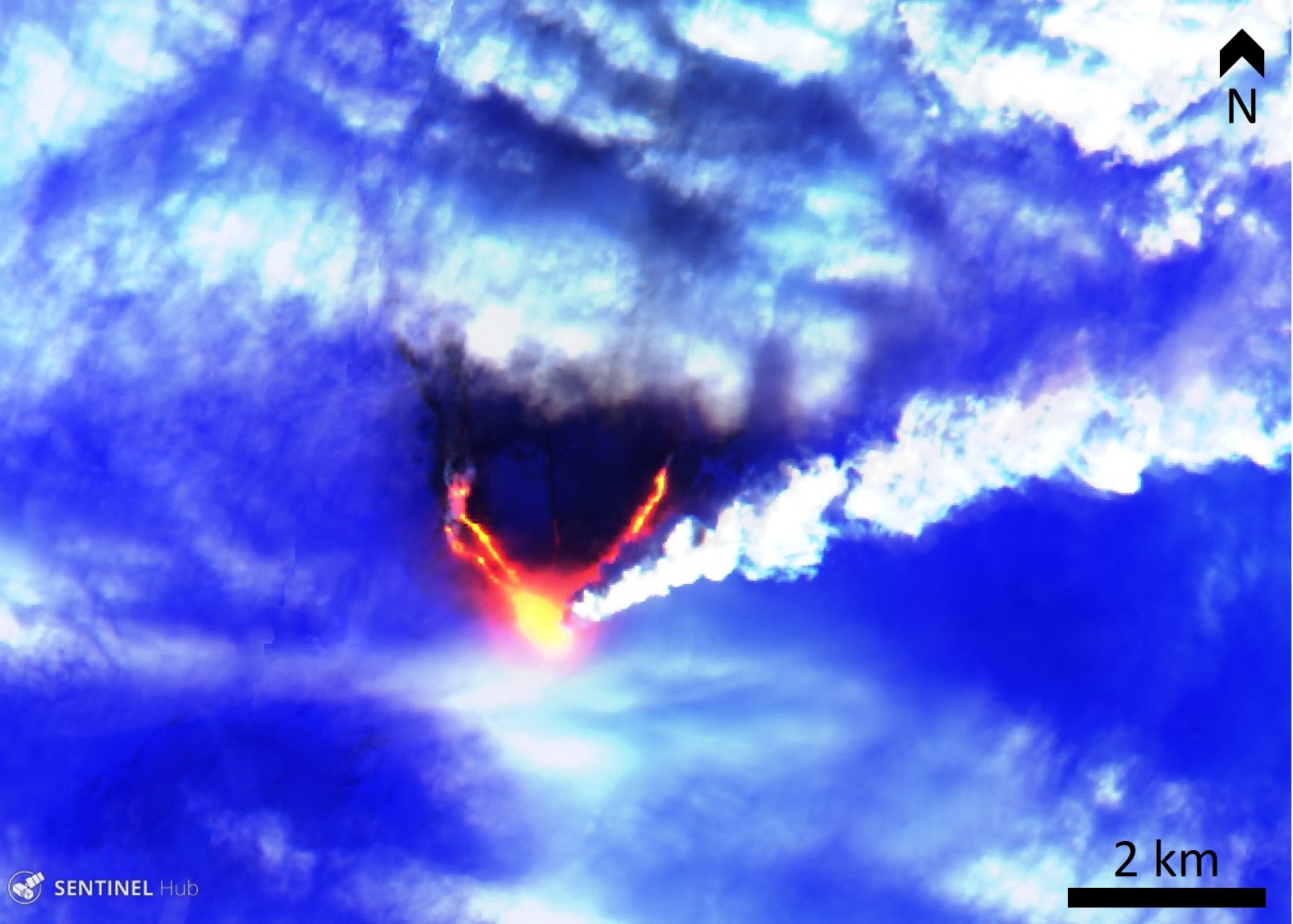
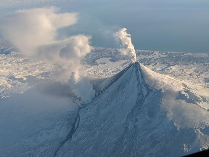
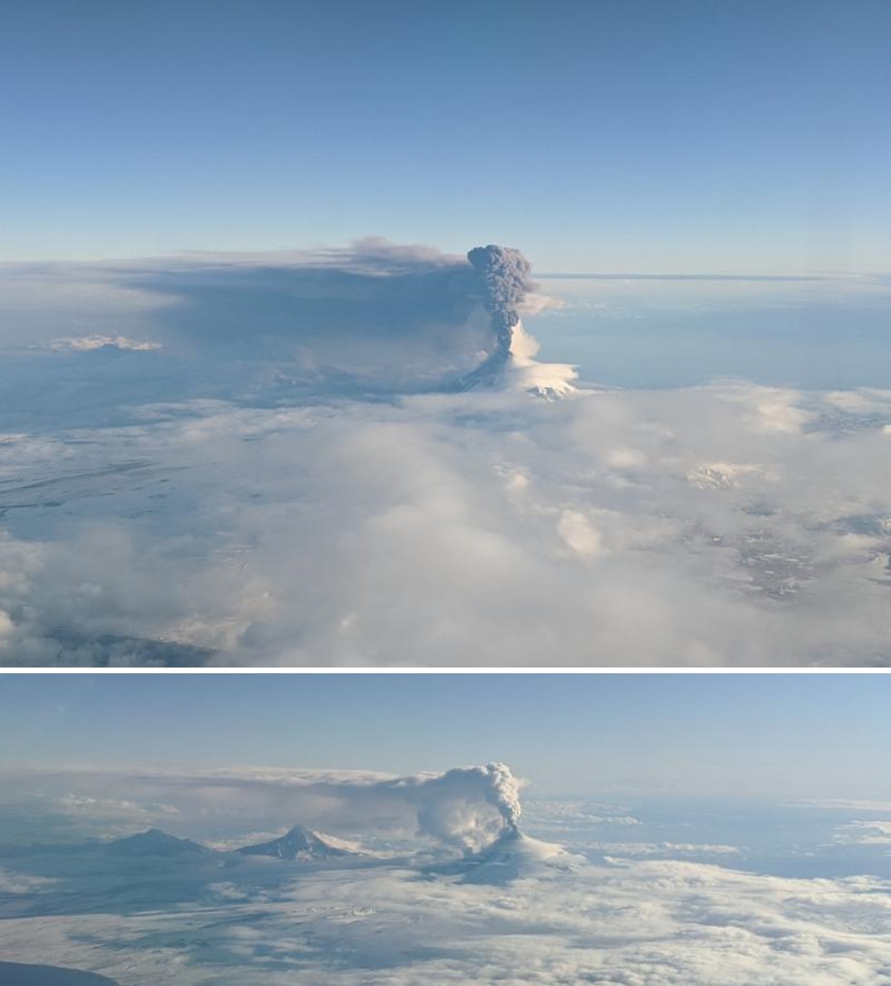
On 7 January the most sustained explosive episode for this eruption period occurred. An ash plume rose to 7 km altitude at 0500 and drifted east to northeast then intensified reaching 7.6 km altitude with increased ash content, prompting an increase of the Aviation Color Code to Red and Volcano Alert Level to Warning. The plume traveled over 200 km to the E to NE (figure 26). Lava flows were produced on the northern flanks and trace amounts of ashfall was reported in communities to the NE, resulting in several flight cancellations. Thermal satellite images showed active lava flows extruding from the summit vent (figure 27). Seismicity significantly decreased around 1200 and the alert levels were lowered to Orange and Watch that evening. Through the following week no notable eruptive activity occurred. An intermittent steam plume was observed in webcam views.
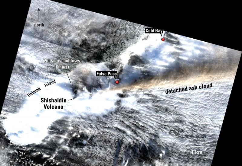
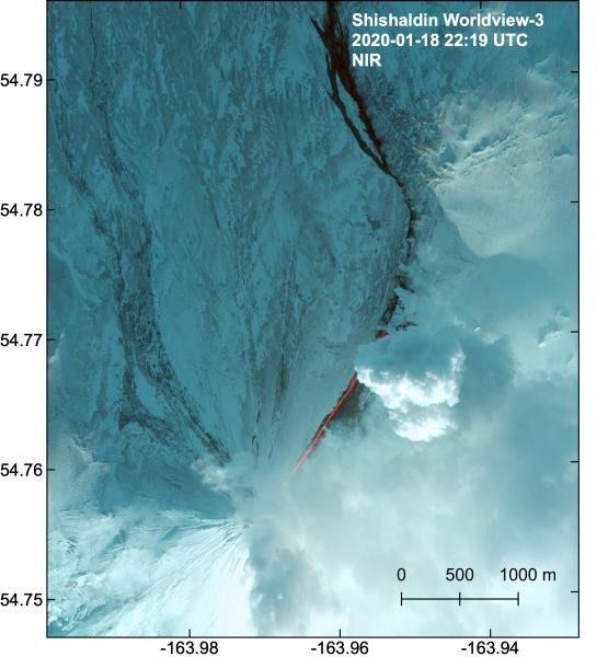
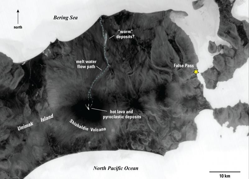
Eruptive activity resumed on 18 January with lava flows traveling 2 km down the NE flank accompanied by a weak plume with possible ash content dispersing to the SW (figure 28). A steam plume was produced at the front of the lava flow and lahar deposits continued to the north (figures 29 to 32). Activity intensified from 0030 on the 19th, generating a more ash-rich plume that extended over 150 km E and SE and reached up to 6 km altitude; activity increased again at around 1500 with ash emissions reaching 9 km altitude. AVO increased the alert levels to Red/Warning. Lava flows traveled down the NE and N flanks producing meltwater lahars, accompanied by elevated seismicity (figures 33). Activity continued through the day and trace amounts of ashfall were reported in False Pass (figure 34). Activity declined to small explosions over the next few days and the alert levels were lowered to Orange/watch shortly after midnight. The next morning weak steam emissions were observed at the summit and there was a thin ash deposit across the entire area. Satellite data acquired on 23 January showed pyroclastic flow deposits and cooling lava flows on the northern flank, and meltwater reaching the northern coast (figure 35).
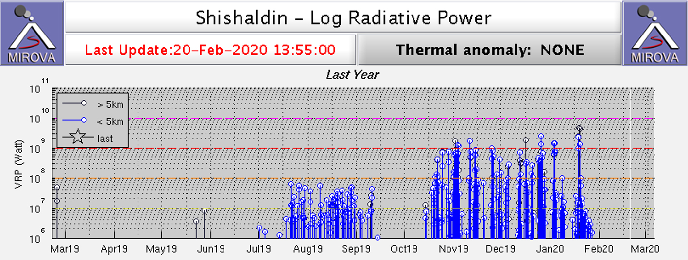
Activity remained low in late January with some ash resuspension (due to winds) near the summit and continued elevated temperatures. Seismicity remained above background levels. Infrasound data indicated minor explosive activity during 22-23 January and small steam plumes were visible on 22, 23, and 26 January. MIROVA thermal data showed the rapid reduction in activity following activity in late-January (figure 36).
Geological Summary. The symmetrical glacier-covered Shishaldin in the Aleutian Islands is the westernmost of three large stratovolcanoes in the eastern half of Unimak Island. The Aleuts named the volcano Sisquk, meaning "mountain which points the way when I am lost." Constructed atop an older glacially dissected edifice, it is largely basaltic in composition. Remnants of an older edifice are exposed on the W and NE sides at 1,500-1,800 m elevation. There are over two dozen pyroclastic cones on its NW flank, which is covered by massive aa lava flows. Frequent explosive activity, primarily consisting of Strombolian ash eruptions from the small summit crater, but sometimes producing lava flows, has been recorded since the 18th century. A steam plume often rises from the summit crater.
Information Contacts: Alaska Volcano Observatory (AVO), a cooperative program of a) U.S. Geological Survey, 4200 University Drive, Anchorage, AK 99508-4667 USA (URL: https://avo.alaska.edu/), b) Geophysical Institute, University of Alaska, PO Box 757320, Fairbanks, AK 99775-7320, USA, and c) Alaska Division of Geological & Geophysical Surveys, 794 University Ave., Suite 200, Fairbanks, AK 99709, USA (URL: http://dggs.alaska.gov/); Simon Plank, German Aerospace Center (DLR) German Remote Sensing Data Center, Geo-Risks and Civil Security, Oberpfaffenhofen, 82234 Weßling (URL: https://www.dlr.de/eoc/en/desktopdefault.aspx/tabid-5242/8788_read-28554/sortby-lastname/); MIROVA (Middle InfraRed Observation of Volcanic Activity), a collaborative project between the Universities of Turin and Florence (Italy) supported by the Centre for Volcanic Risk of the Italian Civil Protection Department (URL: http://www.mirovaweb.it/); Planet Labs, Inc. (URL: https://www.planet.com/); Sentinel Hub Playground (URL: https://www.sentinel-hub.com/explore/sentinel-playground).