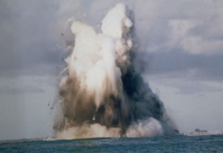
Report on Nishinoshima (Japan) — July 1979
Scientific Event Alert Network Bulletin, vol. 4, no. 7 (July 1979)
Managing Editor: David Squires.
Nishinoshima (Japan) Water discoloration seen on 15 November 1978
Please cite this report as:
Global Volcanism Program, 1979. Report on Nishinoshima (Japan) (Squires, D., ed.). Scientific Event Alert Network Bulletin, 4:7. Smithsonian Institution. https://doi.org/10.5479/si.GVP.SEAN197907-284096
Nishinoshima
Japan
27.247°N, 140.874°E; summit elev. 100 m
All times are local (unless otherwise noted)
On 15 November 1978, discolored water was visible at 27.25°N, 140.88°E, 6.5 km NW of Nishino-shima, the first activity there since the explosions of May 1973-summer 1974.
Reference. Ehara, S., Yuhara, K., and Ossaka, J., 1977, Rapid cooling of volcano Nishinoshima-shinto, the Ogasawara Islands: Bulletin of the Volcanological Society of Japan, v. 22, p. 75-84 (SEAN Part I-Observational Results) and p. 123-131 (Part II-Interpretations).
Geological Summary. The small island of Nishinoshima was enlarged when several new islands coalesced during an eruption in 1973-74. Multiple eruptions that began in 2013 completely covered the previous exposed surface and continued to enlarge the island. The island is the summit of a massive submarine volcano that has prominent peaks to the S, W, and NE. The summit of the southern cone rises to within 214 m of the ocean surface 9 km SSE.
Information Contacts: JMSA, Tokyo; JMA, Tokyo.

