Report on Karymsky (Russia) — August 1979
Scientific Event Alert Network Bulletin, vol. 4, no. 8 (August 1979)
Managing Editor: David Squires.
Karymsky (Russia) Explosions and lava flows
Please cite this report as:
Global Volcanism Program, 1979. Report on Karymsky (Russia) (Squires, D., ed.). Scientific Event Alert Network Bulletin, 4:8. Smithsonian Institution. https://doi.org/10.5479/si.GVP.SEAN197908-300130
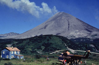
Karymsky
Russia
54.049°N, 159.443°E; summit elev. 1513 m
All times are local (unless otherwise noted)
Tass reported on 31 July that explosions every 2-3 minutes produced 1-km-high ash clouds, and two lava flows were moving down the flanks.
Geological Summary. Karymsky, the most active volcano of Kamchatka's eastern volcanic zone, is a symmetrical stratovolcano constructed within a 5-km-wide caldera that formed during the early Holocene. The caldera cuts the south side of the Pleistocene Dvor volcano and is located outside the north margin of the large mid-Pleistocene Polovinka caldera, which contains the smaller Akademia Nauk and Odnoboky calderas. Most seismicity preceding Karymsky eruptions originated beneath Akademia Nauk caldera, located immediately south. The caldera enclosing Karymsky formed about 7600-7700 radiocarbon years ago; construction of the stratovolcano began about 2000 years later. The latest eruptive period began about 500 years ago, following a 2300-year quiescence. Much of the cone is mantled by lava flows less than 200 years old. Historical eruptions have been vulcanian or vulcanian-strombolian with moderate explosive activity and occasional lava flows from the summit crater.
Information Contacts: Tass News Agency.