Report on Galunggung (Indonesia) — September 1982
Scientific Event Alert Network Bulletin, vol. 7, no. 9 (September 1982)
Managing Editor: Lindsay McClelland.
Galunggung (Indonesia) Occasional explosions continue
Please cite this report as:
Global Volcanism Program, 1982. Report on Galunggung (Indonesia) (McClelland, L., ed.). Scientific Event Alert Network Bulletin, 7:9. Smithsonian Institution. https://doi.org/10.5479/si.GVP.SEAN198209-263140
Galunggung
Indonesia
7.25°S, 108.058°E; summit elev. 2168 m
All times are local (unless otherwise noted)
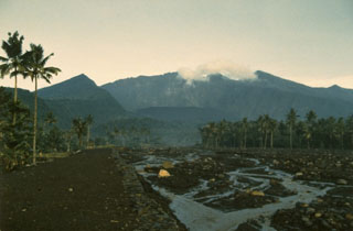
Occasional eruption clouds could be seen on satellite imagery in September. Explosive activity that probably began about 0000-0030 on 19 September, produced a moderate-sized plume that appeared on an image at 0100. Six hours later, the plume was considerably more diffuse and feeding had stopped. At 1900 on the 22nd, an image showed an eruption cloud beginning to emerge from the volcano. No other explosions have been reported through the end of September.
Geological Summary. The forested slopes of Galunggung in western Java SE of Bandung are cut by a 2-km-wide collapse scarp open towards the ESE. The "Ten Thousand Hills of Tasikmalaya" dotting the plain below the volcano are debris-avalanche hummocks from the collapse about 4,200 years ago. An eruption in 1822 produced pyroclastic flows and lahars that killed over 4,000 people. A series of major explosive eruptions starting in April 1982 destroyed a number of villages, killed as many as 30 people, and forced over 60,000 to evacuate. Pyroclastic flows and heavy widespread ash caused significant damage. A large passenger jet that encountered the ash plume on 24 June lost power to all four engines but managed to land safely in Jakarta. The 1982 activity destroyed a 1918 dome and formed the Warirang crater, almost as wide as the valley, about 2 km down from the summit.
Information Contacts: M. Matson, D. Haller, and J. Hawkins, NOAA.