Report on Kusatsu-Shiranesan (Japan) — October 1982
Scientific Event Alert Network Bulletin, vol. 7, no. 10 (October 1982)
Managing Editor: Lindsay McClelland.
Kusatsu-Shiranesan (Japan) Phreatic explosion; volcanic tremor
Please cite this report as:
Global Volcanism Program, 1982. Report on Kusatsu-Shiranesan (Japan) (McClelland, L., ed.). Scientific Event Alert Network Bulletin, 7:10. Smithsonian Institution. https://doi.org/10.5479/si.GVP.SEAN198210-283120
Kusatsu-Shiranesan
Japan
36.618°N, 138.528°E; summit elev. 2165 m
All times are local (unless otherwise noted)
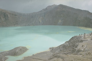
A brief phreatic explosion from three vents on 26 October ejected a dark column that rose 100 m above the lakes in two summit craters, Yugama and Karagama (figure 1). Onset time of the explosion was uncertain, but the seismograph at the Maebashi District Meteorological Observatory, 1.1 km NE of Yugama, began to record volcanic tremor with an amplitude of 0.2 µm at 0855. Gray plumes were recognized at 0905. The tremor gradually increased in amplitude and peaked about an hour after onset.
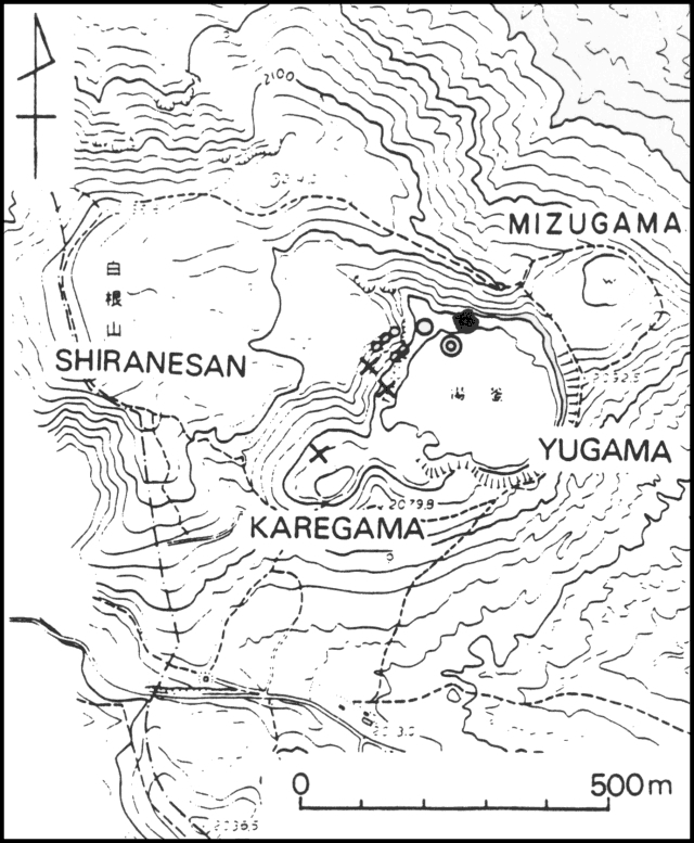 |
Figure 1. Map of the summit region of Kusatsu-Shirane. Small circles indicate fumaroles; the other marks represent vents active since the 27 October 1982 eruption. An 'x' indicates an emission point of the 26 October 1982 eruption plume. The large open circle is Pit No. 6; the concentric circles are Pit No. 7. The solid circle is a new pit that formed on 13 November. Pits No. 2 and 3 (not shown) are on the W inner wall of Yugama. Courtesy of JMA. |
Activity at Karagama ended at 0920, only 15 minutes after it was first recognized, and at 0930 activity at Yugama was reduced to white vapor emission (which ended the next day). Volcanic tremor, however, continued at peak levels for a few hours then gradually weakened, ceasing at 0124 on 30 October. A swarm of volcanic earthquakes lasting 5 hours was recorded on 26-27 October, and there was another minor swarm on [27] October.
JMA reported that a strong wind carried ash from as far as 3 km to the SE; ash was 1 mm thick on the crater rim. Tokiko Tiba reported a maximum of 3 cm of ash in the summit area. The total volume of ejecta was estimated to be 2,800-3,400 tons. No damage was reported. As of 2 November no further eruptions had been reported, and fumarolic activity in Yugama had declined. . . .
Geological Summary. The Kusatsu-Shiranesan complex, located immediately north of Asama volcano, consists of a series of overlapping pyroclastic cones and three crater lakes. The andesitic-to-dacitic volcano was formed in three eruptive stages beginning in the early to mid-Pleistocene. The Pleistocene Oshi pyroclastic flow produced extensive welded tuffs and non-welded pumice that covers much of the E, S, and SW flanks. The latest eruptive stage began about 14,000 years ago. Historical eruptions have consisted of phreatic explosions from the acidic crater lakes or their margins. Fumaroles and hot springs that dot the flanks have strongly acidified many rivers draining from the volcano. The crater was the site of active sulfur mining for many years during the 19th and 20th centuries.
Information Contacts: T. Tiba, National Science Museum, Tokyo; JMA, Tokyo.