Report on Banda Api (Indonesia) — August 1988
Scientific Event Alert Network Bulletin, vol. 13, no. 8 (August 1988)
Managing Editor: Lindsay McClelland.
Banda Api (Indonesia) Satellite data suggest May cloud to >16 km
Please cite this report as:
Global Volcanism Program, 1988. Report on Banda Api (Indonesia) (McClelland, L., ed.). Scientific Event Alert Network Bulletin, 13:8. Smithsonian Institution. https://doi.org/10.5479/si.GVP.SEAN198808-265090
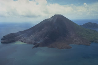
Banda Api
Indonesia
4.523°S, 129.881°E; summit elev. 596 m
All times are local (unless otherwise noted)
Analysis of imagery from Japan's GMS satellite suggested that the eruption clouds reached much higher altitudes than indicated by ground observations. Coldest surface temperatures of eruption clouds measured by the JMA were -78, -79, and -67°C on 29 May at 0700, 0800, and 1100 respectively, corresponding to altitudes of 16-16.5 km above sea level (figure 06ban01f). Aerosol layers were detected at similar altitudes 1-2 months later by lidar in Hawaii and Japan. At Mauna Loa, Hawaii, very small fresh-looking layers were centered at 15.9 and 17.7 km altitude (just above the tropopause) in June, and a thin layer was evident over Fukuoka, Japan at 15.4 km, about 1 km below the tropopause, in early July (see Atmospheric Effects in SEAN 13:06).
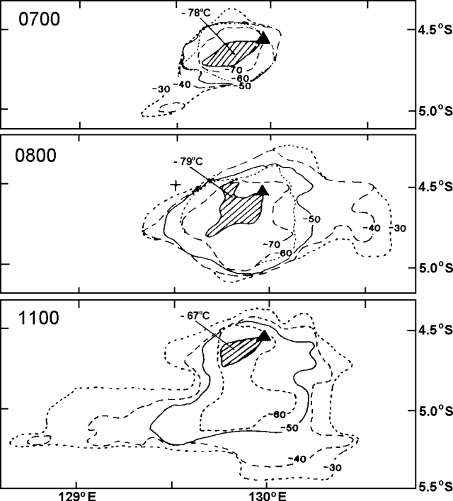 |
Figure 1. Temperature gradients in the eruption cloud from Banda Api (solid triangle) measured from GMS infrared images returned on 29 May at 0700, 0800, and 1100. Courtesy of Y. Sawada. |
Activity at Banda Api declined toward more normal inter-eruptive levels during August. Low-pressure fumes reached 25-50 m above the summit. A daily average of three tectonic and three volcanic events were recorded by seismographs.
Geological Summary. The 3-km-wide island of Banda Api is the northern-most volcano in the Banda arc and has a long period of recorded observation because of its key location in the Portuguese and Dutch spice trade. The basaltic-to-rhyodacitic volcano is located in the SW corner of a mostly submerged 7 km caldera. At least two episodes of caldera formation are thought to have occurred, with the arcuate islands of Lonthor and Neira considered to be pre-caldera remnants. A conical peak rises to about 600 m at the center of the island. Eruptions have been recorded since 1586 CE, mostly consisting of Strombolian eruptions from the summit crater, but larger explosive eruptions have occurred and occasional lava flows have reached the coast.
Information Contacts: Y. Sawada, JMA; VSI.