Report on Planchon-Peteroa (Chile) — 10 November-16 November 2010
Smithsonian Institution / US Geological Survey
Weekly Volcanic Activity Report, 10 November-16 November 2010
Managing Editor: Sally Sennert.
Please cite this report as:
Global Volcanism Program, 2010. Report on Planchon-Peteroa (Chile) (Sennert, S, ed.). Weekly Volcanic Activity Report, 10 November-16 November 2010. Smithsonian Institution and US Geological Survey.
Planchon-Peteroa
Chile
35.223°S, 70.568°W; summit elev. 3977 m
All times are local (unless otherwise noted)
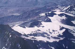
On 11 November, SERNAGEOMIN reported that seismicity from Planchón-Peteroa remained low. Observations from multiple sources, including a web camera and satellite images, showed that the height of the gas plume was lower than the previously reported height of 200 m, observed during 15-25 October. The Alert Level was lowered to 2, Green.
Geological Summary. Planchón-Peteroa is an elongated complex volcano along the Chile-Argentina border with several overlapping calderas. Activity began in the Pleistocene with construction of the basaltic-andesite to dacitic Volcán Azufre, followed by formation of basaltic and basaltic-andesite Volcán Planchón, 6 km to the north. About 11,500 years ago, much of Azufre and part of Planchón collapsed, forming the massive Río Teno debris avalanche, which traveled 95 km to reach Chile's Central Valley. Subsequently, Volcán Planchón II was formed. The youngest volcano, andesitic and basaltic-andesite Volcán Peteroa, consists of scattered vents between Azufre and Planchón. Peteroa has been active into historical time and contains a small steaming crater lake. Historical eruptions from the complex have been dominantly explosive, although lava flows were erupted in 1837 and 1937.
Source: Servicio Nacional de Geología y Minería (SERNAGEOMIN)