Report on Ranakah (Indonesia) — 19 October-25 October 2011
Smithsonian Institution / US Geological Survey
Weekly Volcanic Activity Report, 19 October-25 October 2011
Managing Editor: Sally Sennert.
Please cite this report as:
Global Volcanism Program, 2011. Report on Ranakah (Indonesia) (Sennert, S, ed.). Weekly Volcanic Activity Report, 19 October-25 October 2011. Smithsonian Institution and US Geological Survey.
Ranakah
Indonesia
8.637°S, 120.5302°E; summit elev. 2288 m
All times are local (unless otherwise noted)
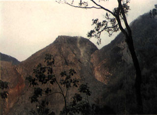
CVGHM reported that throughout September and during 1-12 October diffuse white plumes rose 10-15 m above the Anak Ranakah lava dome. Plumes were not observed during 13-21 October. Starting on 1 July, seismicity had increased to a peak level on 15 August then declined through 20 October. Based on visual observations, seismicity, and deformation data, CVGHM lowered the Alert Level to 2 (on a scale of 1-4) on 22 October.
Geological Summary. The Anak Ranakah (Child of Ranakah) lava dome was formed in 1987 in an area without previous recorded eruptions at the base of the large older lava dome of Gunung Ranakah. An arcuate group of lava domes extending about 12 km west from Gunung Ranakah to Poco Mandosawa occurs on the outer N flanks of the poorly known Poco Leok caldera on western Flores Island.
Source: Pusat Vulkanologi dan Mitigasi Bencana Geologi (PVMBG, also known as CVGHM)