Report on Kadovar (Papua New Guinea) — 3 October-9 October 2018
Smithsonian Institution / US Geological Survey
Weekly Volcanic Activity Report, 3 October-9 October 2018
Managing Editor: Sally Sennert.
Please cite this report as:
Global Volcanism Program, 2018. Report on Kadovar (Papua New Guinea) (Sennert, S, ed.). Weekly Volcanic Activity Report, 3 October-9 October 2018. Smithsonian Institution and US Geological Survey.
Kadovar
Papua New Guinea
3.608°S, 144.588°E; summit elev. 365 m
All times are local (unless otherwise noted)
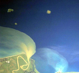
RVO reported quiet conditions at Kadovar during 1-20 September with only diffuse white plumes rising from the volcano. Activity increased on 21 September and remained elevated at least through 26 September, the date the last visual observation was received by RVO. During the period if increased activity dense dark gray and brown ash plumes rose several hundred meters above the summit crater (700-800 m) and drifted NW. Intense incandescence from Main Crater, the SE coastal vent, and other areas was visible. Minor amounts of ash fell on Blup Blup island. On 1 October an ash plume rose to 900 m (3,000 ft) a.s.l. and drifted W. An ash plume was visible in satellite images on 3 October drifting W at an altitude of 2.1 km (6,900 ft) a.s.l.
Geological Summary. The 2-km-wide island of Kadovar is the emergent summit of a Bismarck Sea stratovolcano of Holocene age. It is part of the Schouten Islands, and lies off the coast of New Guinea, about 25 km N of the mouth of the Sepik River. Prior to an eruption that began in 2018, a lava dome formed the high point of the andesitic volcano, filling an arcuate landslide scarp open to the south; submarine debris-avalanche deposits occur in that direction. Thick lava flows with columnar jointing forms low cliffs along the coast. The youthful island lacks fringing or offshore reefs. A period of heightened thermal phenomena took place in 1976. An eruption began in January 2018 that included lava effusion from vents at the summit and at the E coast.
Sources: Rabaul Volcano Observatory (RVO), Darwin Volcanic Ash Advisory Centre (VAAC)