Report on Taal (Philippines) — 22 January-28 January 2020
Smithsonian Institution / US Geological Survey
Weekly Volcanic Activity Report, 22 January-28 January 2020
Managing Editor: Sally Sennert.
Please cite this report as:
Global Volcanism Program, 2020. Report on Taal (Philippines) (Sennert, S, ed.). Weekly Volcanic Activity Report, 22 January-28 January 2020. Smithsonian Institution and US Geological Survey.
Taal
Philippines
14.0106°N, 120.9975°E; summit elev. 311 m
All times are local (unless otherwise noted)
PHIVOLCS reported that white steam-laden plumes rose as high as 800 m above Taal’s main vent during 22-28 January and drifted SW and NE; ash emissions ceased around 0500 on 22 January. Remobilized ash drifted SW on 22 January due to strong low winds, affecting the towns of Lemery (16 km SW) and Agoncillo, and rose as high as 5.8 km (19,000 ft) a.s.l. as reported by pilots.
PHIVOLCS stated that since the 12-13 January phreatomagmatic eruption activity has generally weakened. Both the number and magnitude of volcanic earthquakes declined; by 21 January hybrid earthquakes had ceased and both the number and magnitude of low-frequency events had diminished. GPS data had recorded a sudden widening of Taal Caldera by ~1 m, uplift of the NW sector by ~20 cm, and subsidence of the SW part of Volcano Island by ~1 m just after the main eruption phase. The rate of the deformation patterns was smaller during 15-22 January, and generally corroborated by field observations; Taal Lake had receded about 30 cm by 25 January but about 2.5 m of lakewater recession (due to uplift) was observed around the SW portion of the lake, near the Pansipit River Valley where ground cracking had been reported. The Alert Level was lowered to 3 (on a scale of 0-5) on 26 January and PHIVOLCS recommended no entry onto Volcano Island and Taal Lake, nor into towns W of the island within a 7-km radius. Sulfur dioxide emissions were low at 140 tonnes per day on 22 January but averaged around 250 tonnes per day through 26 January; emissions were 87 tonnes per day on 27 January and below detectable limits the next day. According to the Disaster Response Operations Monitoring and Information Center (DROMIC) there were a total of 125,178 people in 497 evacuation centers as of 2020 on 28 January.
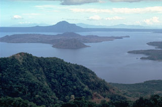
Geological Summary. Taal is one of the most active volcanoes in the Philippines and has produced some powerful eruptions. The 15 x 20 km Talisay (Taal) caldera is largely filled by Lake Taal, whose 267 km2 surface lies only 3 m above sea level. The maximum depth of the lake is 160 m, with several submerged eruptive centers. The 5-km-wide Volcano Island in north-central Lake Taal is the location of all observed eruptions. The island is composed of coalescing small stratovolcanoes, tuff rings, and scoria cones. Powerful pyroclastic flows and surges have caused many fatalities.
Sources: Philippine Institute of Volcanology and Seismology (PHIVOLCS), Disaster Response Operations Monitoring and Information Center (DROMIC)

