Report on Iliwerung (Indonesia) — August 1993
Bulletin of the Global Volcanism Network, vol. 18, no. 8 (August 1993)
Managing Editor: Edward Venzke.
Iliwerung (Indonesia) Submarine eruption produces 100-m-high water columns
Please cite this report as:
Global Volcanism Program, 1993. Report on Iliwerung (Indonesia) (Venzke, E., ed.). Bulletin of the Global Volcanism Network, 18:8. Smithsonian Institution. https://doi.org/10.5479/si.GVP.BGVN199308-264250
Iliwerung
Indonesia
8.532°S, 123.573°E; summit elev. 583 m
All times are local (unless otherwise noted)
A submarine eruption in the Alor Strait was reported on 16 September by a Japanese cargo ship. Crew members felt three shocks at around 0630, and observed a rising steam cloud or plume soon after. Explosions occurred at 0656 and 0855. Each explosion produced a water column ~100 m high, followed by a cone of upwelling water; no other unusual phenomena were observed after the explosions. From ~6.5 km away, the ship located the explosion site at about 8.538°S, 123.592°E, [2 km ESE of the Iliwerung summit]. The VSI confirmed that an eruption had occurred from the submarine Hobal vent at Iliwerung....
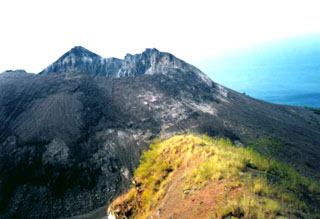
Geological Summary. Constructed on the southern rim of the Lerek caldera, Iliwerung forms a prominent south-facing peninsula on Lembata (formerly Lomblen) Island. Craters and lava domes have formed along N-S and NW-SE lines on the complex volcano; activity has been observed at vents from the summit to the submarine SE flank. The summit lava dome was formed during an eruption in 1870. In 1948 the Iligripe lava dome grew on the E flank at 120 m elevation. Beginning in 1973-74, when three ephemeral islands were formed, submarine eruptions began on the lower ESE flank at a vent named Hobal; several other eruptions have since taken place at this vent.
Information Contacts: JMA; M.A. Purvawinata, VSI.