Report on Taal (Philippines) — October 1977
Natural Science Event Bulletin, vol. 2, no. 10 (October 1977)
Managing Editor: David Squires.
Taal (Philippines) Weak phreatic eruption with harmonic tremor
Please cite this report as:
Global Volcanism Program, 1977. Report on Taal (Philippines) (Squires, D., ed.). Natural Science Event Bulletin, 2:10. Smithsonian Institution. https://doi.org/10.5479/si.GVP.NSEB197710-273070
Taal
Philippines
14.0106°N, 120.9975°E; summit elev. 311 m
All times are local (unless otherwise noted)
A weak phreatic eruption from the NE portion of the 1976 crater began at 1515 on 3 October, and had ended by 1400 the next day. Brownish to grayish basaltic ash clouds initially rose 300 m, and reached a maximum height of 500 m after a few hours. Activity then gradually declined to strong steaming. The eruption was accompanied by harmonic tremor. Residents of Taal Island were evacuated, and had not returned by late October because of the possibility of renewed activity.
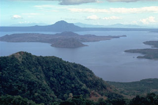
Geological Summary. Taal is one of the most active volcanoes in the Philippines and has produced some powerful eruptions. The 15 x 20 km Talisay (Taal) caldera is largely filled by Lake Taal, whose 267 km2 surface lies only 3 m above sea level. The maximum depth of the lake is 160 m, with several submerged eruptive centers. The 5-km-wide Volcano Island in north-central Lake Taal is the location of all observed eruptions. The island is composed of coalescing small stratovolcanoes, tuff rings, and scoria cones. Powerful pyroclastic flows and surges have caused many fatalities.
Information Contacts: G. Andal, COMVOL, Quezon City.

