Global Volcanism Program | Image GVP-03643
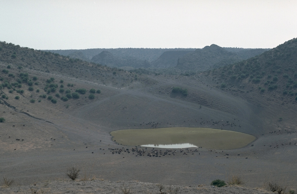
The bottom of El Jagüey maar is occupied by a small lake which marks the level of the groundwater table that lies about 60 m below the top of the surrounding lava plain and serves as a critical regional water hole for cattle (foreground). Explosions occurred when rising magma encountered this aquifer and produced the intersecting La Breña-El Jagüey maars. The NW rim of the 1,400-m-wide La Breña maar forms the horizon beyond the saddle between La Breña and the 700-m-wide El Jagüey maar.
Photo by Jim Luhr, 1988 (Smithsonian Institution).
![]() This image is made available under the Public Domain Dedication CC0 license, but proper attribution is appreciated.
This image is made available under the Public Domain Dedication CC0 license, but proper attribution is appreciated.
Galleries: Craters
Durango Volcanic Field