Global Volcanism Program | Image GVP-07839
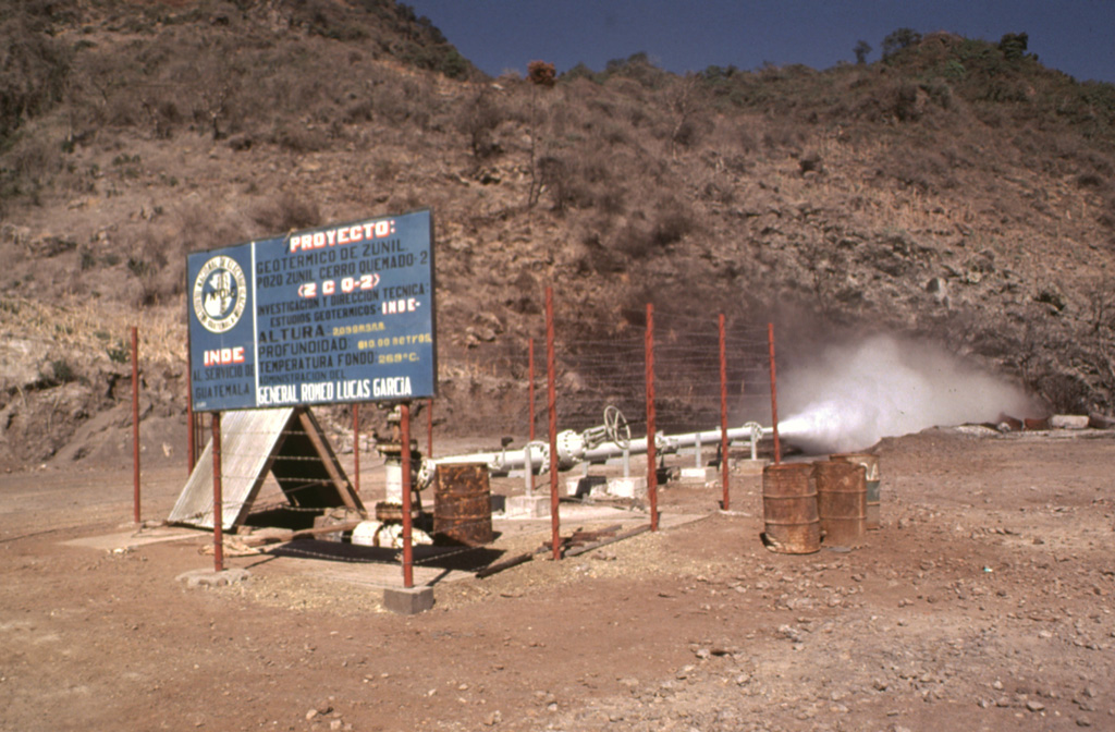
The Almolonga volcano Zunil geothermal project is seen here in 1981, a decade prior to a landslide that buried the well site. Well ZCQ-4 was drilled in 1981 to a depth of about 1.3 km and cemented to a depth of 400 m. In October 1989 the recorded bottom hole temperature was 260°C. The upper part of the geothermal system contains acid-sulfate hot springs. Associated mud pools and fumaroles occur at high points on both sides of the Río Samalá, and bicarbonate-rich hot springs discharge into the river's canyon.
Photo by Bill Rose, 1981 (Michigan Technological University).
![]() This image is made available under the Creative Commons BY-NC-ND 4.0 license terms.
This image is made available under the Creative Commons BY-NC-ND 4.0 license terms.
Keywords: geothermal
Almolonga