Global Volcanism Program | Image GVP-08138
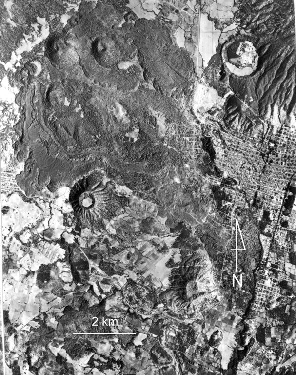
Cerro el Jabalí (upper left) and the adjacent Cerro el Sapien (immediately to the east) of the Michoacan-Guanajuato volcanic field produced the unvegetated lava flow extending across the top of the photo. Ashfall from Cerro el Jabalí scoria cone, located about 15 km SE of Parícutin, erupted about 3,830 years ago. The city of Uruapan is in the right side of the photo, south of the circular Costo (Cerro Cotji) maar.
Aerial photo by Comisión de Estudios del Territorio Nacional (CETENAL).
![]() This image is made available under the Public Domain Dedication CC0 license, but proper attribution is appreciated.
This image is made available under the Public Domain Dedication CC0 license, but proper attribution is appreciated.
Galleries: Craters | Scoria Cones
Keywords: lava flow | scoria cone | crater | volcanic field | maar
Michoacán-Guanajuato