Global Volcanism Program | Image GVP-11180
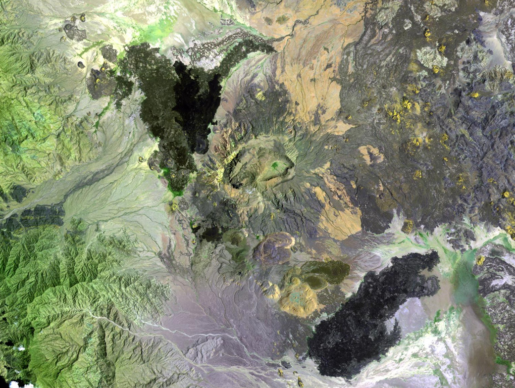
The Ma Alalta stratovolcano (center), also known as Pierre Pruvost, is located W of the Danakil depression. There are two elongate, nested summit calderas, 6 km and 4 km wide in the long direction. Young basaltic lava flows were erupted on the NW, SE, and E flanks of the volcano, and young pantellerite obsidian domes and lava flows were erupted on the S flank.
NASA Landsat image, 1999 (courtesy of Hawaii Synergy Project, Univ. of Hawaii Institute of Geophysics & Planetology).
![]() This image is made available as a Public Domain Work, but proper attribution is appreciated.
This image is made available as a Public Domain Work, but proper attribution is appreciated.
Keywords: remote sensing | caldera | lava flow
Ma Alalta