Global Volcanism Program | Image GVP-11565
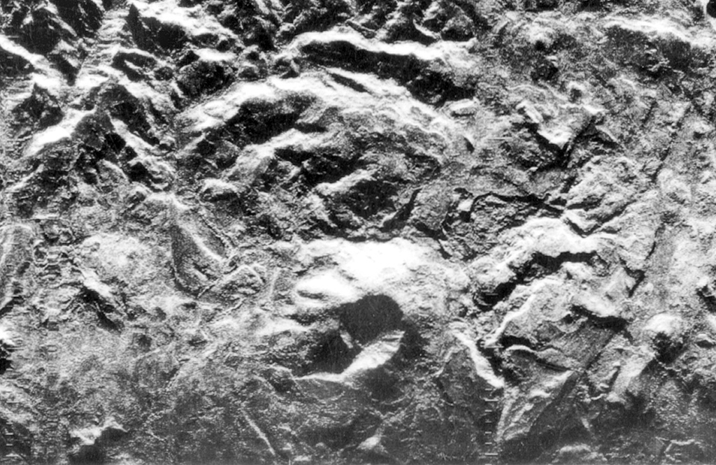
The stratovolcano at the lower center of this radar image is Cerro el Ciguatepe, one of several Quaternary volcanoes that lie in the Nicaraguan interior highlands. A well-preserved 1.5-km-wide crater is breached to the SW and partially filled by a blocky plug dome. The steep-sided stratovolcano was constructed at the boundary of flat-lying Tertiary ignimbrite deposits and fault-blocks bordering the Nicaraguan depression.
Radar image, 1971 (courtesy of Jaime Incer).
![]() This image is made available under the Creative Commons BY-NC 4.0 license terms.
This image is made available under the Creative Commons BY-NC 4.0 license terms.
Cerro el Ciguatepe