Global Volcanism Program | Image GVP-11868
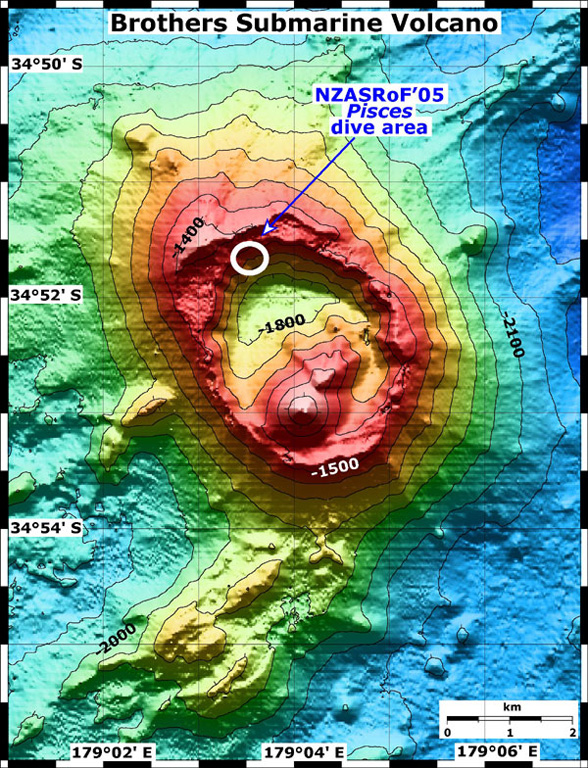
A bathymetric map of Brothers submarine volcano. The NZASRoF 2005 Pisces V dives are indicated in the NW caldera area. The contour interval is 100 m and the resolution of the bathymetry data is 25 m. The bathymetry data are provided courtesy of the New Zealand National Institute of Water and Atmospheric Research (NIWA).
Image courtesy of New Zealand-American Submarine Ring of Fire 2005 Exploration, NOAA Vents Program.
![]() This image is made available as a Public Domain Work, but proper attribution is appreciated.
This image is made available as a Public Domain Work, but proper attribution is appreciated.
Keywords: submarine volcano | stratovolcano | remote sensing | technology | DEM | map | bathymetry
Brothers