Global Volcanism Program | Image GVP-11874
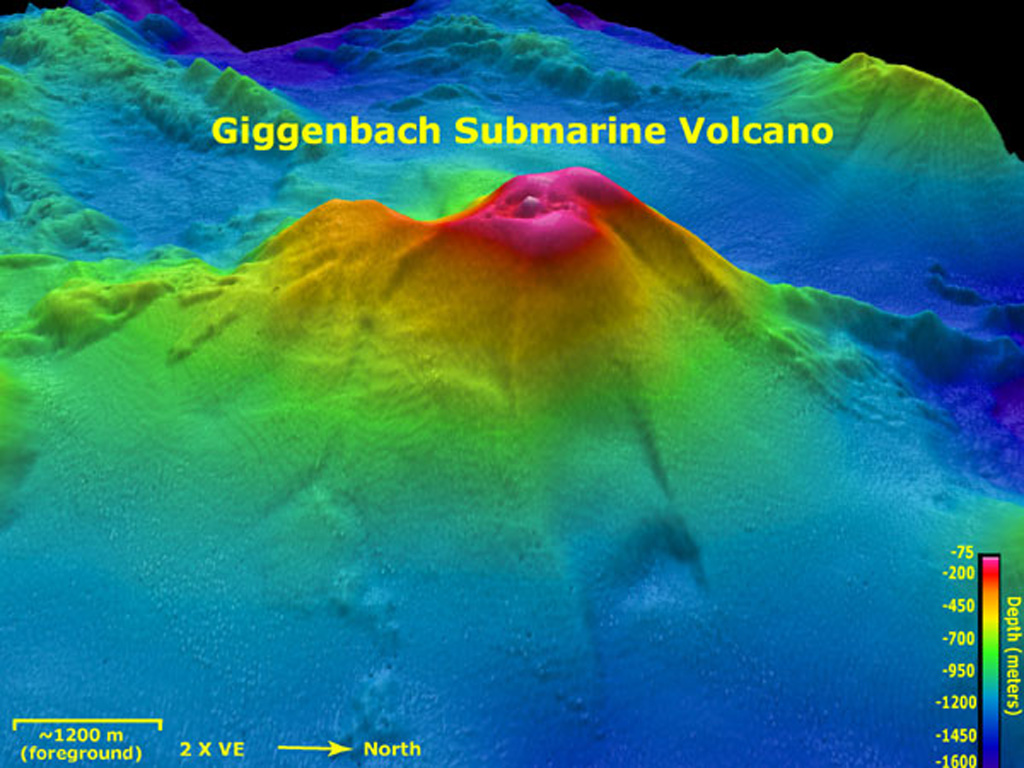
Giggenbach submarine volcano viewed from the E in this aerial oblique view with two times vertical exaggeration. Depths range from 75 to 1,600 m in this image and the resolution of the bathymetry data is 25 m. Giggenbach is ~30 km NW of the center of Macauley caldera. The bathymetry data are courtesy of the New Zealand National Institute of Water and Atmospheric Research (NIWA).
Image courtesy of New Zealand-American Submarine Ring of Fire 2005 Exploration, NOAA Vents Program.
![]() This image is made available as a Public Domain Work, but proper attribution is appreciated.
This image is made available as a Public Domain Work, but proper attribution is appreciated.
Keywords: submarine volcano | stratovolcano | remote sensing | technology | DEM | map | bathymetry
Giggenbach