Global Volcanism Program | Image GVP-12397
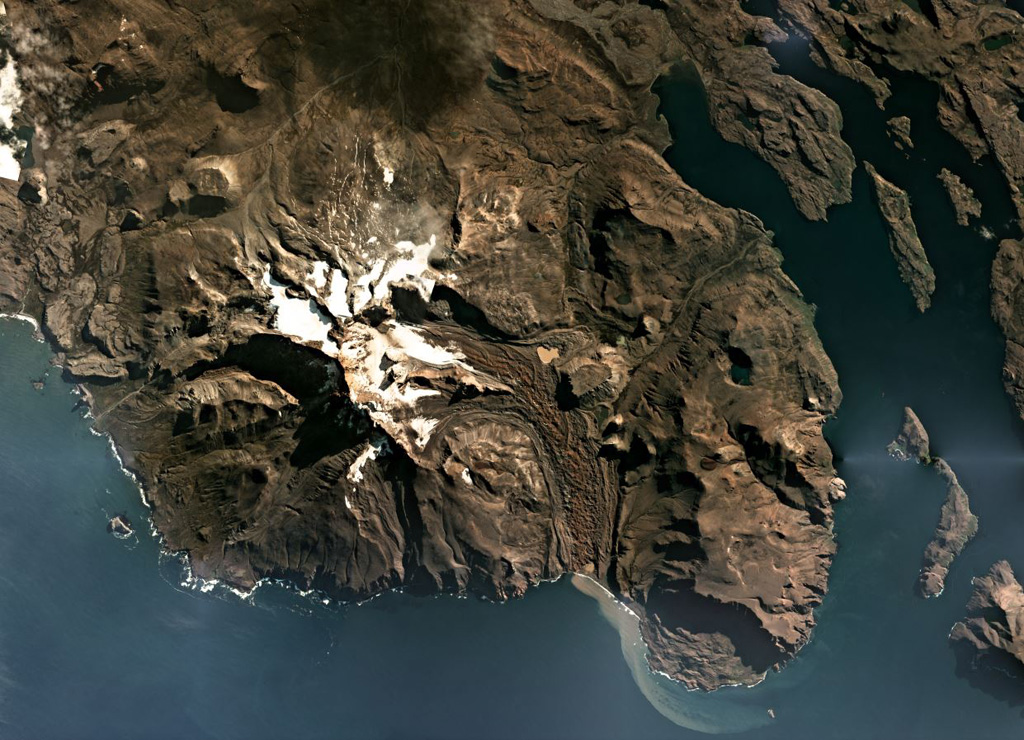
The Kerguelen Islands are part of an extensive Large Igneous Province, and are composed largely of extensive lava flows, exposed intrusive rock, and several volcanic centers such as Mount Ross which is shown in this April 2019 Planet Labs satellite image monthly mosaic (N is at the top; this image is approximately 30 km across). The Buffon glacier is on the eastern flank and immediately E of where it turns S is the flat-topped remnant of a lava lake.
Satellite image courtesy of Planet Labs Inc., 2019 (https://www.planet.com/).
Copyrighted image used with permission. All Rights Reserved. Contact photographer for any usage requests.
Keywords: remote sensing | erosion
Kerguelen Islands