Global Volcanism Program | Image GVP-12401
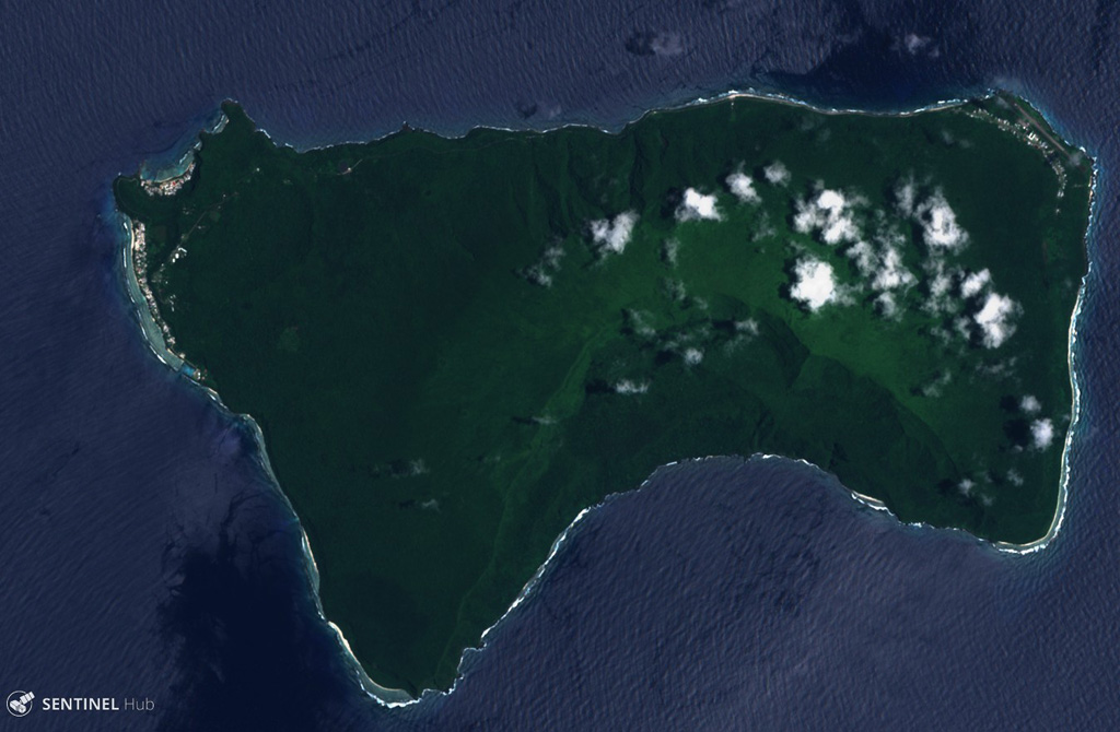
Ta’u Island in eastern American Samoa is the exposed portion of the Lata shield volcano, seen in this 29 October 2019 Sentinel-2 satellite image (N is at the top; this image is approximately 13 km across). Smaller cones and craters have formed across the flanks, and a major flank collapse event around 22 ka resulted in the steep scarps on the southern side of the island.
Satellite image courtesy of Copernicus Sentinel Data, 2018.
![]() This image is made available under the Creative Commons BY-SA 4.0 license terms.
This image is made available under the Creative Commons BY-SA 4.0 license terms.
Keywords: island volcano | landslide scarp | flank collapse

Ta'u