Aira | 30 March-5 April 2022 | Continuing Activity Cite this Report Cite this Report |
 Aira Aira
Kyushu (Japan)
|
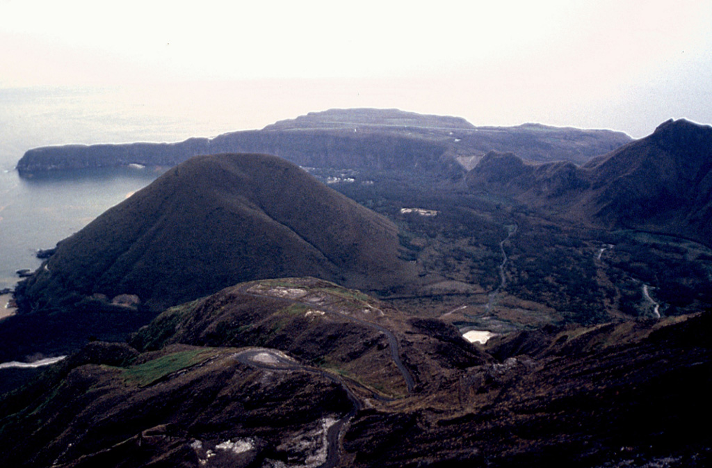
JMA reported that very small eruptive events were recorded at Minamidake Crater (at Aira Caldera’s Sakurajima volcano) during 29 March through 4 April. After 2 April, incandescence was observed at night with a high-sensitivity surveillance camera. The Alert Level remained at 3 (on a 5-level scale), and residents were warned to stay 2 km away from the crater.
Source: Japan Meteorological Agency (JMA)
|
Ambae | 30 March-5 April 2022 | Continuing ActivityCite this Report |
 Ambae Ambae
Vanuatu
|
On 31 March the Vanuatu Meteorology and Geo-Hazards (VMGD) reported that explosions at the cone in Ambae’s Lake Voui continued to produce steam and ash emissions. Wet tephra that was also ejected from the cone during this activity remained within the caldera. Light ashfall was reported in nearby villages. The Alert Level remained at 2 (on a scale of 0-5) and the public was warned to stay outside of the Danger Zone, defined as a 2-km radius around the active vents in Lake Voui, and away from drainages during heavy rains.
Source: Vanuatu Meteorology and Geohazards Department (VMGD)
|
Ambrym | 30 March-5 April 2022 | Continuing ActivityCite this Report |
 Ambrym Ambrym
Vanuatu
|
On 31 March the Vanuatu Meteorology and Geo-Hazards Department (VMGD) reported that nighttime crater incandescence from Ambrym’s Benbow Crater was no longer visible, though steam emissions persisted. The Alert Level remained at 2 (on a scale of 0-5). VMGD warned the public to stay outside of Permanent Danger Zone A, defined as a 1-km radius around Benbow Crater and a 2-km radius around Marum Crater, and additionally to stay 500 m away from the ground cracks created by the December 2018 eruption.
Source: Vanuatu Meteorology and Geohazards Department (VMGD)
|
Bezymianny | 30 March-5 April 2022 | Continuing ActivityCite this Report |
 Bezymianny Bezymianny
Central Kamchatka (Russia)
|
KVERT reported that a daily thermal anomaly over Bezymianny was visible in satellite images during 26 March through 1 April. Strong fumarolic activity, incandescence at the lava dome, and avalanches were also reported. Dome collapses were detected on 25 and 31 March and ash clouds rose to 4 km (13,000 ft) a.s.l., expanding 40 km E and 20 km SW, respectively. The Aviation Color Code remained at Yellow (the second lowest level on a four-color scale). Dates are based on UTC times; specific events are in local time where noted.
Source: Kamchatkan Volcanic Eruption Response Team (KVERT)
|
Dukono | 30 March-5 April 2022 | Continuing ActivityCite this Report |
 Dukono Dukono
Halmahera
|
Based on satellite and wind model data, the Darwin VAAC reported that during 29 March through 4 April ash plumes from Dukono rose to 2.1 km (7,000 ft) a.s.l. and drifted SE, S, E, and ENE. The Alert Level remained at 2 (on a scale of 1-4), and the public was warned to remain outside of the 2-km exclusion zone.
Source: Darwin Volcanic Ash Advisory Centre (VAAC)
|
Fuego | 30 March-5 April 2022 | Continuing ActivityCite this Report |
 Fuego Fuego
South-Central Guatemala
|
INSIVUMEH reported that 4-8 explosions per hour were detected at Fuego during 30 March through 5 April, generating gas-and-ash emissions that rose to 4.9 km (16,000 ft) a.s.l. and drifted as far as 30 km NW, W, SW, and S. Block avalanches descended the Las Lajas (SE), Seca (W), Ceniza (SSW), Taniluyá (SW), Trinidad (S), Honda, and Santa Teresa drainages. At night, incandescence was observed up to 150 m above the crater. Fine ashfall was reported in Panimaché I and II (8 km SW), Morelia (9 km SW), Santa Sofía (12 km SW), Finca Palo Verde, Yepocapa (8 km NW), El Porvenir (8 km ENE), and Sangre de Cristo (8 km WSW). Shock waves from the explosions and rumbling sounds rattled local structures. Based on satellite and wind model data, the Washington VAAC reported that during 29 March through 4 April ash plumes from Fuego rose to 4.9 km (16,000 ft) a.s.l. and drifted SE, E, SW, S, WNW, WSW.
Sources: Instituto Nacional de Sismologia, Vulcanologia, Meteorologia, e Hidrologia (INSIVUMEH), Coordinadora Nacional para la Reducción de Desastres (CONRED), Washington Volcanic Ash Advisory Center (VAAC)
|
Great Sitkin | 30 March-5 April 2022 | Continuing ActivityCite this Report |
 Great Sitkin Great Sitkin
Andreanof Islands (USA)
|
AVO reported that slow lava effusion at Great Sitkin continued during 30 March through 5 April and low seismicity persisted. Cloud cover prevented views of the volcano most of the week, but slow lava effusion continued; minor flow fronts advanced from the W and S lobes, as well as the E margin. The Aviation Color Code and the Volcano Alert Level remained at Orange and Watch, respectively.
Source: US Geological Survey Alaska Volcano Observatory (AVO)
|
Ibu | 30 March-5 April 2022 | Continuing ActivityCite this Report |
 Ibu Ibu
Halmahera
|
PVMBG reported that the eruption at Ibu continued during 25-31 March. On 30 March at 1048 an ash plume rose 1 km above the summit that drifted S. Roughly 58 avalanches traveled 100-400 m N and NW. The Alert Level remained at a 2 (on a scale of 1-4), and the public was warned to stay at least 2 km away from the active crater and 3.5 km away on the N side.
Source: Pusat Vulkanologi dan Mitigasi Bencana Geologi (PVMBG, also known as CVGHM)
|
Karymsky | 30 March-5 April 2022 | Continuing ActivityCite this Report |
 Karymsky Karymsky
Eastern Kamchatka (Russia)
|
KVERT reported that a thermal anomaly over Karymsky was visible in satellite images during 24-26 March. The volcano was either quiet or obscured by clouds on the other days during 27 March through 1 April. The Aviation Color Code remained at Orange (the second highest level on a four-color scale). Dates are based on UTC times; specific events are in local time where noted.
Source: Kamchatkan Volcanic Eruption Response Team (KVERT)
|
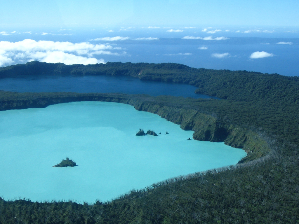
Kavachi | 30 March-5 April 2022 | Continuing ActivityCite this Report |
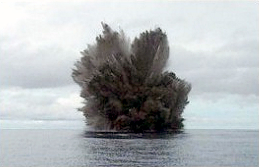 Kavachi Kavachi
Solomon Islands
|
Satellite data showed discolored water around Kavachi on 31 March. The discolored water fanned out to the S over a short distance, though it was not clearly observed due to cloudy weather.
Sources: Sentinel Hub, Culture Volcan
|
Kikai | 30 March-5 April 2022 | Continuing ActivityCite this Report |
 Kikai Kikai
Ryukyu Islands (Japan)
|
JMA reported that eruptive activity continued to be recorded at Satsuma Iwo-jima, a subaerial part of Kikai’s NW caldera rim, during 29 March through 4 April. White gas-and-steam plumes rose 1 km above the crater rim. Surveillance cameras observed nightly incandescence. The Alert Level remained at 2 (on a 5-level scale), and residents were warned to stay 500 m away from the crater.
Source: Japan Meteorological Agency (JMA)
|
Kilauea | 30 March-5 April 2022 | Continuing ActivityCite this Report |
 Kilauea Kilauea
Hawaiian Islands (USA)
|
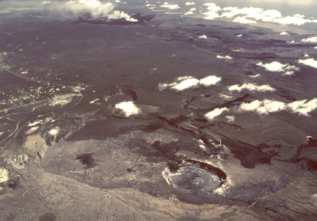
HVO reported that lava effusion from vents in the lower W wall of Kilauea’s Halema`uma`u Crater continued at variable rates during 30 March through 5 April. Lava from a vent flowed into the active W part of the lava lake and onto the crater floor. Numerous and sustained ooze outs of lava along the lake’s margins; effusion along interior surface fractures persisted during the week but showed decreasing activity. On 31 March a hornito that was forming on the E side of the lake exhibited spattering throughout the day. HVO noted that by 29 March about 64 million cubic meters of lava had been erupted since the current eruption began, raising the crater floor by 96 m (315 ft). The sulfur dioxide emission rate was approximately 3,100 tons/day, based on measurements made on 31 March. During 2-5 April continued ooze outs were occurring along the E half of the crater floor and NW margin, but at a decreased rate, and crustal overturning occurred occasionally on the NW margin. The Aviation Color Code and the Volcano Alert Level remained at Orange and Watch, respectively.
Source: US Geological Survey Hawaiian Volcano Observatory (HVO)
|
Kirishimayama | 30 March-5 April 2022 | Continuing ActivityCite this Report |
 Kirishimayama Kirishimayama
Kyushu (Japan)
|
JMA reported a high number of volcanic earthquakes just below Shinmoedake (Shinmoe peak, a stratovolcano of the Kirishimayama volcano group). On 31 March the number of volcanic earthquakes increased below Ebino Kogen (located on the NW flank of the Karakunidake stratovolcano, about 5 km NW of Shinmoedake). Fumarolic plumes continued to rise from a fissure on the W flank. The Alert Level remained at 2 (on a 5-level scale), and residents were warned to stay 2 km away from the crater. The public was warned to stay at least 2 km away from the crater.
Source: Japan Meteorological Agency (JMA)
|
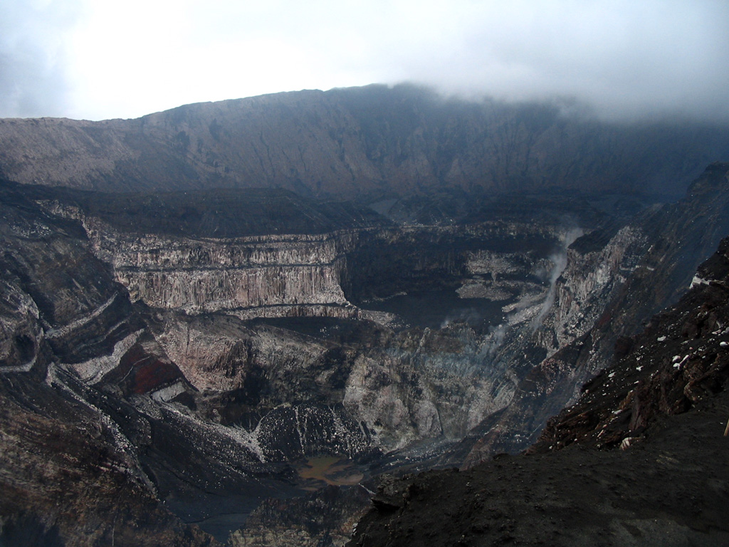
Krakatau | 30 March-5 April 2022 | Continuing ActivityCite this Report |
 Krakatau Krakatau
Sunda Strait
|
PVMBG reported that the eruption at Anak Krakatau continued during 25-31 March. On 1326 on 30 March an eruption that lasted 96 seconds generated a gray-black ash plume that rose 700 m above the summit and drifted NE based on webcam images. White gas-and-steam emissions rose 25-100 m above the summit. The Alert Level remained at 2 (on a scale of 1-4), and the public was warned to stay at least 2 km away from the crater.
Source: Pusat Vulkanologi dan Mitigasi Bencana Geologi (PVMBG, also known as CVGHM)
|
Lewotolok | 30 March-5 April 2022 | Continuing ActivityCite this Report |
 Lewotolok Lewotolok
Lembata Island
|
The eruption at Lewotolok continued during 25-31 March according to PVMBG. White-and-gray emissions rose 50-500 m above the summit and drifted W and NW. Ash emissions rose 200-500 m above the summit. On 31 March at 1204 an ash plume rose 800 m above the summit and drifted NW according to a ground observer. The Alert Level remained at 3 (on a scale of 1-4) and the public was warned to stay 3 km away from the summit crater.
Source: Pusat Vulkanologi dan Mitigasi Bencana Geologi (PVMBG, also known as CVGHM)
|
Merapi | 30 March-5 April 2022 | Continuing ActivityCite this Report |
 Merapi Merapi
Central Java
|
BPPTKG reported no significant morphological changes at Merapi’s summit lava dome during 25-31 March, though the height of the dome below the SW rim had increased by 4 m. Based on photo analyses, the volume of the SW lava dome had a volume of 1.7 million cubic meters while the central lava dome was 2.6 million cubic meters. Seismicity remained at high levels. As many as 118 lava avalanches originating from the SW dome traveled a maximum of 2.5 km down the Bebeng drainage on the SW flank. On 28 March two pyroclastic flows were recorded on a seismogram that descended 2.5 km SW, one of which occurred at 1509. On 1 April a pyroclastic flow at 1500 descended 1.5 km down the SW flank. Based webcam, satellite, and wind data, the Darwin VAAC reported re-suspended ash that rose to 100 m (300 ft) a.s.l. As many as 37 avalanches were detected, but the distance and direction were not observed. The Alert Level remained at 3 (on a scale of 1-4), and the public was warned to stay 3-5 km away from the summit based on location.
Sources: Balai Penyelidikan dan Pengembangan Teknologi Kebencanaan Geologi (BPPTKG), Darwin Volcanic Ash Advisory Centre (VAAC)
|
Nevados de Chillan | 30 March-5 April 2022 | Continuing ActivityCite this Report |
 Nevados de Chillan Nevados de Chillan
Central Chile
|
Based on satellite and webcam data, isolated ash pulses from Nevados de Chillán were reported by the Buenos Aires VAAC during 31 March that rose to 4.9 km (16,000 ft) a.s.l. and drifted N and NNE. Intermittent hotspots were observed in satellite imagery on 1 April.
Source: Buenos Aires Volcanic Ash Advisory Center (VAAC)
|
Pavlof | 30 March-5 April 2022 | Continuing ActivityCite this Report |
 Pavlof Pavlof
Alaska Peninsula, Alaska
|
AVO reported that weak eruptive activity was ongoing at Pavlof during 30 March through 4 April, and seismic tremor persisted. Weak explosive activity was detected during 31 March and 2-3 April with low-level plumes visible in the mornings, though satellite and webcam views were mostly obscured by clouds. During 3-4 April elevated surface temperatures were detected in satellite images despite the cloudy weather. The Volcano Alert Level remained at Watch and the Aviation Color Code remained at Orange.
Source: US Geological Survey Alaska Volcano Observatory (AVO)
|
Popocatepetl | 30 March-5 April 2022 | Continuing ActivityCite this Report |
 Popocatepetl Popocatepetl
Mexico
|
CENAPRED reported that the eruption at Popocatépetl continued during 30 March through 5 April. Each day there were 11-29 diffuse gas-and-steam emissions with ash rising from the crater and drifting S, E, NE, and SE. Based on webcam, satellite and wind models, the Washington VAAC reported ash plumes that rose to 7.3 km (24,000 ft) a.s.l. that drifted E and SE. A moderate explosion was recorded at 2022 on 29 March, resulting in light ashfall in San Pedro Benito Juárez, a municipality of Atlixco. Three volcano-tectonic (VT) earthquakes were recorded on 30 March at 1129, 1146, and 1514. Intermittent VT earthquakes continued during the week. The Alert Level remained at Yellow, Phase Two (the middle level on a three-color scale).
Sources: Centro Nacional de Prevencion de Desastres (CENAPRED), Washington Volcanic Ash Advisory Center (VAAC)
|
Reventador | 30 March-5 April 2022 | Continuing ActivityCite this Report |
 Reventador Reventador
Ecuador
|
IG reported that a high level of activity continued at Reventador during 30 March through 5 April, though cloudy weather conditions sometimes prevented visual observations. Gas-and-ash plumes, often observed multiple times a day with the webcam or reported by the Washington VAAC, rose as high as 4.6 km (15,000 ft) a.s.l. and drifted mainly NW, W, and SW. As many as 68 daily explosions were detected, in addition to long-period (LP) and emission tremors. Daily thermal anomalies were also reported. On clear weather nights, incandescence could be observed in the upper part of the E flank of the volcano. Blocks were recorded rolling 400 m below the crater on all flanks during 4 April, in addition to the incandescence in the crater.
Source: Instituto Geofísico-Escuela Politécnica Nacional (IG-EPN)
|
Rincon de la Vieja | 30 March-5 April 2022 | Continuing ActivityCite this Report |
 Rincon de la Vieja Rincon de la Vieja
Costa Rica
|
OVSICORI-UNA reported that 10 eruptive events at Rincón de la Vieja had been recorded since 15 March, one of which was detected on 27 March. Between 28 and 29 March a swarm of long-period earthquakes were detected. On 4 April at 1042 an eruption that lasted 1.5 minutes produced a plume, but the height was not observed due to weather conditions.
Source: Observatorio Vulcanologico y Sismologico de Costa Rica-Universidad Nacional (OVSICORI-UNA)
|
Ruapehu | 30 March-5 April 2022 | Continuing ActivityCite this Report |
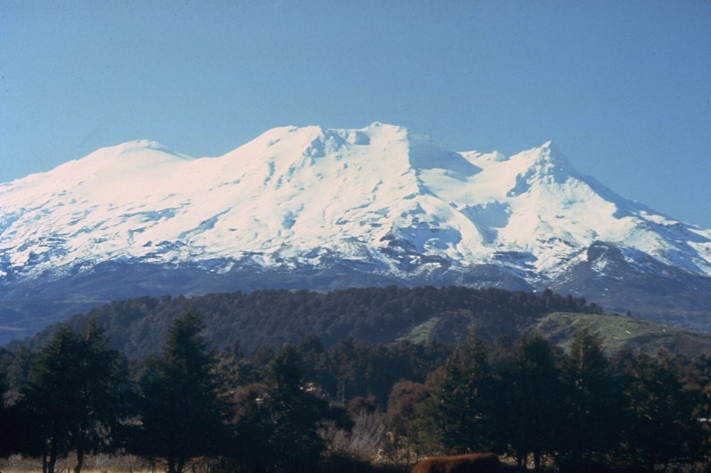 Ruapehu Ruapehu
North Island (New Zealand)
|
On 28 March and 5 April GeoNet reported that unrest continued at Ruapehu with elevated levels of tremor and increasing crater lake water temperatures from 32 degrees Celsius to 36 degrees Celsius. The Volcanic Alert Level remained at 2 (on a scale from 0-5) and the Aviation Color Code was raised to Yellow on 28 March.
Source: GeoNet
|
Sangay | 30 March-5 April 2022 | Continuing ActivityCite this Report |
 Sangay Sangay
Ecuador
|
IG reported that the eruption at Sangay continued during 30 March through 5 April. Weather clouds and rain often prevented visual and webcam observations, though daily gas-and-ash plumes that rose to 6.7 km (22,000 ft) a.s.l. and drifted W, SW, WSW, and NW were identified in satellite images by the Washington VAAC or in webcam views. As many as 96 daily explosions were detected along with frequent long-period events and emission tremors. Daily thermal anomalies were also visible in satellite data. Incandescent material was visible on the flanks in webcam imagery on clear weather days.
Sources: Instituto Geofísico-Escuela Politécnica Nacional (IG-EPN), Washington Volcanic Ash Advisory Center (VAAC)
|
Santa Maria | 30 March-5 April 2022 | Continuing ActivityCite this Report |
 Santa Maria Santa Maria
Southwestern Guatemala
|
INSIVUMEH reported that the eruption at Santa María’s Santiaguito lava-dome complex continued during 30 March through 5 April. Incandescence from Caliente crater and the lava flows on the W and SW flanks were visible during the night and early morning, accompanied by weak-to-moderate block-and-ash avalanches along its path down the W, SW, and S flanks that reached the base of the dome. The avalanches generated ash plumes that drifted W. Fine ashfall occurred near the volcano on 3 April, including in San Marcos (8 km SW) and Loma Linda Palajunoj (7 km SW). The smell of sulfur was sometimes detected in Las Marias.
Source: Instituto Nacional de Sismologia, Vulcanologia, Meteorologia, e Hidrologia (INSIVUMEH)
|
Sao Jorge | 30 March-5 April 2022 | Continuing ActivityCite this Report |
 Sao Jorge Sao Jorge
Azores
|
A seismic swarm beneath the W half of São Jorge began at 1605 on 19 March, with earthquakes along the Manadas volcanic fissure system between Velas (S side of the island) and Fajã do Ouvidor (N coast). On 31 March there were 714 seismic events detected, according to a preliminary analysis of seismic records. As the week progressed, the number of daily events fluctuated from 397 on 1 April to 592 on 5 April; magnitudes were relatively low. The Alert Level remained at V4 (on a scale of V0-V6).
Source: Centro de Informação e Vigilância Sismovulcânica dos Açores (CIVISA)
|
Semeru | 30 March-5 April 2022 | Continuing ActivityCite this Report |
 Semeru Semeru
Eastern Java
|
PVMBG reported that the eruption at Semeru continued during 25-31 March. Activity included a pyroclastic flow, ash plumes that rose 300-700 m and drifted mainly N and NW, and gas-and-steam emissions reaching 200-300 m above the summit. Ground observers, webcam images, and satellite data detected ash plumes that rose to 4.3 km (14,000 ft) a.s.l. and drifted N and W, according to MAGMA Indonesia and the Darwin VAAC. Avalanches were reported on 1 April. On 3 April a strong thermal anomaly was detected in infrared satellite imagery. The Alert Level remained at 3 (on a scale of 1-4). The public was warned to stay at least 500 m away from Kobokan drainages within 17 km of the summit, along with other drainages originating on Semeru, including the Bang, Kembar, and Sat, due to lahar, avalanche, and pyroclastic flow hazards.
Sources: Pusat Vulkanologi dan Mitigasi Bencana Geologi (PVMBG, also known as CVGHM), Darwin Volcanic Ash Advisory Centre (VAAC)
|
Semisopochnoi | 30 March-5 April 2022 | Continuing ActivityCite this Report |
 Semisopochnoi Semisopochnoi
Aleutian Islands (USA)
|
AVO reported that low-level eruptive activity at Semisopochnoi's North Cerberus cone continued during 30 March-4 April. Periods of seismic tremor and occasional small explosions were detected daily in seismic and regional infrasound data. Daily minor ash emissions rose no higher than 3 km (10,000 ft) a.s.l. and occasional steam emissions were visible in webcam and satellite images; clouds sometimes prevented satellite views. The Aviation Color Code remained at Orange and the Volcano Alert Level remained at Watch.
Source: US Geological Survey Alaska Volcano Observatory (AVO)
|
Sheveluch | 30 March-5 April 2022 | Continuing ActivityCite this Report |
 Sheveluch Sheveluch
Central Kamchatka (Russia)
|
KVERT reported that a thermal anomaly over Sheveluch was identified in satellite images during 26 March through 1 April. The lava dome continued to grow and strong fumarolic activity, incandescence, and avalanches accompanied this activity. The Aviation Color Code remained at Orange (the second highest level on a four-color scale). Dates are based on UTC times; specific events are in local time where noted.
Source: Kamchatkan Volcanic Eruption Response Team (KVERT)
|
Sirung | 30 March-5 April 2022 | Continuing ActivityCite this Report |
 Sirung Sirung
Pantar Island
|
PVMBG reported that white emissions rose 10-50 m above the summit of Sirung and drifted NE, E, and SE. Seismicity was relatively low and showed a consistent decrease since July 2021. As a result, the Alert Level was lowered to 1 (on a scale of 1-4) at 1800 on 1 April.
Source: Pusat Vulkanologi dan Mitigasi Bencana Geologi (PVMBG, also known as CVGHM)
|
Suwanosejima | 30 March-5 April 2022 | Continuing ActivityCite this Report |
 Suwanosejima Suwanosejima
Ryukyu Islands (Japan)
|
JMA reported that eruptive activity continued to be recorded at Suwanosejima's Ontake Crater during 29 March through 4 April. As many as 122 explosions were recorded, and crater incandescence was visible nightly. Eruption plumes rose as high as 2.8 km above the crater rim and ejected blocks as far as 900 m from the crater. Ashfall was reported in Toshima village (3.5 km SSW). The Alert Level remained at 3 and the public was warned to stay 2 km away from the crater.
Source: Japan Meteorological Agency (JMA)
|
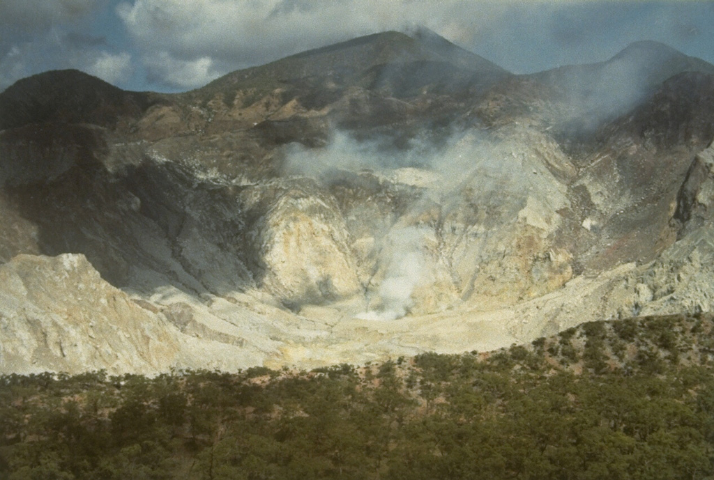
Taal | 30 March-5 April 2022 | Continuing ActivityCite this Report |
 Taal Taal
Luzon (Philippines)
|
PHIVOLCS reported that hot volcanic fluids circulated and upwelled in Taal’s Main Crater lake during 30 March through 6 April, producing plumes that rose as high as 2 km above the lake’s surface and drifted SW. Sulfur dioxide emissions averaged 265-7,856 tonnes/day during the week. Tremor events persisted daily until 5 April. Three phreatomagmatic bursts from the Main Crater were detected at 1039, 1047, and 1055 on 1 April, based on seismic data and webcam images, which produced plumes 500-900 m tall that drifted SW. PHIVOLCS noted that Alert Level 3 (magmatic unrest) means that there has been a magmatic intrusion and evacuation of high-risk barangays is recommended.
Source: Philippine Institute of Volcanology and Seismology (PHIVOLCS)
|
Telica | 30 March-5 April 2022 | Continuing ActivityCite this Report |
 Telica Telica
Sierra de los Marrabios
|
Based on webcam images, the Washington VAAC reported that on 29 March ash emissions at Telica rose as high as 1.5 km (5,000 ft) a.s.l. and drifted W.
Source: Washington Volcanic Ash Advisory Center (VAAC)
|
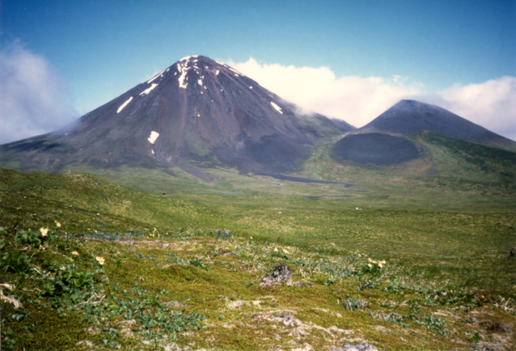
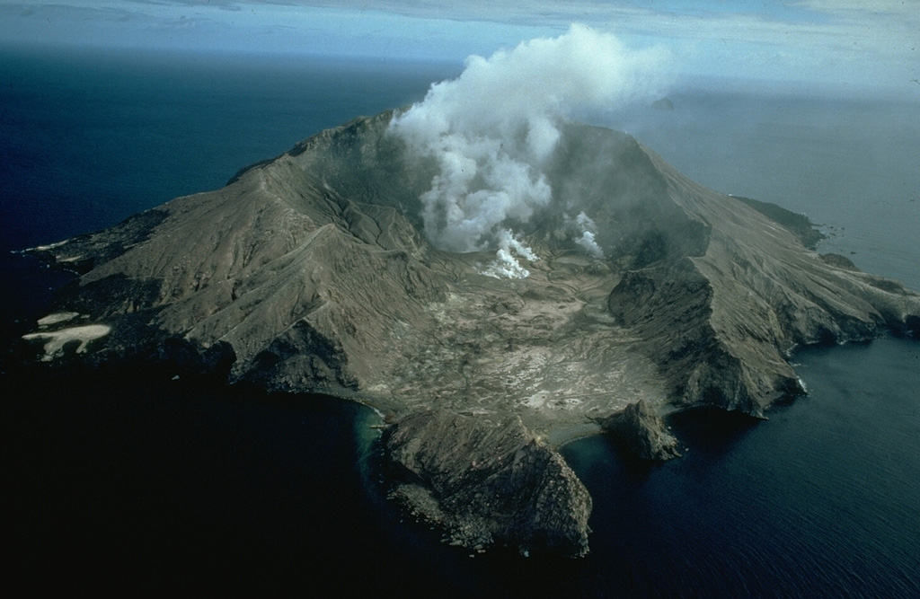
Whakaari/White Island | 30 March-5 April 2022 | Continuing ActivityCite this Report |
 Whakaari/White Island Whakaari/White Island
North Island (New Zealand)
|
On 4 April GeoNet reported that the ash emissions at Whakaari/White Island had not been observed since late February 2022; gas temperatures had declined to below 300 degrees Celsius. As a result, the Volcanic Alert Level was lowered to 1 and the Aviation Color Code was lowered to Green.
Source: GeoNet
|
Wolf | 30 March-5 April 2022 | Continuing ActivityCite this Report |
 Wolf Wolf
Isla Isabela (Galapagos)
|
IG reported that the eruption at Wolf continued during 30 March through 5 April. Daily thermal alert counts, as many as around 145, indicated active and advancing lava flows.
Source: Instituto Geofísico-Escuela Politécnica Nacional (IG-EPN)
|
Yasur | 30 March-5 April 2022 | Continuing ActivityCite this Report |
 Yasur Yasur
Vanuatu
|
On 31 March the Vanuatu Meteorology and Geohazards Department (VMGD) reported that activity at Yasur continued at a high level of “major unrest,” as defined by the Alert Level 2 status (the middle level on a scale of 0-4). Ash-and-gas emissions and loud explosions continued to be recorded, with bombs falling in and around the crater. The public was reminded not to enter the restricted area within 600 m around the cone, defined by Danger Zone A on the hazard map.
Source: Vanuatu Meteorology and Geohazards Department (VMGD)
|

 Agung
Agung Poas
Poas Purace