Ol Doinyo Lengai
Tanzania
2.764°S, 35.914°E; summit elev. 2962 m
All times are local (unless otherwise noted)
Ol Doinyo Lengai is the only volcano on Earth currently erupting carbonatite lavas. Activity is based in the crater offset to the N about 100 m below the summit, where hornitos (small cones) and pit craters produce lava flows and spattering. After displaying effusive activity in the north crater since at least 1983, it became filled and lava began overflowing in 1998. The eruption transitioned to significant explosive activity in September 2007 through March 2008 that cleared out and recreated the crater (figure 175). Since then, intermittent effusive carbonatite eruptions have continued. This report summarizes observed activity from August 2014 through August 2018, including observations by visitors and satellite data (figure 176).
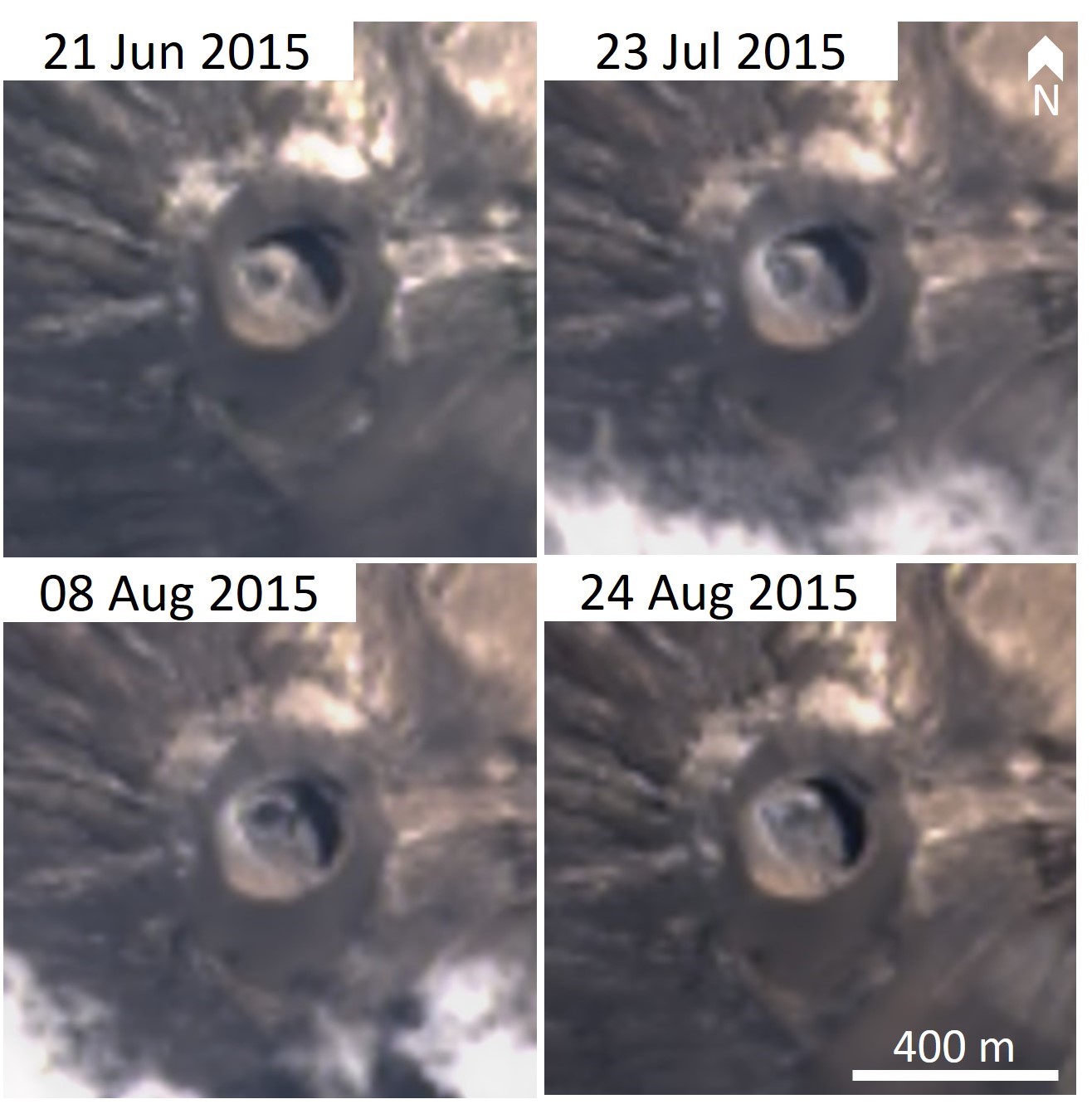
Lava fountaining was seen by geologists on 5 July 2014 (BGVN 39:07). A tourist report on Trip Advisor for an unknown date in July 2014 described potential fumarolic activity, while another report that month did not note any activity. No clear reports are known describing activity between August 2014 and May 2015. On 20 June 2015 an Earth Sciences group from the University of Glasgow and University of Dodoma, including volcanologist David Brown, visited the crater (figure 177). They observed minor eruptive activity consisting of gentle spattering at one of the mounds. Evidence of this activity continuing through August is seen in Landsat satellite images (figure 178).
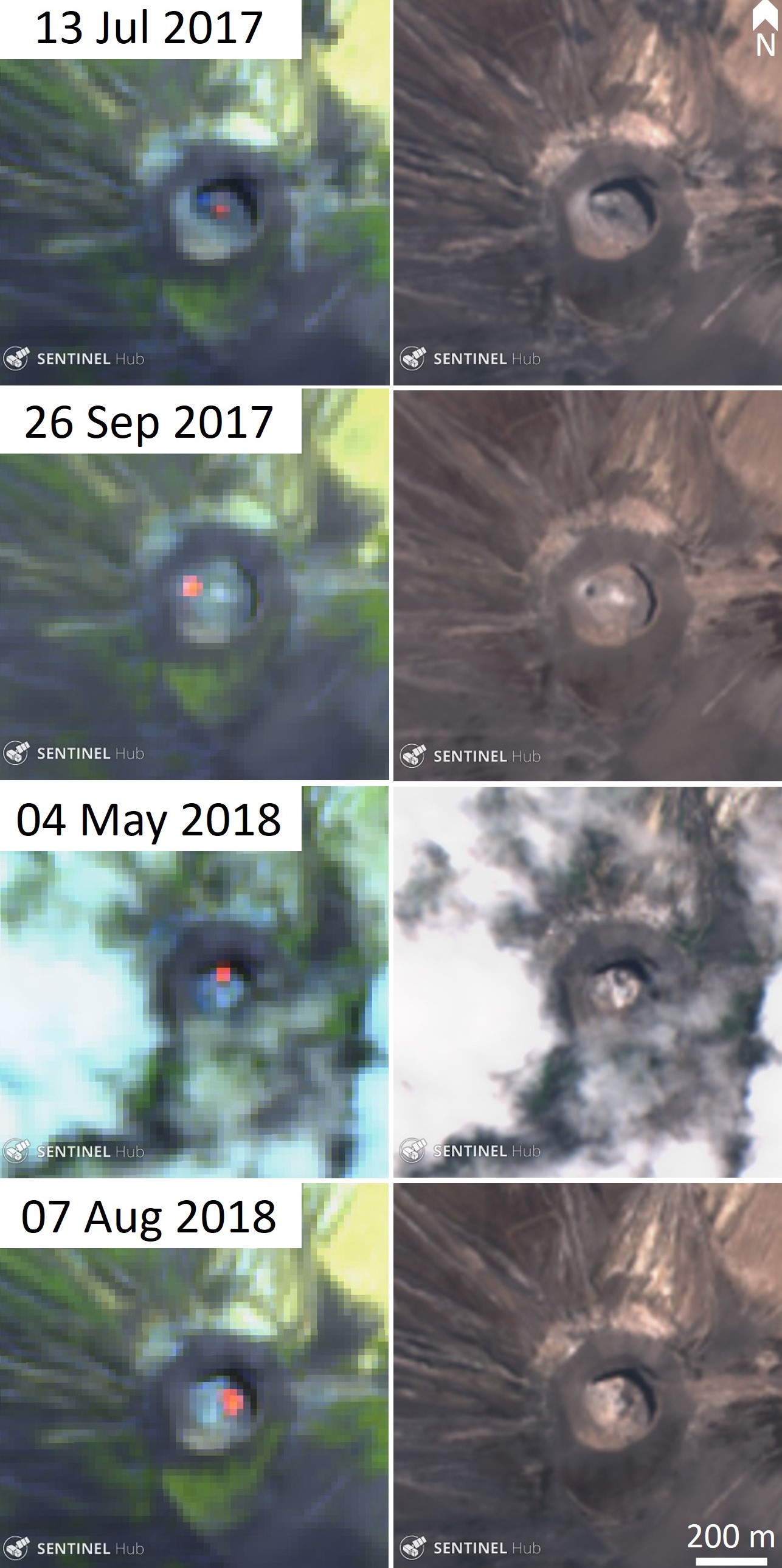
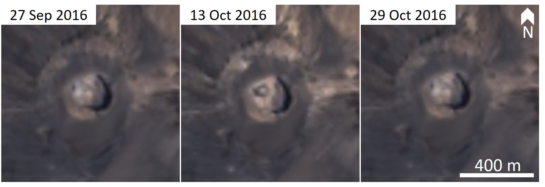
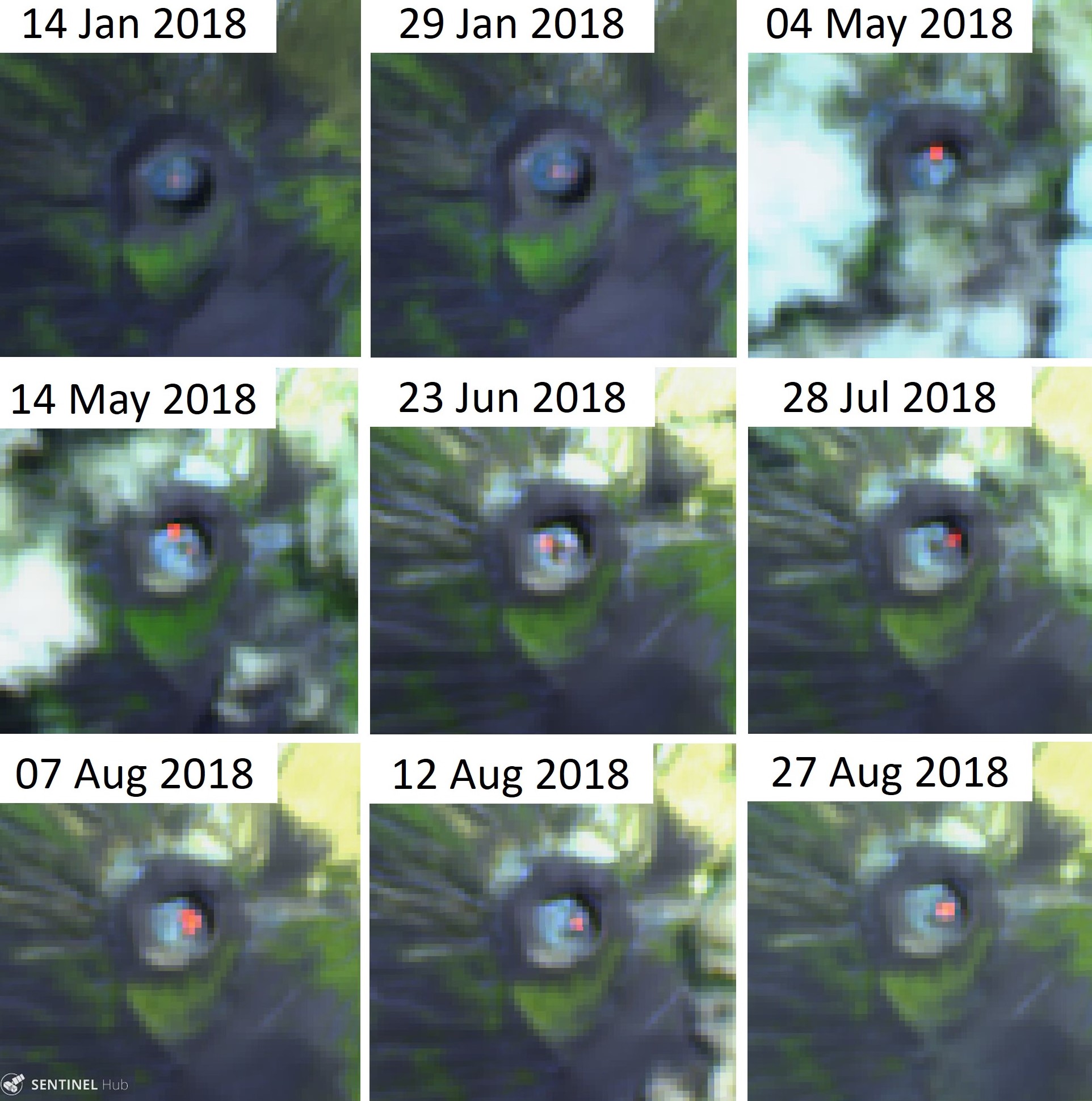
Only one Sentinel-2 thermal image (out of 22 cloud-free images) contained elevated temperatures during 2016. The image showed activity in the northern part of the crater. Landsat-8 true color images show color variations on the crater floor in October 2016 indicating activity at that time (figure 179).
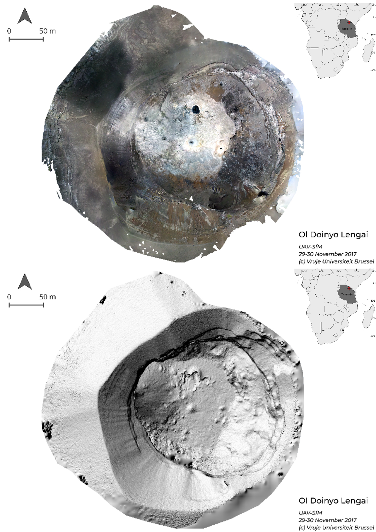
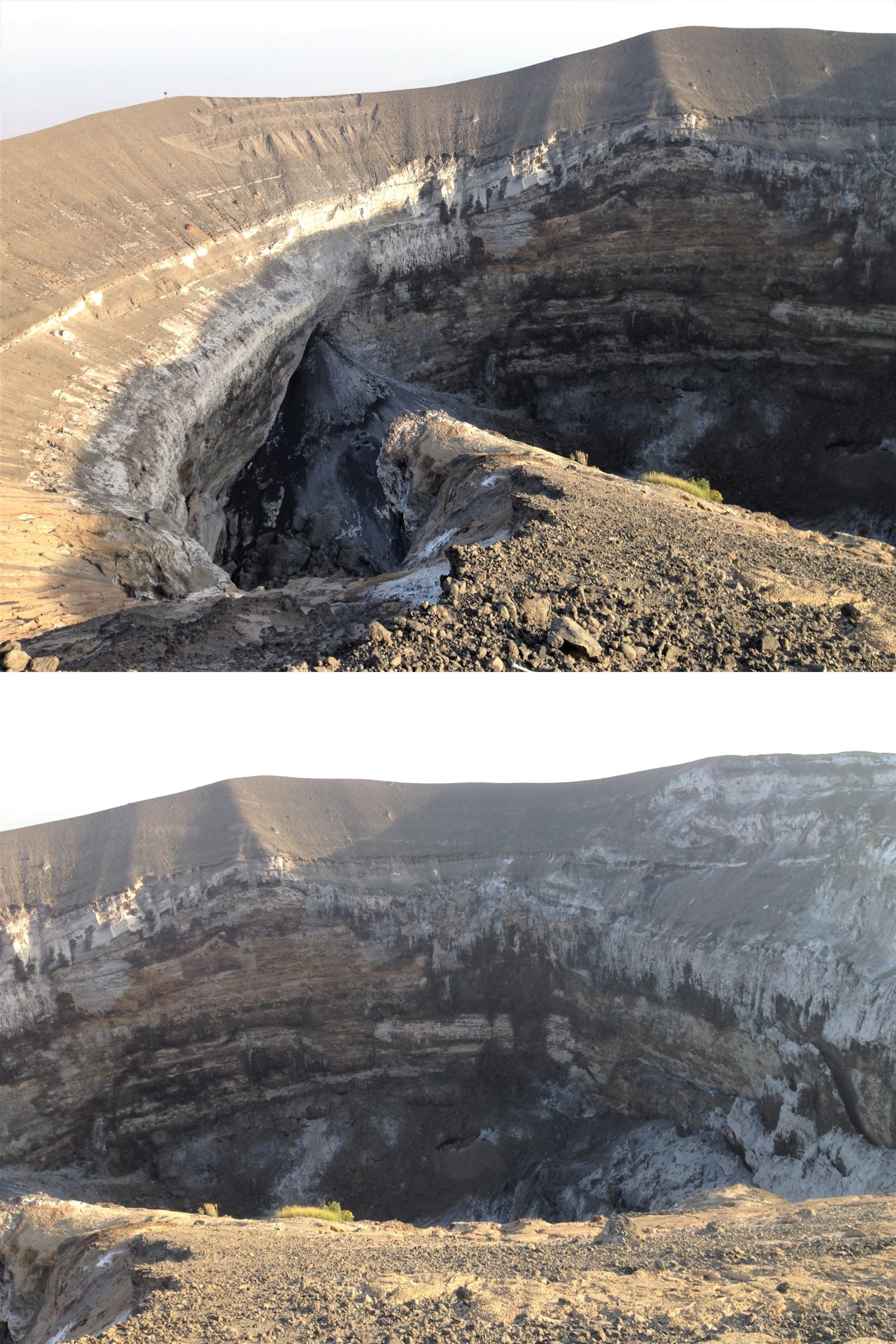
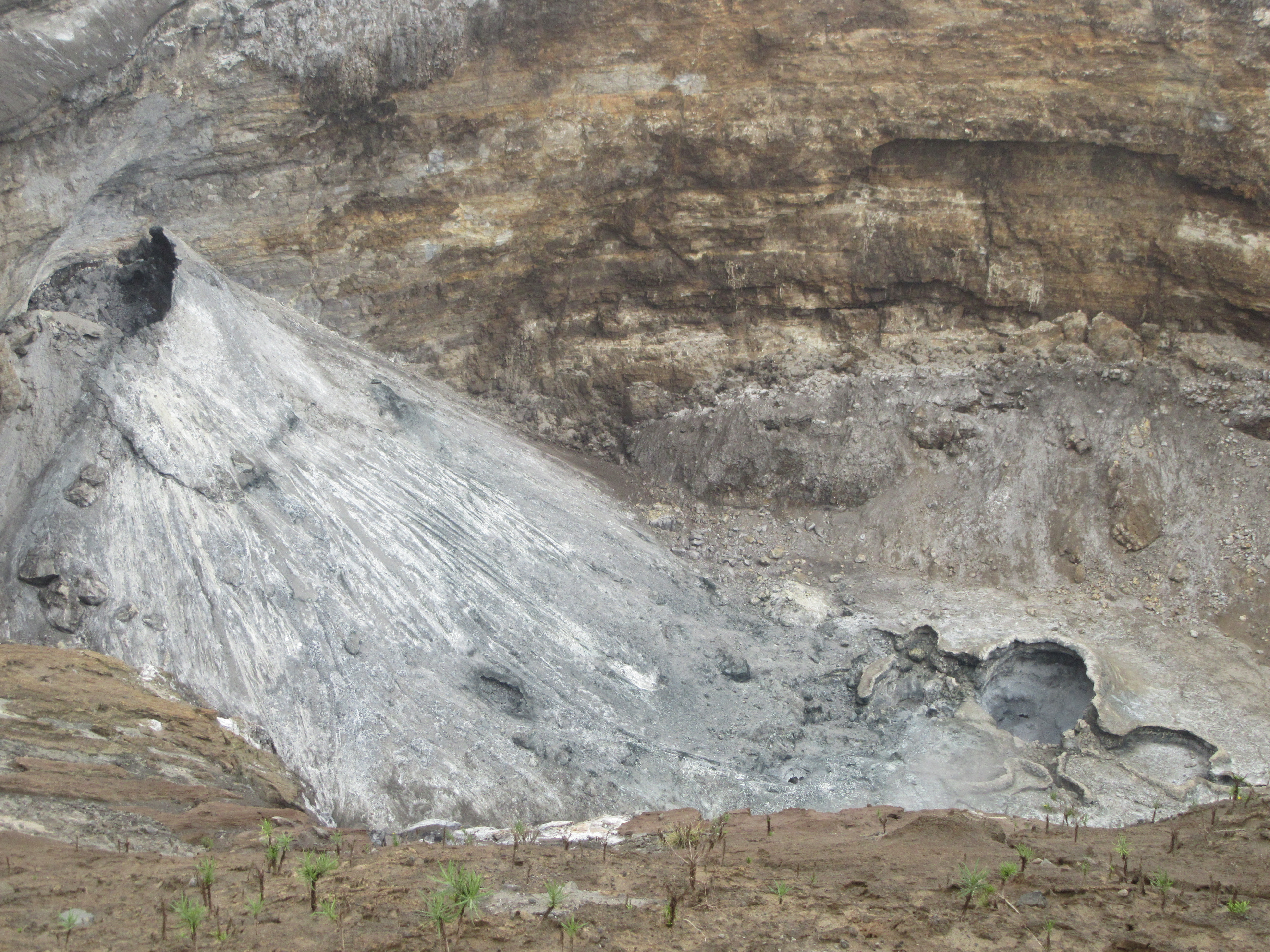
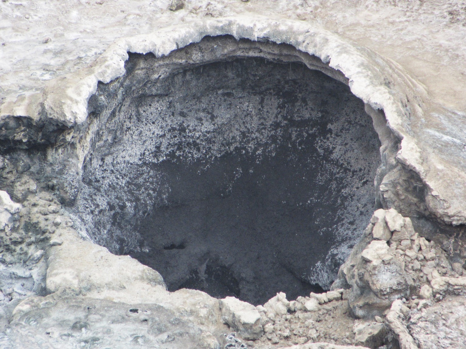
On 29-30 November 2017, a French-Belgium team including M. Kervyn conducted a summit morphology study. Accounts from previous visitors in September-October 2017 reported significant activity in the large half-cone with regular emission of spatter from the summit vent. They observed significant fumarolic activity and the remnants of rockfalls in the crater. Several secondary vents were visible on the side of the large half-cone along the western wall, but no activity was witnessed at this time (figure 180). Active spattering was occurring from a lava pool within a vent in the north-central part of the crater where spattering up to 10 m above the vent continued for several hours (figure 181). A circular cavity in the north-central part of the crater contained a lava pool that had partially crusted over. Darker surfaces suggested recent activity from several vents in the crater.
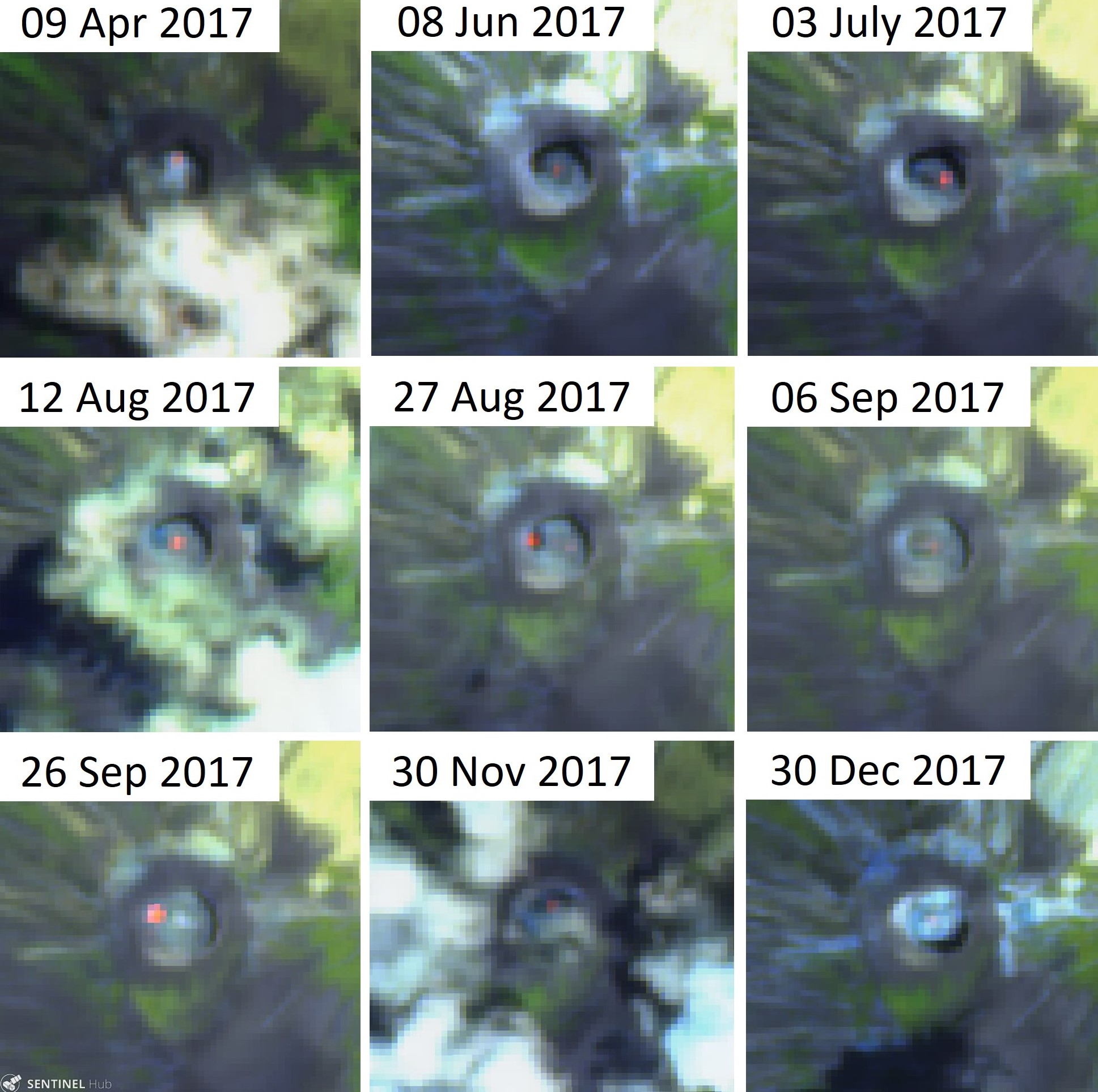
Sentinel-2 thermal satellite images acquired during 2017 show intermittent activity in the crater (figure 182). Out of 21 cloud-free images, 13 contained elevated thermal signatures between April through December. The locations of the activity move around the crater, indicating that the center of activity was variable through time. Lava pond activity was also noted in early December 2017 by Gian Schachenmann, documented with photos taken during an overflight and posted at Volcano Discovery.
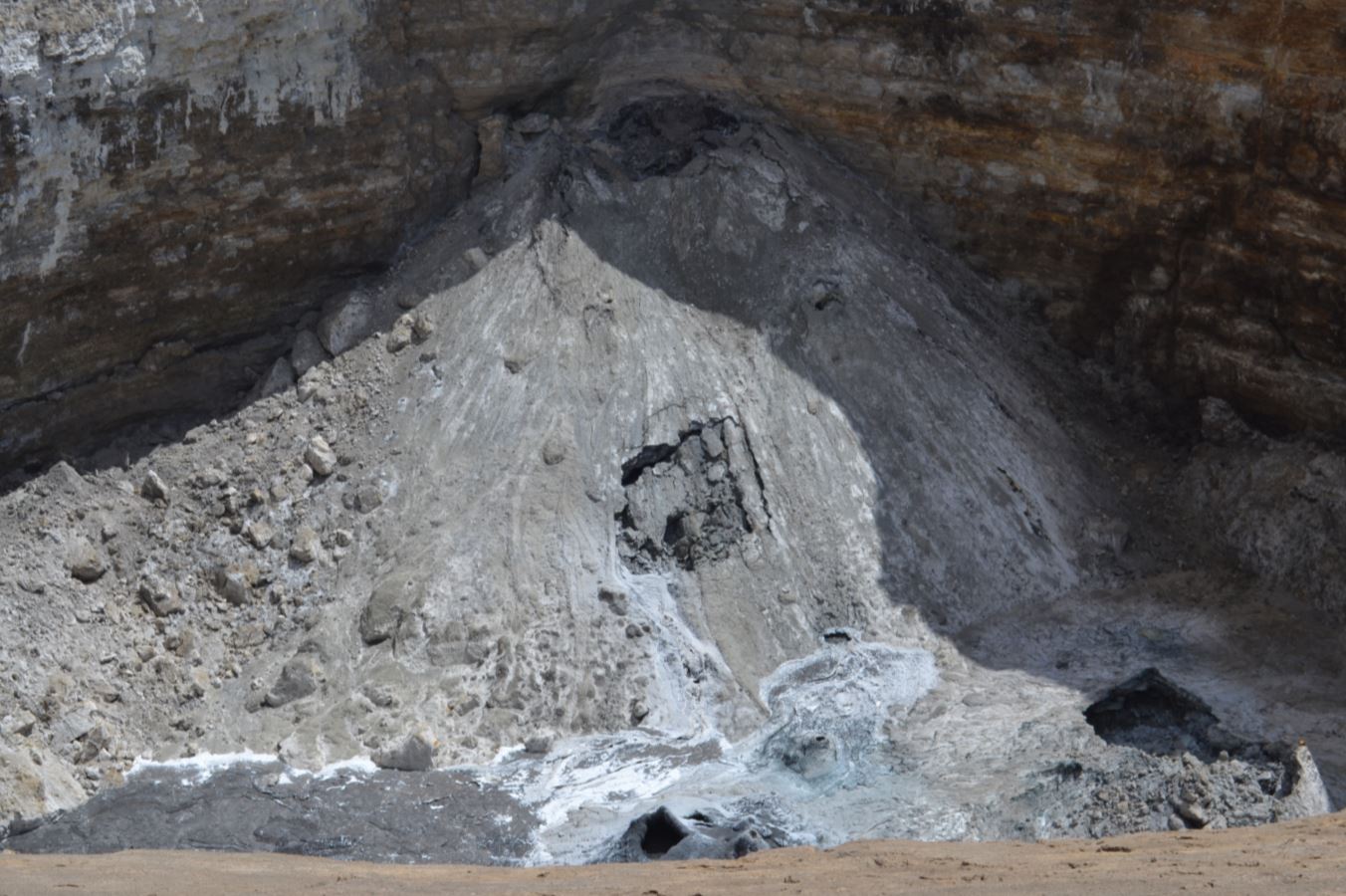
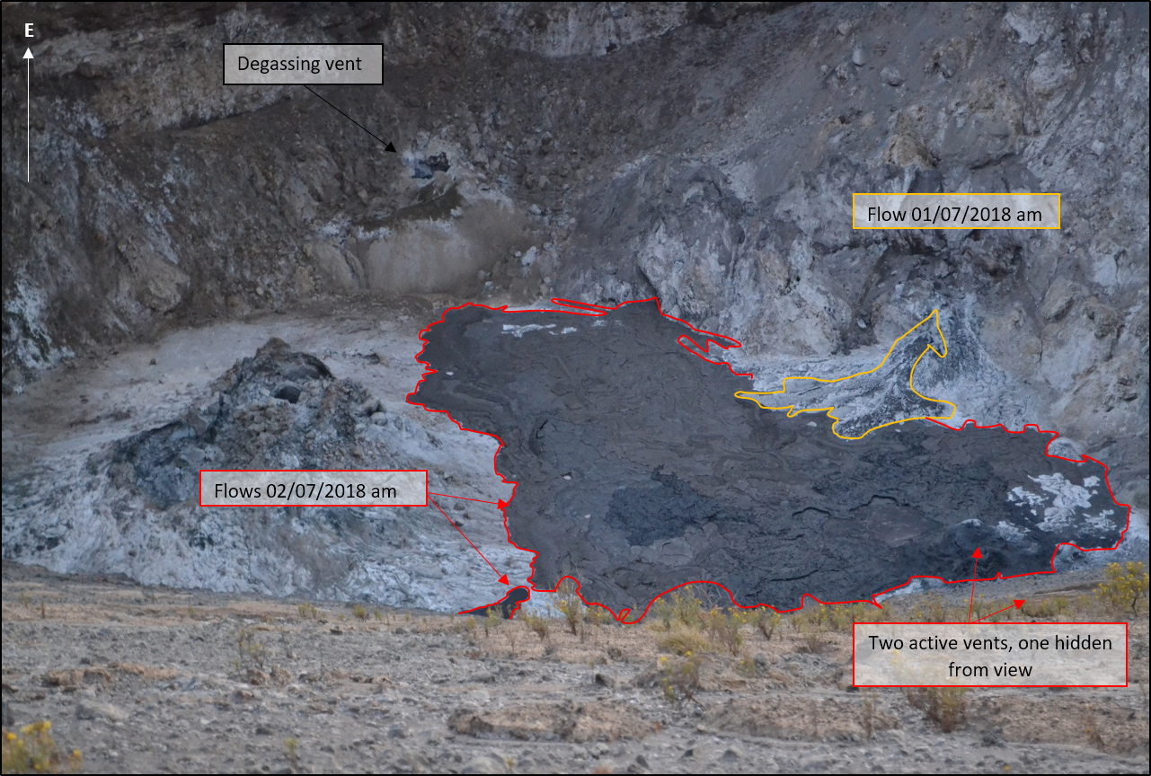
On 1-2 July 2018, K. A. Laxton and F. Boschetty from University College London visited the summit, accompanied by local guides Papakinye Lemolo Ngayeni, Amadeus Mtui, and Ignas Mtui. Vigorous fumarolic activity was observed near the summit, with sulfur deposits and acrid-smelling gases. A small lava flow was observed that had cooled and turned from black to white by later that day. A pool of lava was observed inside a small hornito in the southern area of the crater floor (figure 183). A small cluster of hornitos were developing in the southern area of the crater and one produced a lava flow on 2 July (figure 184).
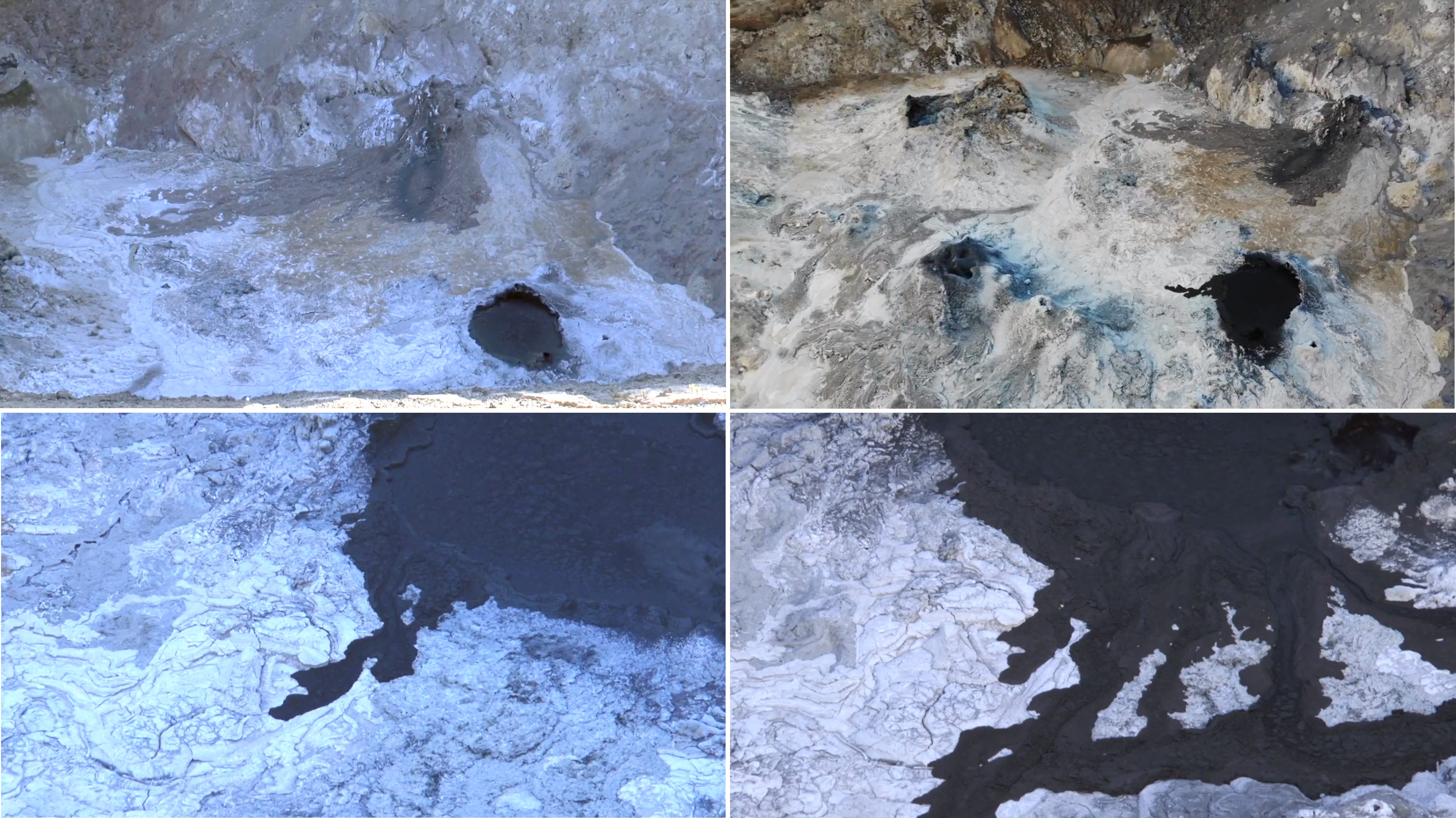
A video taken by Patrick Marcel in August 2018 showed a recent lava flow that had occurred from a vent at the base of the crater wall and an active flow over-spilling from an active lava pond (figure 185). Throughout 2018, there were 18 out of 24 Sentinel-2 thermal cloud-free images which contained areas of elevated thermal activity. Like 2017, the 2018 activity was located in different areas around the crater (figure 186).
Geological Summary. The symmetrical Ol Doinyo Lengai is the only volcano known to have erupted carbonatite tephras and lavas in historical time. The prominent stratovolcano, known to the Maasai as "The Mountain of God," rises abruptly above the broad plain south of Lake Natron in the Gregory Rift Valley. The cone-building stage ended about 15,000 years ago and was followed by periodic ejection of natrocarbonatitic and nephelinite tephra during the Holocene. Historical eruptions have consisted of smaller tephra ejections and emission of numerous natrocarbonatitic lava flows on the floor of the summit crater and occasionally down the upper flanks. The depth and morphology of the northern crater have changed dramatically during the course of historical eruptions, ranging from steep crater walls about 200 m deep in the mid-20th century to shallow platforms mostly filling the crater. Long-term lava effusion in the summit crater beginning in 1983 had by the turn of the century mostly filled the northern crater; by late 1998 lava had begun overflowing the crater rim.
Information Contacts: Matthieu Kervyn, Vrije Universiteit Brussel, Department of Geography, Pleinlaan 2, 1050 Brussels, Belgium (URL: http://we.vub.ac.be/en/matthieu-kervyn-de-meerendre); Kate Laxton and Felix Boschetty, University College London, Gower Street, London, WC1E 6BT, United Kingdom (URL: https://www.ucl.ac.uk/earth-sciences/people/research-students/kate-laxton); Patrick Marcel (URL: https://www.youtube.com/watch?v=ZqxuYOEFNLk); David Brown, School of Geographical and Earth Sciences, University of Glasgow, University Avenue, Glasgow G12 8QQ, United Kingdom (URL: https://www.gla.ac.uk/schools/ges/staff/davidbrown/); Sentinel Hub Playground (URL: https://www.sentinel-hub.com/explore/sentinel-playground); Gian Schachenmann, Volcano Discovery (URL: https://www.volcanodiscovery.com/nl/photos/ol-doinyo-lengai/dec2017/crater.html); Trip Advisor (URL: https://www.tripadvisor.com with initial search term 'Ol Doinyo Lengai').