Report on Ulawun (Papua New Guinea) — October 1999
Bulletin of the Global Volcanism Network, vol. 24, no. 10 (October 1999)
Managing Editor: Richard Wunderman.
Ulawun (Papua New Guinea) Explosions in mid-October-the first in 6.5 years
Please cite this report as:
Global Volcanism Program, 1999. Report on Ulawun (Papua New Guinea) (Wunderman, R., ed.). Bulletin of the Global Volcanism Network, 24:10. Smithsonian Institution. https://doi.org/10.5479/si.GVP.BGVN199910-252120
Ulawun
Papua New Guinea
5.05°S, 151.33°E; summit elev. 2334 m
All times are local (unless otherwise noted)
During the past 6.5 years, through September 1999, summit activity at Ulawun consisted of variable amounts of emissions that ranged from very thin white vapor to moderate volumes of thick white vapor. Seismic activity was generally low. Low frequency earthquakes were recorded. Their occurrence was very variable and the amplitudes of the events fluctuated, but remained near background levels. In June 1998 a number of high-frequency earthquakes began occurring, but have been very sporadic since.
After this period of very low activity, Ulawun produced moderate explosions at 2015 and 2049 (UT) on 19 October. The first explosion produced a thick dark ash column, visible in the moonlight, that rose several hundred meters above the summit before it was blown to the N and NW, causing ashfall on the flanks. The second explosion was smaller but also produced a dark ash column. People on Lolobau Island, ~18 km NW of Ulawun, observed very weak, dull glow on the summit. The partially working seismograph picked up tremor activity during the time of the explosions. The following morning, 20 October, summit activity consisted of thick volumes of white and occasionally gray vapor. This tapered off to moderate volumes of white vapor by the end of the month. Seismic activity also decreased to normal background levels.
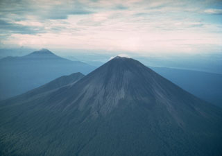
Geological Summary. The symmetrical basaltic-to-andesitic Ulawun stratovolcano is the highest volcano of the Bismarck arc, and one of Papua New Guinea's most frequently active. The volcano, also known as the Father, rises above the N coast of the island of New Britain across a low saddle NE of Bamus volcano, the South Son. The upper 1,000 m is unvegetated. A prominent E-W escarpment on the south may be the result of large-scale slumping. Satellitic cones occupy the NW and E flanks. A steep-walled valley cuts the NW side, and a flank lava-flow complex lies to the south of this valley. Historical eruptions date back to the beginning of the 18th century. Twentieth-century eruptions were mildly explosive until 1967, but after 1970 several larger eruptions produced lava flows and basaltic pyroclastic flows, greatly modifying the summit crater.
Information Contacts: Ima Itikarai, Kila Mulina, and Steve Saunders, RVO.

