Aira
Japan
31.5772°N, 130.6589°E; summit elev. 1117 m
All times are local (unless otherwise noted)
Sakurajima is the active volcano within the Aira Caldera in Kyushu, Japan. With several craters historically active, the current activity is concentrated in the Minamidake summit crater. Activity usually consists of small explosions producing ashfall and ballistic ejecta, with occasional pyroclastic flows and lahars. The current eruption has been ongoing since 25 March 2017, but activity has been frequent over the past few hundred years. This bulletin summarizes activity that occurred during July through December 2020 and is largely based on reports by the Japan Meteorological Agency (JMA) and satellite data. The Alert Level remains at 3 on a 5-level scale. There was no activity at the Showa crater in 2020.
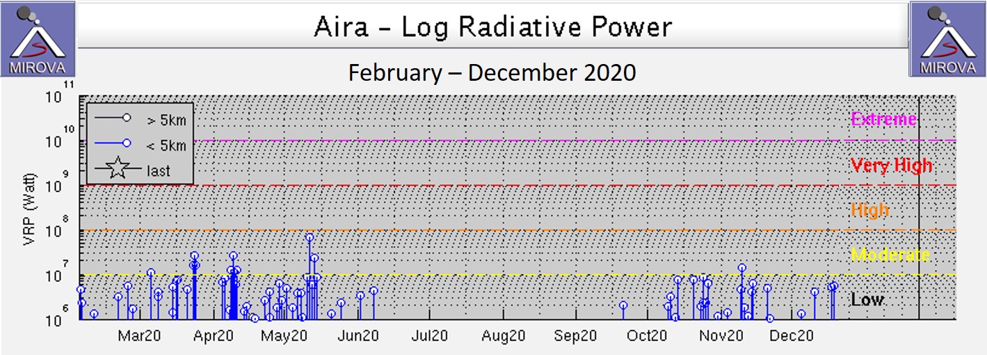
The number of recorded explosive and ash eruptions for 2020 at the Minamidake crater were 221 and 432, respectively (228 and 393 the previous year). Activity declined in July and remained low through the end of December. There was ash reported on 79 days of the year, most frequently in January, and only 26 of those days during August-December (table 24 and figure 104). The largest ash plumes during this time reached 5 km at 0538 on 9 August, 3 km at 1959 on 17 December, and 3.5 km at 1614 on 29 December. The decline in events was reflected in thermal data, with a decline in energy detected during June through October (figure 105). Recorded SO2 was generally high in the first half of the year then began to decrease from April to around 1,000 tons/day until around late May. Emissions increased after August and were extremely high in October. There were no notable changes in the geothermal areas around the craters.
Table 24. Number of monthly total eruptions, explosive eruptions, days of ashfall, and ashfall amounts from Sakurajima's Minamidake crater at Aira during 2020. Note that smaller events that did not reach the threshold of explosions or eruptions also occurred. Ashfall was measured at Kagoshima Local Meteorological Observatory; ash weights are rounded down to the nearest 0.5 g/m2 and zero values indicate that less than this amount was recorded. Data courtesy of JMA.
| Month | Explosive Eruptions | Ash Eruptions | Days of Ashfall | Ashfall Amount (g/m2) |
|---|
| Jan 2020 |
65 |
104 |
12 |
75 |
| Feb 2020 |
67 |
129 |
14 |
21 |
| Mar 2020 |
10 |
26 |
8 |
3 |
| Apr 2020 |
14 |
51 |
2 |
0 |
| May 2020 |
24 |
51 |
8 |
19 |
| Jun 2020 |
16 |
28 |
9 |
71 |
| Jul 2020 |
0 |
0 |
0 |
0 |
| Aug 2020 |
1 |
1 |
1 |
0 |
| Sep 2020 |
0 |
7 |
4 |
2 |
| Oct 2020 |
0 |
2 |
6 |
2 |
| Nov 2020 |
6 |
8 |
11 |
5 |
| Dec 2020 |
18 |
25 |
4 |
14 |
| Total 2020 |
221 |
432 |
79 |
212 |
During July "very small" explosions were observed on the 1st, 2nd, and 8th, with the last explosion producing a plume up to 600 m above the crater. These events didn't generate enough of an ash plume to be counted as either a quiet or explosive eruption, leaving no eruptions reported during July. No incandescence was observed at the crater since 3 June. Field surveys on 2, 13, and 21 July detected 600 to 1,300 tons of SO2 per day.
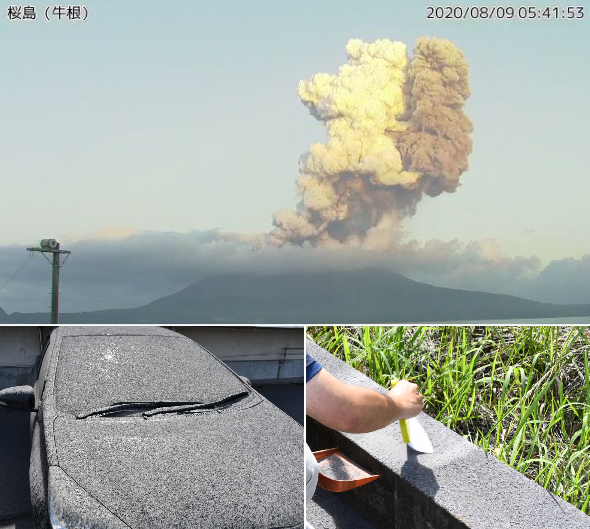
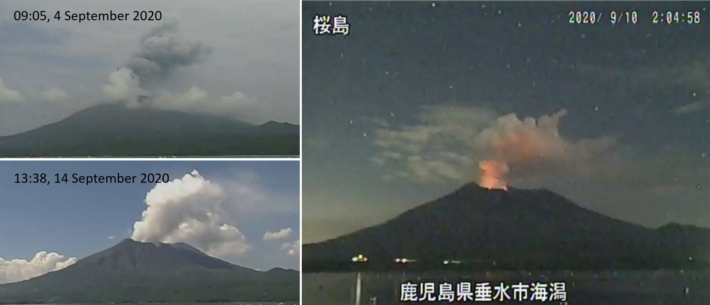
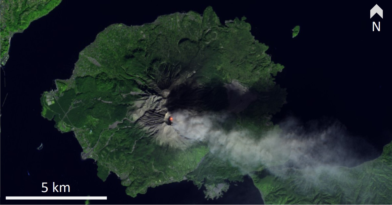
An explosion occurred at 0538 on 9 August, producing an ash plume to 5 km above the crater, dispersing NE (figure 106). This was the largest explosion observed through the Sakurajima surveillance camera since 8 November 2019. Ashfall was reported in Kagoshima City, Aira City, Kirishima City, Yusui Town, and parts of Miyazaki and Kumamoto Prefectures. Ashfall measured to be 300 g/m2 in Shirahama on Sakurajima island (figure 106). No ballistic ejecta were observed due to clouds at the summit, but very small explosions were occasionally observed afterwards.
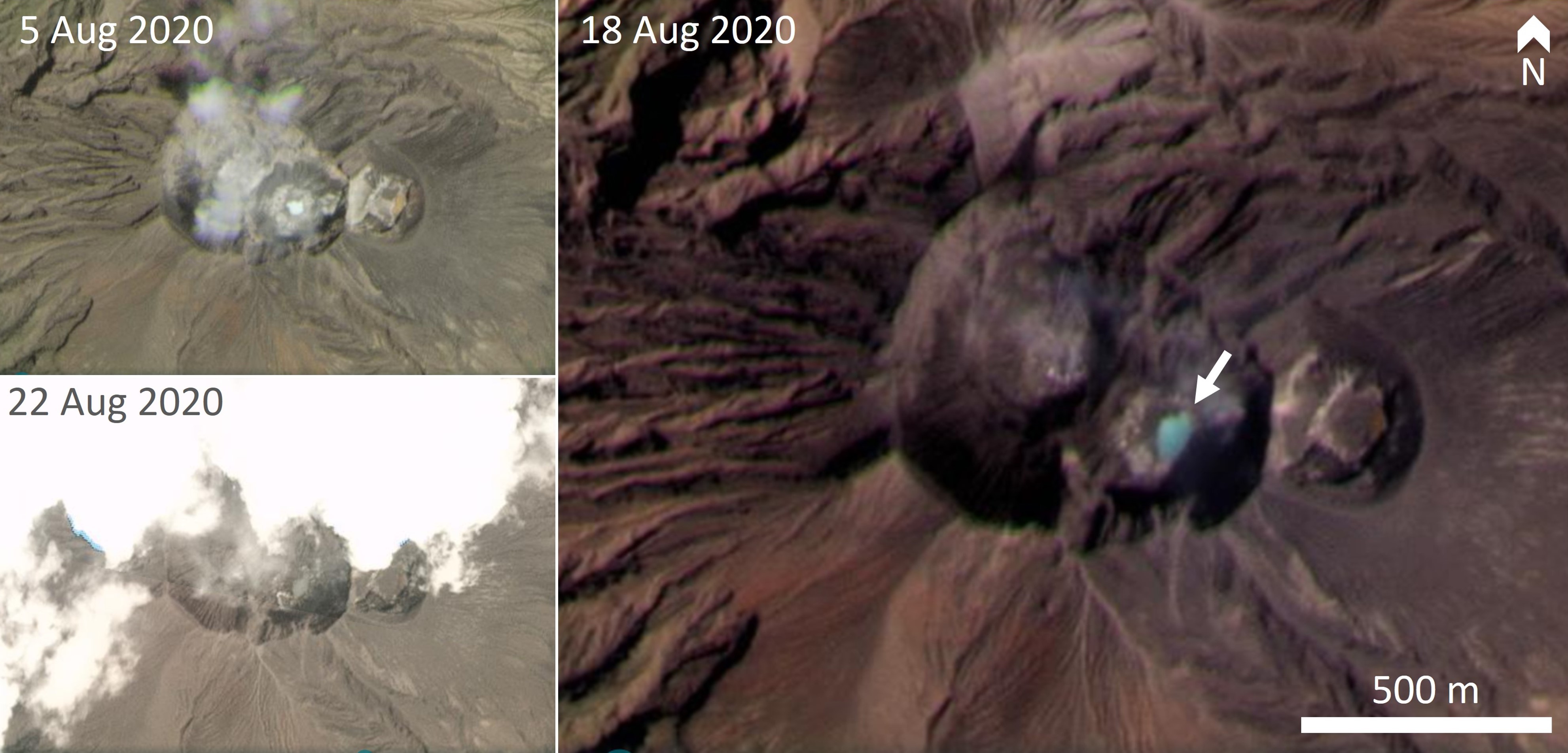
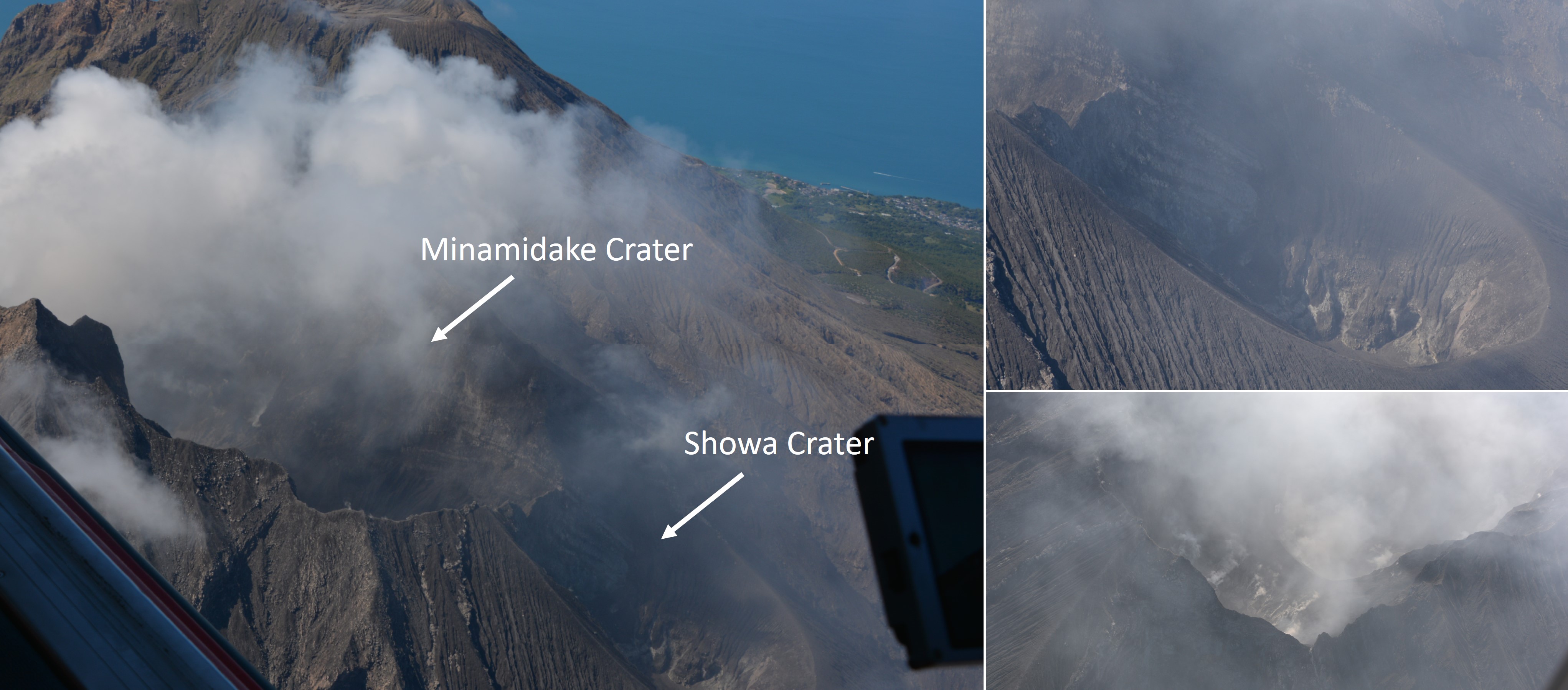
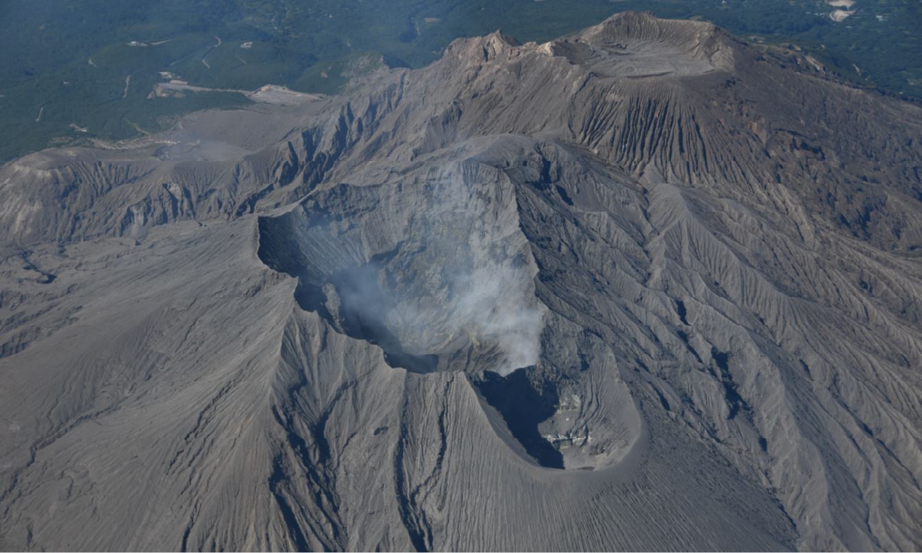
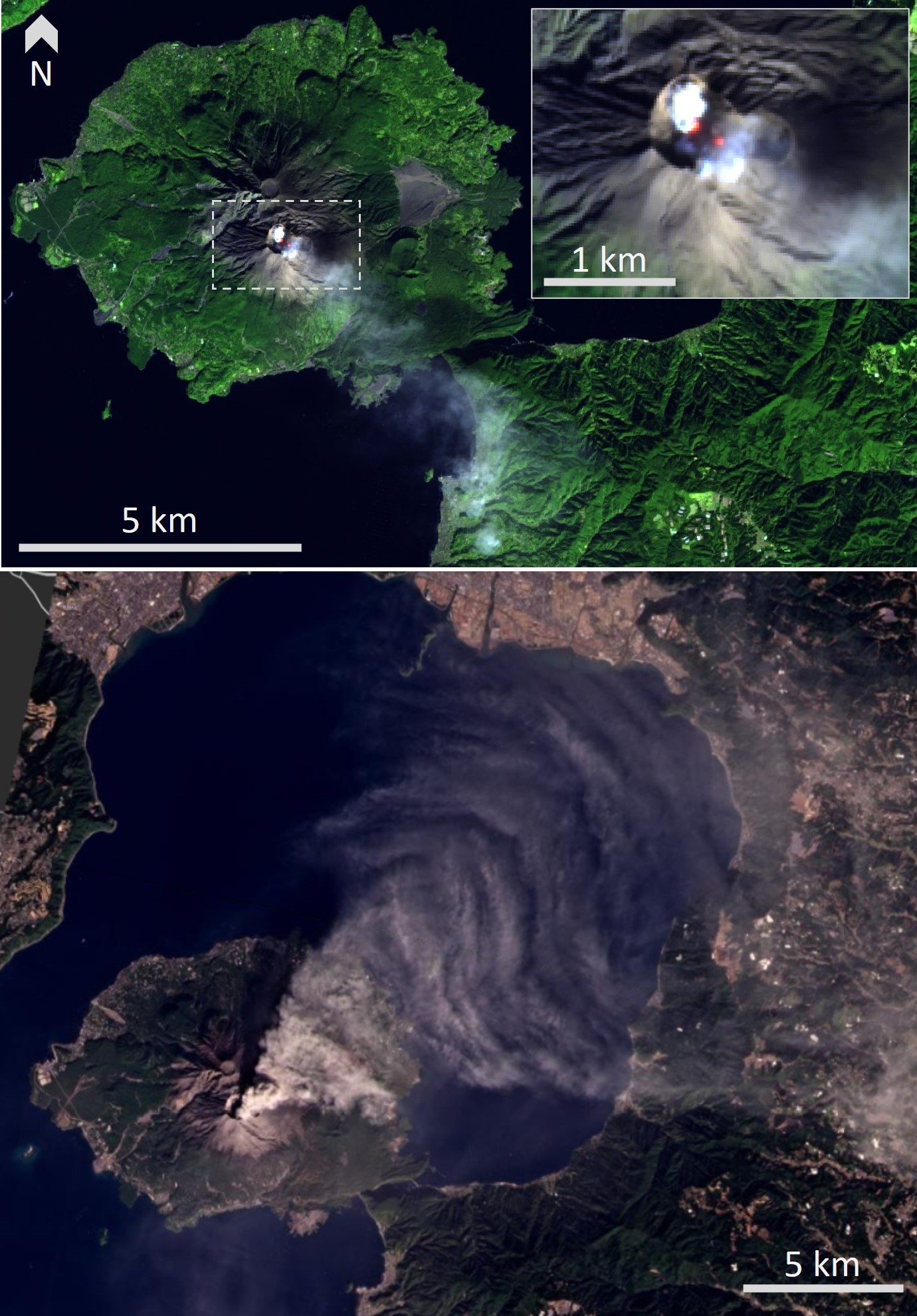
A small lake or pond in the eastern Minamidake crater was first observed in PlanetScope satellite imagery on 1 August (through light cloud cover) and intermittently observed when the summit was clear through to the 22nd (figure 107). The summit is obscured by cloud cover in many images before this date. An observation flight on 14 August confirmed weak gas emission from the inner southern wall of the Showa crater, and a 200-m-high gas plume rose from the Minamidake crater, dispersing SE (figure 108). Thermal imaging showed elevated temperatures within the crater. SO2 measurements were conducted during field surveys on the 3rd, 13th, 24th and 31st, with amounts similar to July at 600 to 1,400 tons per day.
Activity continued at Minamidake crater throughout September with seven observed eruptions sending plumes up to 1.7 km above the crater, and additional smaller events (figure 109). An ash plume reached 1 km at 0810 on the 15th. Ashfall was reported on four days through the month with a total of 2 g/m2 measured. Incandescence was observed in nighttime surveillance cameras from the 9-10th for the first time since 2 June, then continued through the month. There was an increase in detected SO2, with measurements on the 11th and 25th ranging from 1,300 to 2,000 tons per day.
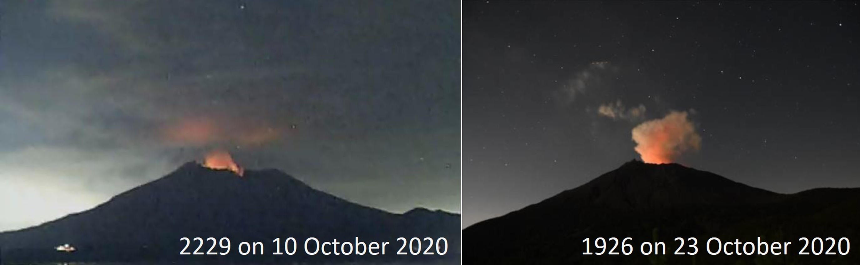
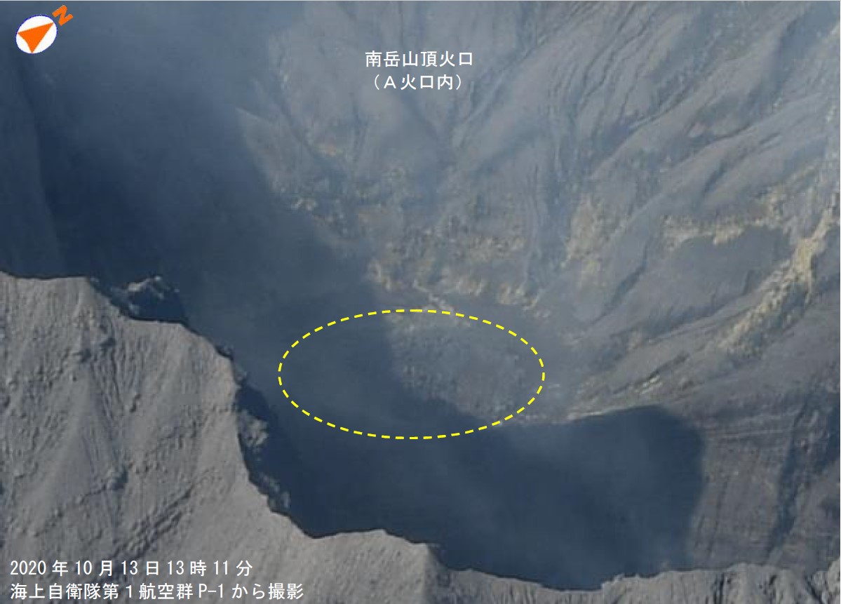
During October two eruptions and occasional smaller events occurred at the Minamidake crater and there were six days where ashfall occurred at the Kagoshima Local Meteorology Observatory (including remobilized ash). An ash plume rose to 1.7 km above the crater at 1635 on the 3rd and 1 km on the 30th. Incandescence was observed at night through the month (figure 110). Gas surveys on the 20th, 21st, 23rd, and 26th recorded 2,200-6,600 tons of SO2 per day, which are high to very high levels and a large increase compared to previous months. An observation flight on the 13th confirmed lava in the bottom of the Minamidake crater (figure 111). Gas emissions were rising to 300 m above the Minamidake crater, but no emissions were observed at the Showa crater (figure 112).
Eight ash eruptions and six explosive eruptions occurred during November as well as additional very small events. At 1551 on the 3rd an ash plume reached 1.8 km above the crater and an event at 1335 on the 10th produced large ballistic ejecta out to 600-900 m from the crater (figure 113). Ashfall was reported on 11 days this month (including remobilized ash). Incandescence was observed at night and elevated temperatures in the Minamidake crater were detected by satellites (figure 114). Detected SO2 was lower this month, with amounts ranging between 1,300 and 2,200 on the 9th, 18th and 24th.
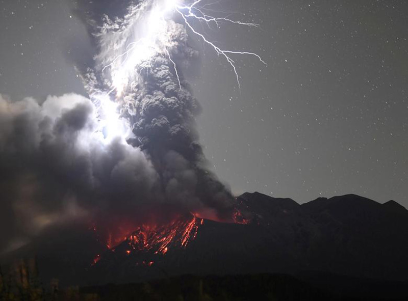
During December there were 25 ash eruptions and 18 explosive eruptions recorded, with large ballistic ejecta reaching 1.3-1.7 km from the crater (figure 115). An explosion on the 2nd sent an ash plume up to 1 km above the crater and ballistic ejecta out to 1-1.3 km, and an event at 0404 on the 12th produced incandescent ballistic ejecta reached out to 1.3-1.7 km from the crater. At 1959 on 17 December an explosion generated an ash plume up to 3 km above the crater and ejecta out to 1.3-1.7 km. A photograph that day showed an ash plume with volcanic lightning and incandescent ejecta impacting around the crater (figure 116). On the 18th an ash plume reached 1.8 km and ejecta impacted out to 1-1.3 km. An event at 1614 on the 29th produced an ash plume reaching 3.5 km above the crater. Elevated temperatures within the Minamidake crater and plumes were observed intermittently in satellite data through the month (figure 117). This month there were four days where ashfall was recorded with a total of 14 g/m2. Incandescence continued to be observed at night through the month. High levels of gas emission continued, with field surveys on 2nd, 7th, 16th and 21st recording values ranging from 1,500 to 2,900 tons per day at the Observatory located 11 km SW.
Geological Summary. The Aira caldera in the northern half of Kagoshima Bay contains the post-caldera Sakurajima volcano, one of Japan's most active. Eruption of the voluminous Ito pyroclastic flow accompanied formation of the 17 x 23 km caldera about 22,000 years ago. The smaller Wakamiko caldera was formed during the early Holocene in the NE corner of the caldera, along with several post-caldera cones. The construction of Sakurajima began about 13,000 years ago on the southern rim and built an island that was joined to the Osumi Peninsula during the major explosive and effusive eruption of 1914. Activity at the Kitadake summit cone ended about 4,850 years ago, after which eruptions took place at Minamidake. Frequent eruptions since the 8th century have deposited ash on the city of Kagoshima, located across Kagoshima Bay only 8 km from the summit. The largest recorded eruption took place during 1471-76.
Information Contacts: Japan Meteorological Agency (JMA), 1-3-4 Otemachi, Chiyoda-ku, Tokyo 100-8122, Japan (URL: http://www.jma.go.jp/jma/indexe.html); Hawai'i Institute of Geophysics and Planetology (HIGP) - MODVOLC Thermal Alerts System, School of Ocean and Earth Science and Technology (SOEST), Univ. of Hawai'i, 2525 Correa Road, Honolulu, HI 96822, USA (URL: http://modis.higp.hawaii.edu/); MIROVA (Middle InfraRed Observation of Volcanic Activity), a collaborative project between the Universities of Turin and Florence (Italy) supported by the Centre for Volcanic Risk of the Italian Civil Protection Department (URL: http://www.mirovaweb.it/); Tokyo Volcanic Ash Advisory Center (VAAC), 1-3-4 Otemachi, Chiyoda-ku, Tokyo 100-8122, Japan (URL: http://ds.data.jma.go.jp/svd/vaac/data/); Sentinel Hub Playground (URL: https://www.sentinel-hub.com/explore/sentinel-playground); Planet Labs, Inc. (URL: https://www.planet.com/); Kyodo/via REUTERS, "Photos of the Week" (URL: https://www.reuters.com/news/picture/photos-of-the-week-idUSRTX8HYLR); Volcano Time-Lapse, YouTube (URL: https://www.youtube.com/watch?v=jTgd152oGVo).